
Top Backpacking Trails in Tennessee
21 routes. Each page shows when we last checked it. Updated November 2026.
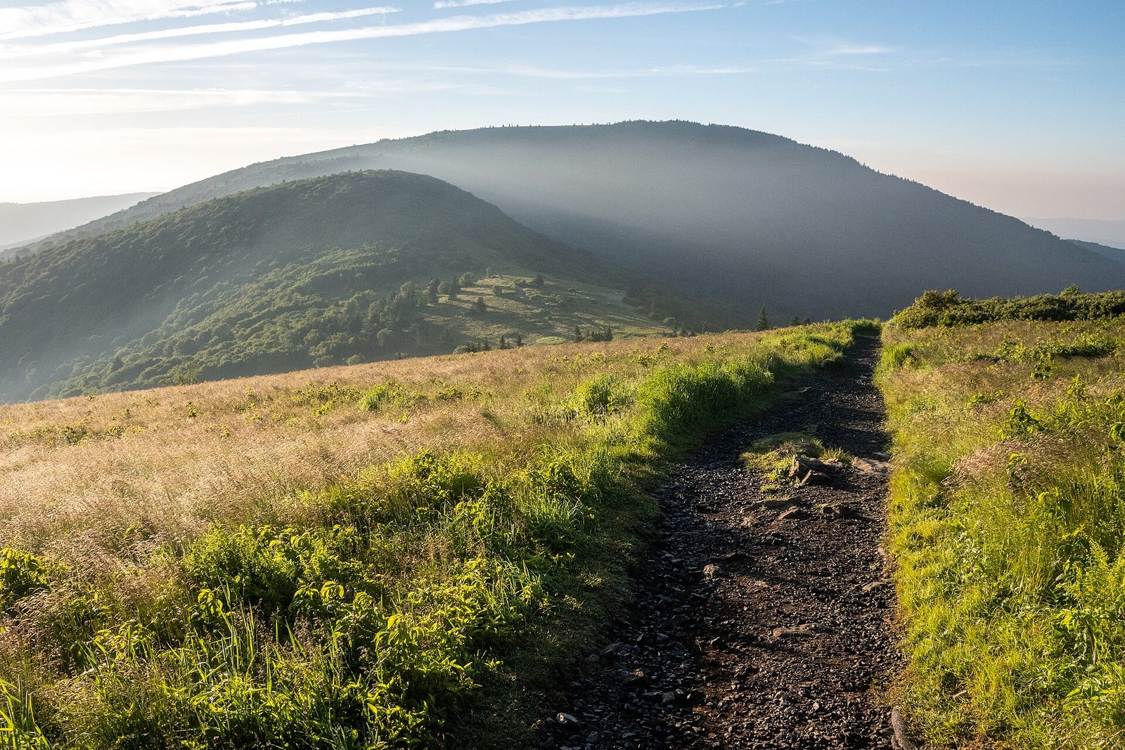
Backpacking in Tennessee covers two kinds of country. In the east, the site’s trips run through Great Smoky Mountains National Park, including Alum Cave to Mount LeConte, Gregory Bald, and Spence Field, and through the Cherokee National Forest, from the Big Frog Wilderness to Laurel Fork and the Roan Highlands on the Appalachian Trail along the North Carolina line. To the west, the Cumberland Plateau and Cumberland Mountains hold sandstone gorges and waterfalls on the Fiery Gizzard Trail, the Savage Gulf loops, Virgin Falls, the Obed, Frozen Head, and the long John Muir route in Big South Fork.
Mountain trips climb steeply to cool, often wet ridges where water can be scarce and winter brings ice. Plateau routes trade elevation for rocky gorge descents, creek fords that can become impassable after heavy rain, and waterfalls whose flow varies with the season. Spring brings wildflowers, and azaleas on Gregory Bald and rhododendron in the Roan Highlands bloom in late June.
Camping rules depend on the manager. The Smokies require a reserved permit for every backcountry night, state parks take reservations for designated campgrounds, Big South Fork issues permits for camping at existing sites, and the national forest allows dispersed camping. Store food from bears on cables or a hang. Check closures too: in mid-October 2026, Cosby Knob Shelter in the Smokies was closed for bear activity, a fire order covered the Roan Mountain area through October 20, and Frozen Head had been under renovation. Wear blaze orange during fall hunting seasons.
Quick picks
- Longest trip: Big South Fork: John Muir Route
- Easier shelter overnight: Newfound Gap to Icewater Spring Shelter and Charlies Bunion
- Waterfall trip: Virgin Falls Trail
- Grassy balds overnight: Roan Highlands: Carvers Gap to Yellow Mountain Gap
- Dispersed camping loop: Big Frog Wilderness Loop
Big South Fork
- Big South Fork: Angel Falls Overlook and Grand Gap Loop Big South Fork National River and Recreation Area (Tennessee side, Leatherwood Ford area) 11.3 miles Moderate Backcountry camping at existing sites (permit required)
- Big South Fork: John Litton Route Big South Fork National River and Recreation Area (Tennessee) 27 miles Hard Backcountry camping at existing sites (permit required)
- Big South Fork: John Muir Route Big South Fork National River and Recreation Area (mostly Tennessee; confirm northern end) 39 miles Hard Backcountry camping at existing sites (permit required)
Cherokee National Forest and AT
- TN TOP TRIP #4 (75/100)Appalachian Trail: Iron Mountain Gap to US 19E over Roan High Knob Cherokee National Forest / Pisgah National Forest (Appalachian Trail along the Tennessee–North Carolina line) 28 miles Hard Shelters and dispersed camping at established sites
- Big Frog Wilderness Loop Big Frog Wilderness, Cherokee National Forest (Polk County, near the Georgia line) 19.1 miles Hard Dispersed camping (no permit reported)
- Laurel Fork Trail and Dennis Cove Loop Cherokee National Forest, Carter County (Pond Mountain area) 19 miles Hard Dispersed camping; AT shelters; Dennis Cove Campground nearby
- TN TOP TRIP #1 (78/100)Roan Highlands: Carvers Gap to Yellow Mountain Gap Roan Highlands, Cherokee and Pisgah National Forests (Appalachian Trail along the Tennessee–North Carolina line) 11 miles Moderate Dispersed camping at established sites; shelters
Cumberland Plateau
- TN TOP TRIP #5 (74/100)Fiery Gizzard Trail (Grundy Forest to Foster Falls) Fiery Gizzard / South Cumberland, Cumberland Plateau 12.5 miles Hard Designated backcountry campgrounds, reservation required
- Obed Wild and Scenic River: Cumberland Trail to Devils Breakfast Table Obed Wild and Scenic River, Cumberland Plateau (Morgan and Cumberland counties) 14.2 miles Hard Dispersed backcountry camping (free permit required); Rock Creek Campground at the trailhead
- Savage Gulf East Loop: Hobbs Cabin, Sawmill, Horsepound Falls, and Suter Falls Savage Gulf State Park, Cumberland Plateau (Grundy and Sequatchie counties) 26 miles Hard Designated backcountry campgrounds and a cabin, reservation required
- Savage Gulf West Loop: Stone Door, Laurel Falls, Alum Gap, Greeter Falls, and Blue Hole Savage Gulf State Park, Cumberland Plateau (Grundy County, Stone Door area) 9 miles Hard Designated backcountry campground, reservation required
- TN TOP TRIP #3 (75/100)Virgin Falls Trail Scott's Gulf Wilderness State Park (Virgin Falls State Natural Area) 8.6 miles Hard Designated backcountry sites, reservation required
Cumberland Trail and Frozen Head
- Cumberland Trail: North Chickamauga Creek Gorge to Stevenson Branch Justin P. Wilson Cumberland Trail State Park / North Chickamauga Creek Gorge State Park (near Chattanooga) 9.5 miles Hard Designated backcountry sites (reservation required)
- Frozen Head State Park Backcountry Frozen Head State Park, Cumberland Mountains (Morgan County) 14 miles Hard Designated backcountry sites (reservation required)
Great Smoky Mountains
- Alum Cave Trail to Mount LeConte Great Smoky Mountains National Park 10 miles Hard Shelter and lodge near summit only
- Appalachian Trail: Newfound Gap to Kuwohi Great Smoky Mountains National Park (ridge along the Tennessee–North Carolina line) 7.5 miles Hard Backcountry shelters (permit and reservation required)
- TN TOP TRIP #2 (76/100)Gregory Bald via Gregory Ridge Trail Great Smoky Mountains National Park (Cades Cove; the bald sits on the Tennessee–North Carolina line) 11.4 miles Hard Backcountry campsites (permit and reservation required)
- Mount Cammerer via Low Gap and the Appalachian Trail Great Smoky Mountains National Park (Cosby, Tennessee) 11.2 miles Hard Backcountry shelters and campsite (permit and reservation required)
- Mount LeConte via the Appalachian Trail and the Boulevard Great Smoky Mountains National Park (Newfound Gap to Mount LeConte) 16.2 miles Hard Backcountry shelter (LeConte Shelter; permit and reservation required)
- Newfound Gap to Icewater Spring Shelter and Charlies Bunion Great Smoky Mountains National Park (Appalachian Trail along the Tennessee–North Carolina line) 8 miles Hard Backcountry shelter (permit and reservation required)
- Spence Field and Rocky Top via Anthony Creek and Bote Mountain Great Smoky Mountains National Park (Cades Cove area) 13.2 miles Hard Backcountry campsites and shelters (permit and reservation required)
More Lowdown from Backpack Trail Guide
Backpacking in Tennessee: common questions
Do you need a permit to backpack in Tennessee?
It depends on who manages the land. Great Smoky Mountains National Park requires a permit and advance reservation for all backcountry camping, made through Recreation.gov, and Big South Fork requires a backcountry permit from a visitor center or online. Tennessee State Parks such as Savage Gulf, Fiery Gizzard, and Virgin Falls take camping by online reservation at designated sites, while no permit was found for the Cherokee National Forest trips on this site, though wilderness orders cap groups at 12 people in Big Frog and 10 in Pond Mountain. Check with the park or forest before you go.
Can you camp anywhere when backpacking in Tennessee?
Usually not. In the Smokies you camp at the campsite or shelter you reserved, and shelter stays are limited to one night, while Savage Gulf State Park says to camp only in designated campgrounds and bans hiking after dark. Big South Fork has no designated backcountry sites, so you use an existing site and stay at least 100 feet from trails, caves, rock shelters, and arches. The Cherokee National Forest allows dispersed camping on trips like Big Frog and Laurel Fork, so check the ranger district's current rules.
Do you need to worry about bears when backpacking in Tennessee?
Plan on it, and store food properly. Smokies campsites and shelters on this site's trips have bear cables, Big South Fork asks you to hang food 10 feet up and 4 feet out and keep it out of your tent, and the Forest Service's Dennis Cove Campground listing calls for a bear-resistant container or a hang 12 feet up and 6 feet out. Bear activity can close sites: as of October 15, 2026, the Smokies listed Cosby Knob Shelter, an option on the Mount Cammerer trip, as closed because of bears.
Can you bring a dog backpacking in Tennessee?
Not in the Smokies: the park has prohibited dogs in the backcountry since the 1930s, and only the Gatlinburg Trail and the Oconaluftee River Trail allow leashed pets. Big South Fork allows pets on a leash no longer than 6 feet, and Tennessee State Parks such as Savage Gulf require pets to be leashed and under control. Rules vary by managing agency, so check before you bring a dog.
Are there Hurricane Helene closures or fire restrictions on Tennessee trails?
Some remain. As of October 15, 2026, the Smokies still listed Helene-related trail and campsite closures, mostly on the park's eastern end, such as Big Creek Trail beyond Mouse Creek Falls, though none on the Smokies routes this site covers. On the Appalachian Trail, the Appalachian Trail Conservancy says the Iron Mountain Gap area reopened on July 29, 2026, the Cherokee National Forest has fire restrictions on Helene-damaged sections of the trail, and a Forest Service order bans building or using a fire, campfire, or stove fire in the Roan Mountain area through October 20, 2026. Check the park's and forest's alert pages before you go.
Is it safe to backpack in Tennessee during hunting season?
Hunting overlaps fall backpacking in several areas. Big South Fork allows hunting under Tennessee and Kentucky seasons and asks backcountry visitors to wear blaze orange, especially during big game season, and the Obed section of the Cumberland Trail crosses part of the Catoosa Wildlife Management Area. TWRA's 2025-26 deer schedule ran archery from late September and gun season from November 22 into early January, so confirm this year's dates with TWRA before a fall trip.
Where this comes from
- National Park Service: Great Smoky Mountains backcountry camping
- National Park Service: Great Smoky Mountains temporary closures and cautions
- National Park Service: Great Smoky Mountains pets
- National Park Service: Big South Fork backcountry camping
- U.S. Forest Service: Roan Mountain fire restrictions (Cherokee National Forest)
- U.S. Forest Service: Fire restrictions on the Appalachian Trail (Helene damage)
- U.S. Forest Service: Cherokee National Forest wilderness closure orders
- Appalachian Trail Conservancy: Storm damage info for 2026 A.T. hikers
- Tennessee State Parks: Savage Gulf camping
- Tennessee Wildlife Resources Agency: Hunting seasons summary