
Trails / Tennessee / Cumberland Plateau
Savage Gulf West Loop: Stone Door, Laurel Falls, Alum Gap, Greeter Falls, and Blue Hole
Savage Gulf State Park, Cumberland Plateau (Grundy County, Stone Door area)
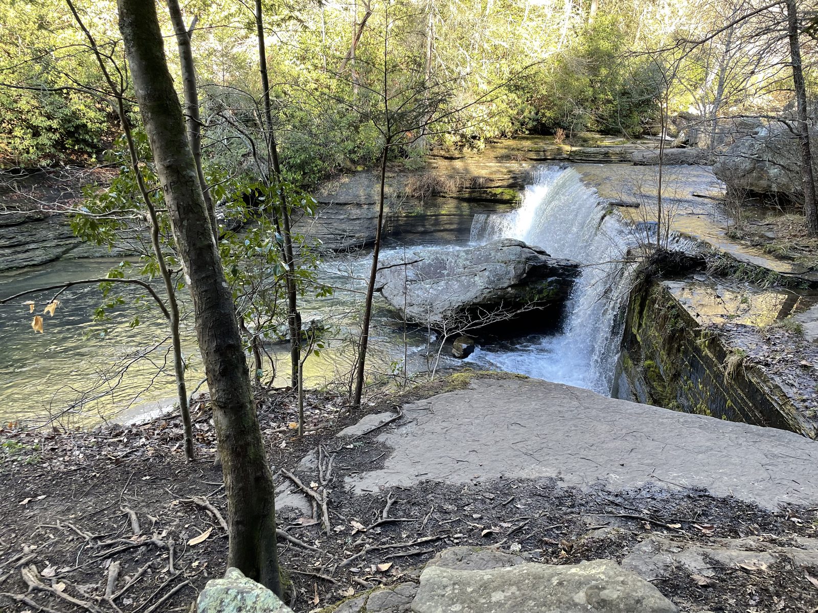
The Stone Door side of Savage Gulf is the more compact half of the park, and it holds one of its best-known viewpoints: Stone Door, a natural crack in the escarpment that leads down into the gorge. Tennessee’s natural areas program describes it as about 10 feet wide and 100 feet deep, like a giant door left ajar. This loop pairs it with a waterfall by the ranger station, a walk along the rim, a campground overlooking the gorge, and side trips to Greeter Falls and a swimming hole.
The hike
The route starts at the Stone Door Ranger Station, which the park’s trailhead listings call Savage Gulf North / Stone Door. Before you set off, Laurel Falls is worth a short detour. It’s a 0.3-mile loop just past the ranger station, where a steep wooden staircase leads to an overlook deck, and the trail passes the site of the historic Laurel Mill before climbing back on a 150-year-old trail.
The first quarter mile of the Stone Door Trail is paved and ends at the Laurel Gulf Overlook. This first mile is the busiest, since the Stone Door overlooks are nearby. Near the one-mile mark you reach Stone Door itself, which Backpacker’s guide calls the best vista on the hike.
At about 0.9 miles you reach the junction where you choose your route. Backpackcamp’s mileposts put the Big Creek Rim Trail to the right, with Alum Gap 3.2 miles ahead on that trail: Split Rock Overlook comes at 0.3 miles, the Sinks Overlook at 1.6 miles, where Big Creek goes underground most of the year, and Big Creek Overlook at 2.7 miles. The alternative is straight ahead on the Big Creek Gulf Trail, down into the gorge. A spur of about 0.4 miles leads to 60-foot Ranger Falls, which Backpacker says flows year-round, though one AllTrails reviewer found the creek dry. From the creek, a 400-foot climb over 0.4 miles brings you up to Alum Gap.
Alum Gap is the hub of the loop, with signs pointing to Greeter Falls, the Laurel Trail, and the Big Creek Rim Trail. Backpacker puts Greeter Falls 1.2 miles west of Alum Gap on the Greeter Falls Trail. You reach the upper falls first, then downclimb to the 50-foot lower falls, where the guide suggests a summer dip in the swimming hole. Tennessee State Parks describes the upper ledge as 15 feet, against 12 feet in Backpacker, and says the lower falls plunge into a cold pool. Greeter Falls also has a trailhead of its own: the park’s maps show a 0.8-mile Greeter Falls Loop and a Blue Hole Trail that runs 0.5 miles to a swimming hole. This Blue Hole is a different place from the one on the Fiery Gizzard Trail near Tracy City.
You can shape the loop several ways. A forum poster on Backpacking Light describes the Laurel Trail and the Big Creek Rim Trail both ending at Alum Gap, so either one can form a loop with the Big Creek Gulf and Stone Door trails, and adding Greeter Falls turns it into a figure eight with Alum Gap at the center. AllTrails lists the Big Creek Gulf, Big Creek Rim, and Stone Door loop at 9.5 miles, and Backpacker’s 2015 version at 8.6. Reviewers say the last climb back up to Stone Door is the hardest part. For the other half of the park, see the Savage Gulf East Loop.
Tips
- Start early. AllTrails says the first mile can be heavily trafficked because the Stone Door overlooks are close by.
- Leave time for the last climb. Reviewers describe the final ascent back to Stone Door as steep and rocky.
- Expect wet feet in winter. Backpacker warns of slick, often icy rocks and one or two fords of frigid, ankle-deep water, and says some cascades freeze into towers in January.
- Watch the rim. The Big Creek Rim Trail passes close to the cliff edge at its overlooks, so take care.
- Don’t jump from the waterfalls. Tennessee State Parks says jumping from waterfalls is strictly prohibited.
Camping
Camping is by online reservation through Tennessee State Parks, in designated campgrounds only. Alum Gap has 10 sites plus a group site, and the Friends of the Parks list it with a seasonal stream nearby. Backpackcamp’s mileposts put it at about 4.1 miles by way of the rim trail (0.9 plus 3.2), and Backpacker puts it at mile 4.6 by way of Big Creek Gulf. There’s an outhouse and fire rings, but no piped water. Backpackcamp says the closest water when it’s dry is Greeter Falls, 1.4 miles away, and Backpacker advises topping off at Big Creek before you climb out of the gorge.
Inside Intel: Backpacker says the sites closest to the gorge, numbers 4 through 8, have the best views, and that a sunrise from one of them is worth the pick. Backpackcamp adds that sites 8 and 9 lead to a nice overlook. The Laurel Trail and Big Creek Rim Trail both end at Alum Gap, so you can go in one way and out the other.
Trail facts
- Distance: About 9 miles for the core loop (8.6 to 9.5 by different sources). Greeter Falls and Blue Hole add more.
- Route type: Loop, or a figure eight with Greeter Falls
- Difficulty: Moderate to challenging
- Campsites: Alum Gap (10 sites plus a group site)
- Water: Not piped. A seasonal stream may be dry. Top off at Big Creek and filter all natural water.
- Permits: Reservation required through Tennessee State Parks
- Rules: Marked trails only; no hiking after dark; fires in established rings only
- Trailhead: Stone Door Ranger Station, off Stone Door Road (the park calls this lot Savage Gulf North)
- Last verified: September 28, 2026
Where this comes from
This page draws on the sources below, along with other guides and trip reports. Links go to the original pages.
- Tennessee Department of Environment and Conservation: Savage Gulf State Natural Area
- Friends of South Cumberland: Savage Gulf State Park
- Friends of South Cumberland: trailhead and trail information
- Southeast Tennessee tourism: Great Stone Door hikes
Before you go: This page is based on published trail guides, trip reports, and reviews, along with official park and agency information where we could find it. It’s meant to help backpackers discover new trails, not to replace current, official information. Conditions, closures, permits, campsites, and water sources change, and some details here may be out of date or wrong. Confirm everything with the managing agency and check current conditions before you head out, and don’t rely on this page alone for safety or navigation. Backcountry travel involves risk.