
Trails / Tennessee / Great Smoky Mountains
Mount Cammerer via Low Gap and the Appalachian Trail
Great Smoky Mountains National Park (Cosby, Tennessee)
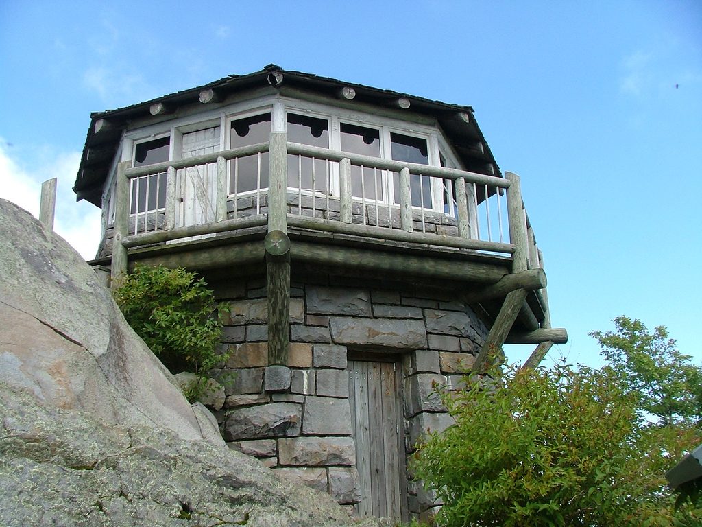
Mount Cammerer is a hard climb with a great payoff: a 1939 stone-and-wood fire tower on a bare ridge, with panoramic views from the platform. Turning it into an overnight takes some planning, because the overnight options are limited.
The hike
Start from the Low Gap Trailhead near Cosby Campground and climb up the Low Gap Trail, following Cosby Creek, to the Appalachian Trail at Low Gap. Sources put that climb at roughly 2.5 to 2.9 miles. Hikers describe the first three miles as almost all uphill, and most of the elevation gain happens there. When you hit the AT the trail levels out, with some views west into Cosby and east toward Mount Sterling.
Turn left and follow the AT for a little over two miles to a side trail that runs about 0.6 miles to the summit and the tower.
The tower is the reason to come. The Civilian Conservation Corps completed it in 1939 after two years of construction, and it was first called White Rock Lookout Tower. One writer notes that its squat design looks nothing like the steel tower on nearby Mount Sterling and instead mimics lookouts in the American West. It’s named for Arno Cammerer, the National Park Service director when the park was formed. Technology eventually made fire lookouts obsolete, and the tower was restored in the 1990s in what one hiking club calls the first project of the group that became Friends of the Smokies.
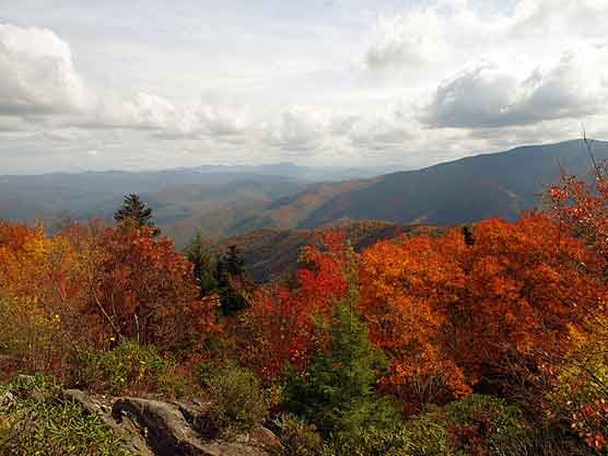
The tower’s upper level is an enclosed octagonal room reached through an unlocked wooden door, and a plaque below tells the story of its construction. One hiking site describes 360-degree views into East Tennessee and the North Carolina Smokies from both the tower and the summit. One travel site says you can see about 60 miles to the Cumberland Escarpment on a clear day, and that the surrounding peaks show how the Greenbrier Thrust Fault pushed up the sandstone. One reference source mentions Mount Guyot as the dominant peak in the view. The hiking club says people often debate whether this is the best view in the park.
Loops are an option. You can go up Low Gap and down the Lower Mount Cammerer Trail, or reverse it, for a loop of about 15 to 17 miles depending on where you start. One reference source lists the Lower Mount Cammerer Trail at 7.4 miles from Cosby Campground to the AT, with sections that can be overgrown. The round trip from Cosby to the tower via Low Gap is about 11 miles, with roughly 3,150 feet of climbing.
If you enjoy fire towers, Cammerer is one of three that hikers can still climb in the Smokies, along with Mount Sterling and Shuckstack. The same hiking club says the 60-foot steel tower on Mount Sterling stands at the highest elevation of any true fire tower left in the eastern United States.
Tips
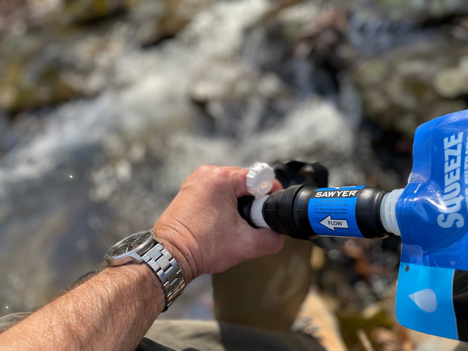
- Water is scarce on the ridge. One guide notes that sources on the AT up to the summit are hard to find, especially late in the season. Carry enough for the climb.
- Camp choices are limited, so reserve early and plan your mileage around them.
- Check trail and campground conditions. The Cosby area has limited parking.
- Leave the dog at home. Dogs aren’t allowed on this trail.
Camping
Three overnight options are commonly used. Gilliland Creek, backcountry campsite #35, is reachable in a long day of about 13 miles if you summit first, and is under 4 miles from the trailhead. Davenport Gap Shelter is an AT shelter with bunks for 12, about 100 yards off the trail, and adds a detour of about 2 miles each way. Cosby Knob Shelter, also with 12 bunks and a spring nearby, sits on the AT near Low Gap; as of Oct. 15, 2026, the park listed it as closed because of bear activity (see the notice). All overnight camping in the Smokies backcountry requires a permit and an online reservation, and shelter stays are limited to one night.
Inside Intel: Hikers who’ve done the loop describe campsite #35 as large, picturesque, and tranquil, and it works as the overnight for either loop. A three-day version splits it up: about 9 miles to Davenport Gap Shelter on day one, then a little over 6 miles to Gilliland Creek on day two, with a walk of under 4 miles out on day three. You may also meet thru-hikers along the AT stretch.
Trail facts
- Distance: About 11.2 miles round trip to the tower via Low Gap. Loops run roughly 15 to 17 miles.
- Route type: Out and back, or loop
- Difficulty: Strenuous
- Elevation: Roughly 3,150 feet of gain to the tower (guides).
- Campsites: Gilliland Creek (#35); Davenport Gap Shelter (12 bunks); Cosby Knob Shelter (12 bunks, spring nearby; closed for bear activity as of Oct. 15, 2026)
- Water: Scarce on the ridge, especially late in the season. Treat all water.
- Permits: Required for every overnight. Reserve online; check the park’s site for current fees and booking window.
- Bear storage: Cables at shelters and campsites. Use them.
- Dogs: Not allowed
- Trailhead: Low Gap Trailhead, Cosby Campground area, near Cosby, TN
- Last verified: October 17, 2026
Have a great pic of this trail? Post it to Instagram and tag us, and we might use it on the site.
More Lowdown from Backpack Trail Guide

Where this comes from
This page draws on the sources below, along with other guides and trip reports. Links go to the original pages.
Before you go: This page is based on published trail guides, trip reports, and reviews, along with official park and agency information where we could find it. It’s meant to help backpackers discover new trails, not to replace current, official information. Conditions, closures, permits, campsites, and water sources change, and some details here may be out of date or wrong. Confirm everything with the managing agency and check current conditions before you head out, and don’t rely on this page alone for safety or navigation. Backcountry travel involves risk.