
Trails / Tennessee / Great Smoky Mountains
Spence Field and Rocky Top via Anthony Creek and Bote Mountain
Great Smoky Mountains National Park (Cades Cove area)
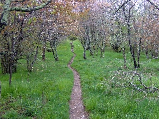
This is the classic Cades Cove climb to the crest of the Smokies: rhododendron tunnels, a high grassy meadow, and wide views along the Appalachian Trail. It’s a hard first day, but you spend the night in a part of the park that feels far from the crowds at the bottom.
The hike
The route starts at the Anthony Creek Trailhead, at the far end of the Cades Cove picnic area near the campground. Anthony Creek Trail follows the creek, crossing it on bridges and footlogs, and climbs at a steady grade. About 1.6 miles in, stay left toward Bote Mountain Trail. Campsite #9 comes at roughly three miles, and the Bote Mountain junction follows at about 3.5 miles. If you’d rather save some distance, the Lead Cove Trail is the shorter approach. It starts on Laurel Creek Road and, according to one reference source, bypasses the first four miles of Bote Mountain Trail. One guide puts the round trip at about 12.2 miles that way, against 13.2 via Anthony Creek.
Then the work begins. After the Anthony Creek junction, the climb on Bote Mountain Trail continues through a former road turnaround and runs steadily south before a switchback marks the final approach to the Appalachian Trail. It’s a steep and rocky 1.7 miles that gains roughly 1,000 feet. At the top, a sign marks the AT, and Spence Field is about a quarter mile to the left.
Spence Field sits at about 4,920 feet and spreads across roughly 200 acres, according to the same reference. In the early 1900s it was the center of a 24-mile pasture stretching from Silers to Gregory Bald, and today much of it has grown over, though one guide says the best spot for hikers is between the trail junctions along the AT. The field is a crossroads: the AT crosses it east to west, the Bote Mountain Trail comes up from the north, and the Eagle Creek Trail comes up from the south and links to the Benton MacKaye Trail and Fontana Lake. Views open toward Rocky Top and Thunderhead Mountain, and south over a long line of peaks.
Rocky Top is about a mile farther along the AT, a strenuous climb of roughly 500 feet. At 5,441 feet, it’s where one regional magazine says the spectacular views are, rather than on Thunderhead itself: Kuwohi, Mount LeConte, Cades Cove, Gregory Bald, Shuckstack, the Eagle Creek watershed, and a sliver of Fontana Lake. It isn’t the highest point of Thunderhead Mountain. That summit is another 0.4 to 0.75 miles along the AT, depending on the source, and one guide says tall brush makes its views lackluster.
Many people speculate that Rocky Top inspired the song by Felice and Boudleaux Bryant, written in Gatlinburg in 1967, which is now an official Tennessee state song. A town in Tennessee, formerly called Lake City, took the name Rocky Top in 2014. If you’re camped at Spence Field, the peak is an easy morning walk without your pack.
For another grassy bald, see our Gregory Bald guide. The park maintains only two grassy balds, Gregory and Andrews.
Tips
- Park carefully. The trailhead has a few spots, but the picnic area closes at dusk, so if you arrive late you may need to park about half a mile away at the campground lot.
- Bring trekking poles. The descent down Bote Mountain is steep.
- Hang everything. One reviewer warns about mice at the Spence Field Shelter, in addition to bears, and suggests hanging your whole pack, not just your food.
- Leave the dog at home. Dogs aren’t allowed on this trail.
Camping
Options along the route are backcountry campsites #9 (Anthony Creek) and #10 (on the Russell Field Trail), Spence Field Shelter, and, if you loop, Russell Field Shelter and Mollies Ridge Shelter. Every overnight in the Smokies backcountry requires a permit and reservation through the online reservation site, and shelter stays are limited to one night. Campsite #9 has bear cables and water from Anthony Creek at the back of the site, and it sits on a slope with room for two or three tents, so arrive early to get a good spot.
Inside Intel: Hikers say Spence Field’s best views are not where the shelter is. The open meadow with the Rocky Top views lies about a quarter mile in the other direction along the AT, so walk there for the views. Leave your pack hanging at the shelter before the Rocky Top climb, which is short but steep. For the route in, opinions split: some prefer the longer Anthony Creek Trail because the first couple of miles are gentler, while others like Lead Cove, the shorter and steeper way up, and note the round trip is about a mile shorter. If you loop back via Russell Field, guides say the views from the two shelters are not the highlight, so treat them as rest stops.
Trail facts
- Distance: About 13 miles round trip to Spence Field via Anthony Creek (about 12 via Lead Cove). The Spence Field and Russell Field loop is about 13 miles.
- Route type: Out and back, or loop
- Difficulty: Strenuous
- Elevation: Bote Mountain climbs roughly 1,000 feet in 1.7 miles. Spence Field is about 4,920 feet.
- Campsites: #9 (Anthony Creek), #10 (Leadbetter Ridge), Spence Field Shelter, Russell Field Shelter, Mollies Ridge Shelter
- Water: Plenty on the loop, but check the stream near the Spence Field Shelter, which can run low. Treat all water.
- Permits: Required for every overnight. Reserve online; check the park’s site for current fees and booking window.
- Bear storage: Cables at campsites and shelters. Use them.
- Dogs: Not allowed
- Trailhead: Anthony Creek Trailhead, Cades Cove picnic area, near Townsend, TN
- Last verified: September 23, 2026
Have a great pic of this trail? Post it to Instagram and tag us, and we might use it on the site.
More Lowdown from Backpack Trail Guide
Where this comes from
This page draws on the sources below, along with other guides and trip reports. Links go to the original pages.
Before you go: This page is based on published trail guides, trip reports, and reviews, along with official park and agency information where we could find it. It’s meant to help backpackers discover new trails, not to replace current, official information. Conditions, closures, permits, campsites, and water sources change, and some details here may be out of date or wrong. Confirm everything with the managing agency and check current conditions before you head out, and don’t rely on this page alone for safety or navigation. Backcountry travel involves risk.