
Trails / Tennessee / Cumberland Trail and Frozen Head
Frozen Head State Park Backcountry
Frozen Head State Park, Cumberland Mountains (Morgan County)
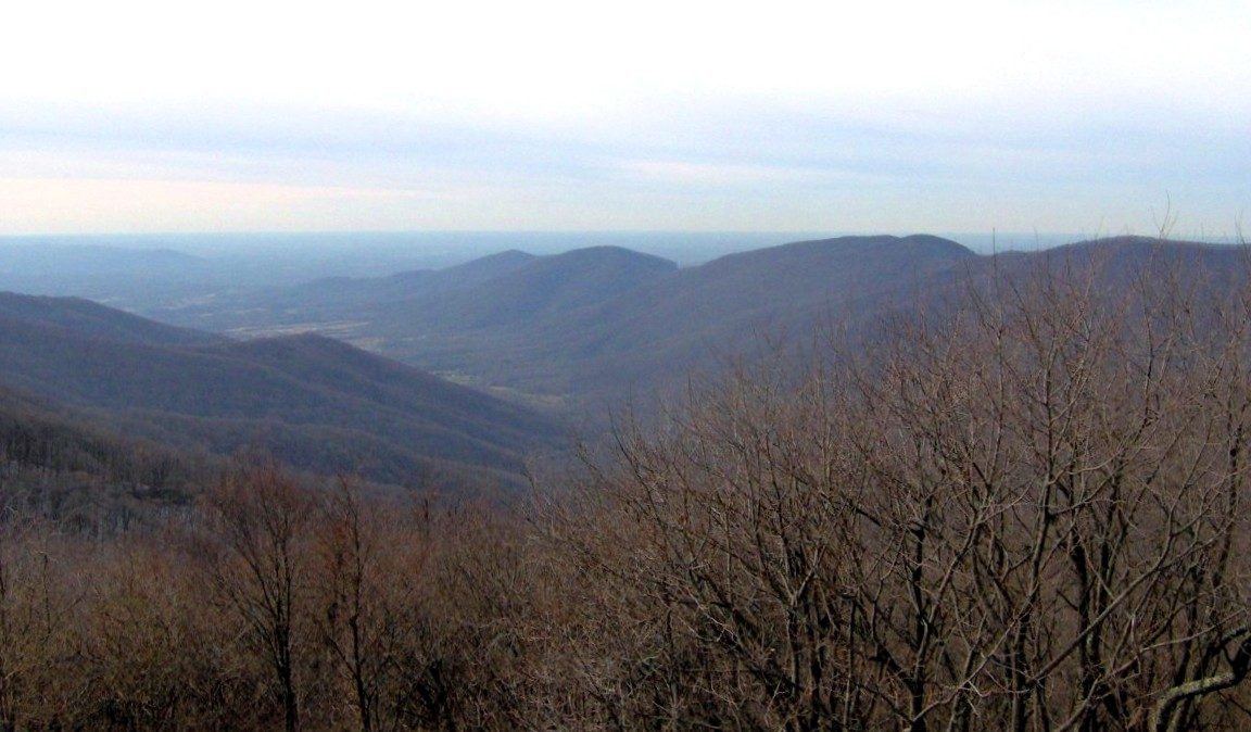
Frozen Head is a rugged wilderness park: more than 24,000 acres of steep ridges and remote hollows in the Cumberland Mountains, named for a 3,324-foot peak often coated in ice in winter. Its backcountry has a system of designated campsites, but at the moment this park is a “check first” destination.
The hike
The most important fact about hiking Frozen Head right now is what’s open. The park says, on a page updated in August 2026, that the only accessible trail is the Chimney Top Trail behind the Visitor Center, which it calls strenuous, with significant elevation gain and up to 14 miles. What follows describes the park’s trails as the state and other guides describe them, not what you can walk today, so call the park before you plan anything.
The Lookout Tower on top of Frozen Head is the signature climb. The state says it offers a 360-degree view of the Cumberland Mountains and the Flat Fork Valley. One local outfitter describes a seven-mile trip on the Lookout Tower Trail from Big Cove to the observation deck, with views of the Smokies, the Tennessee Valley, Walden Ridge, and the Cumberland Plateau, and says in winter you may see the icy peaks that give the park its name. A local hiking guide from January 2026 says the East Lookout Tower Trail from Armes Gap is the shortest and least strenuous route, gaining about 1,200 feet against about 1,800 feet on the West Lookout Trail. It describes the east route as an old logging road used as a fire road, wide and gravel. From it you can detour to the Old Prison Mine Trail, which leads to the coal mine that Brushy Mountain prisoners once worked.
That history runs deep here. The state says it bought the land in the late 1800s for the Brushy Mountain State Penitentiary and used it for coal mining. Part of it later became Morgan State Forest, until 1970, and remnants of a Civilian Conservation Corps camp remain. The four principal peaks are Frozen Head, Old Mac, Chimney Top, and Bird Mountain, according to a regional travel guide, and the state says the Bird Mountain, Lookout Tower, and Chimney Top trails offer ridge-top views.
The Spicewood Branch Trail is a spur off the Old Mac Trail that skirts Spicewood Branch Creek before climbing Frozen Head, according to the state. One trail app says the Chimney Top route via Spicewood Branch peaks for wildflowers from April through early May. One reviewer’s loop went out on North Old Mac to the tower and back by Spicewood to Judge Branch, and noticed a patch of dwarf crested iris at the Tub Springs campsite.
Waterfalls are close to the road. The state lists Debord Falls at 12 feet and Emory Gap Falls at 25 feet and says you can wade or swim below them. The regional travel guide calls Emory Gap Falls, reached by a short trail from Flat Fork Road, the most popular, a seasonal cascade that runs full in spring and after heavy rain. The park is also the home of the Barkley Marathons, which the outfitter says began in 1986.
Sources describe roughly 50 miles of backpacking trails, and the trail app lists about 80 miles of trails in all. The local hiking guide says rangers expect you to be off the trail, at your car or your campsite, an hour before sunset.
Tips
- Call before you drive. The park has been restoring facilities in stages, and closures may still apply.
- Never hike after dark. The park prohibits it, so allow plenty of daylight to reach your site.
- Check the fire index. It’s posted at the Visitor Center parking lot. Levels 1 and 2 allow backcountry fires, and levels 3 to 5 don’t.
- Keep your reservation receipt on the dash. A paper copy or your name and site must be on the dash of any car parked overnight.
Camping
The park has designated backcountry campsites, nine according to the state, four of them group sites. Hiking is required to reach each one, and every site has a fire ring. The state says your reservation receipt is your permit, and advises reserving early. Water must be filtered from natural sources or carried in, and not all sites have a dependable source. Campfires must use heat-treated wood or downed wood collected inside the park near the campsite.
A 2017 state announcement lists several regular sites by name: Bird Mountain, Coffin Springs, North Old Mac, Panther Branch, Panther Gap Rock House, and Spicewood, plus group sites Judge Branch, Mart Fields, Squire Knob, and Tub Springs. That’s ten names, which doesn’t match the state’s current count of nine, so confirm the current list.
Inside Intel: Our sources describe the sites but don’t rank them, so we won’t pick a favorite. One practical tip from the state: site mileages appear with each site’s description on the reservation page, so you can match the walk to your day before you book. Ask the park which sites are available now.
Trail facts
- Distance: Chimney Top Trail is listed at up to 14 miles (the only trail reported open at last check)
- Route type: Varies; backcountry sites are reached by trail
- Difficulty: Strenuous
- Campsites: Nine designated backcountry sites (four group sites), per the state. Names above are from 2017.
- Water: Filter from natural sources or carry it in. Not all sites have a dependable source.
- Permits: Reservation required through the park; your receipt is your permit.
- Rules: No hiking after dark. Fires by fire-index level. Heat-treated or downed wood only.
- Trailhead: Visitor Center area (Chimney Top Trail); other trailheads may be closed
- Last verified: October 17, 2026
Have a great pic of this trail? Post it to Instagram and tag us, and we might use it on the site.
More Lowdown from Backpack Trail Guide
Where this comes from
This page draws on the sources below, along with other guides and trip reports. Links go to the original pages.
- Tennessee State Parks: Frozen Head State Park
- Tennessee State Parks: Frozen Head reservations (closure notice)
- Knox TN Today: Get Out and Play at Frozen Head State Park
Before you go: This page is based on published trail guides, trip reports, and reviews, along with official park and agency information where we could find it. It’s meant to help backpackers discover new trails, not to replace current, official information. Conditions, closures, permits, campsites, and water sources change, and some details here may be out of date or wrong. Confirm everything with the managing agency and check current conditions before you head out, and don’t rely on this page alone for safety or navigation. Backcountry travel involves risk.