
Trails / Tennessee / Cumberland Plateau
Fiery Gizzard Trail (Grundy Forest to Foster Falls)
Fiery Gizzard / South Cumberland, Cumberland Plateau
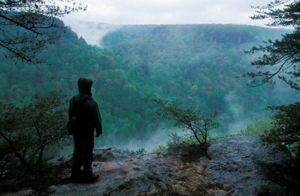
The Gizz has a reputation, and it earns it. A national backpacking magazine has ranked it among the top hiking trails in the country, and the 12.5-mile route between Tracy City and Foster Falls is known for waterfalls, rocky gorges, old hemlocks, and swimming holes. It’s a hard two-day trip and a satisfying one.
The hike
The classic start is the Grundy Forest Day Loop trailhead, which a lodging blog says has a parking lot and restrooms, and the loop begins at the picnic shelter. One reference source reports a 20-foot waterfall after just 500 feet, the remains of Civilian Conservation Corps Camp S-67 about half a mile on, and three swimming holes, two of them with waterfalls. Hanes Hole Falls sits on the loop’s western half and Blue Hole Falls on the eastern half, and the same source describes Blue Hole as about 7 feet deep with a 9-foot waterfall. The Fiery Gizzard Trail joins roughly midway around the loop.
At the bridge junction, about 0.7 miles in by hiking guides and 0.9 by the park’s map, you cross Little Fiery Gizzard Creek and stay on the Fiery Gizzard Trail. Just past the bridge, Little and Big Fiery Gizzard Creeks merge and are squeezed through Black Canyon, named for the organic stain on its rock. A hiking blog says pink lady’s slippers bloom near the confluence in mid-May. Chimney Rock, a 20-foot column by one reference source’s count, comes about a mile in, and a blue-blazed spur near 1.2 miles leads to Sycamore Falls, which the park map lists at 12 feet and one guide at 15. One gear brand’s guide calls the top of the falls a great place for a snack.
Around 1.5 to 1.7 miles in, depending on the source, the Dog Hole Trail branches off. A guide calls it an easier route up the mountain, and one reviewer says the most scenic stretch is the 1.7 miles from the trailhead to that junction. Farther along, the park map notes Anderson Creek Ford, with 80-foot, double-drop Anderson Falls just downstream.
One guide puts the start of the climb to Raven Point at about 3.7 miles. One reference source quotes the park map as calling it possibly one of the most rugged and difficult trails in Tennessee, with a spur of roughly half a mile to a spectacular overlook. A lodging blog says the overlook is consistently described as one of the best views on the Cumberland Plateau. The Raven Point campsite is closed, so the overlook is a stop, not a place to sleep.
From there the trail follows the flatter plateau top, with one hard exception. The park map, as quoted in one reference source, describes a precarious 0.3-mile dip into Laurel Branch Gorge that drops about 200 feet each way across rocks that seem to move as you step on them. The route ends at Foster Falls, which one trail guide lists at 60 feet and describes as popular for rock climbing and for viewing the waterfall.
The name has more than one story. One trail guide says the creek was named for the gizzard shad that once lived in it, while a reference source records legends involving Davy Crockett and a burned tongue, and a chief’s turkey gizzard thrown on a fire. Nearby, Greeter Falls is covered in our Savage Gulf West Loop guide.
About half of the trail crosses private property, and much of the rim trail will stay private. Stay on the marked trail and follow the posted signs.
Tips
- Think about direction. One hiker who went from Foster Falls north said that direction lets you descend the steepest sections.
- Water flows vary. One reviewer saw little flow at the falls in dry conditions, so don’t plan around waterfalls being at their best.
- Don’t hike after dark. The park prohibits it, and at several campgrounds you must arrive by dark.
- Stay on the trail. The park bans shortcuts and off-trail hiking, and most of the rim trail is on private land.
Camping
Overnight camping is by online reservation through the state park system, in designated campgrounds only. The state park lists backcountry campgrounds along the trail system, and all of them require a hike in and water carried or filtered from a natural source. Fires are allowed in established fire rings only. According to a park support group, Father Adamz Campground has 9 sites and sits about 0.4 miles from the Foster Falls lot, with water at the parking lot. Small Wild Campground has 6 sites, 2.5 miles from Foster Falls. Grundy Forest Campground has five sites plus a group site, about 0.6 to 0.75 miles from the Grundy Forest lot, with water at the lot. Little Cove sits farther along, roughly 5 or 6 miles from the Foster Falls end, and has a group campsite.
Do not camp at Raven’s Point. It was long the most popular site on the trail, but it’s on private land, the park has closed it indefinitely, and camping there is illegal. Old guides and some reviews still mention it.
Inside Intel: One hiker who did it in two days started at Foster Falls, camped at Little Cove, and finished at the north trailhead, and recommended that direction for descending the steeper sections. If you want a gentler first night, Father Adamz and Small Wild are close to the Foster Falls end. The trail has many places to swim, which is worth planning around in warm months.
Trail facts
- Distance: 12.5 miles one way (Tracy City / Grundy Forest to Foster Falls)
- Route type: Point to point. Needs a shuttle, or two cars.
- Difficulty: Strenuous
- Campsites: Father Adamz (9 sites); Small Wild (6 sites); Grundy Forest (5 sites plus group); Little Cove (with group site). Raven’s Point is closed.
- Water: Carry it in or filter it from a natural source. Water is available at the Grundy Forest and Foster Falls parking lots.
- Permits: Reservation required through the state park system. Arrive at your campground before dark.
- Trailheads: Grundy Forest (north, near Tracy City) and Foster Falls (south)
- Last verified: September 23, 2026
Have a great pic of this trail? Post it to Instagram and tag us, and we might use it on the site.
More Lowdown from Backpack Trail Guide
Where this comes from
This page draws on the sources below, along with other guides and trip reports. Links go to the original pages.
- Wikipedia: Fiery Gizzard Trail
- Wikipedia: South Cumberland State Park
- Southeast Tennessee tourism: Hike to Raven Point
- Friends of South Cumberland: overnight hikes
Before you go: This page is based on published trail guides, trip reports, and reviews, along with official park and agency information where we could find it. It’s meant to help backpackers discover new trails, not to replace current, official information. Conditions, closures, permits, campsites, and water sources change, and some details here may be out of date or wrong. Confirm everything with the managing agency and check current conditions before you head out, and don’t rely on this page alone for safety or navigation. Backcountry travel involves risk.