
Trails / Tennessee / Cumberland Plateau
Savage Gulf East Loop: Hobbs Cabin, Sawmill, Horsepound Falls, and Suter Falls
Savage Gulf State Park, Cumberland Plateau (Grundy and Sequatchie counties)
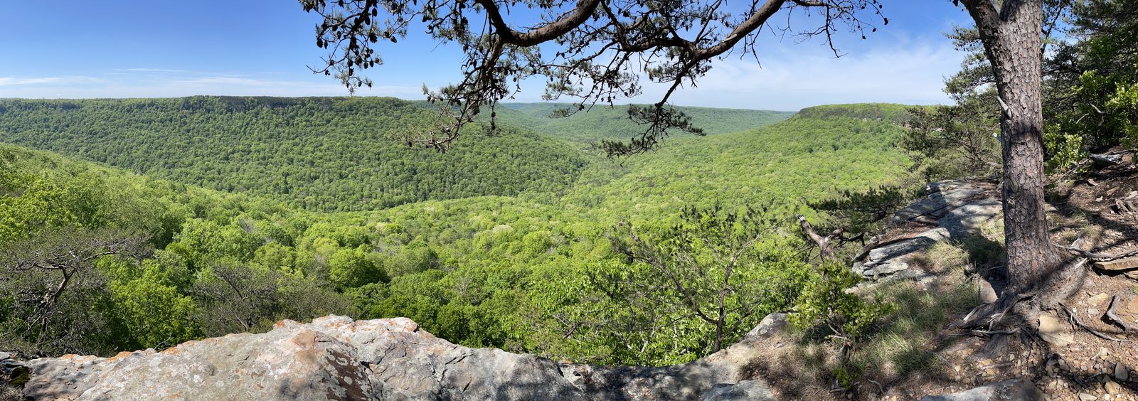
Savage Gulf is a wilderness cut into the western edge of the Cumberland Plateau, and Tennessee State Parks describes it as one of the state’s most scenic, with sheer sandstone cliffs, rugged canyons, and waterfalls. The east loop is the big circuit: a multi-day trip that links a rustic cabin, a campground beside the Collins Gulf Trail, and two of the park’s best waterfalls. It’s hard going, with rocky trail, creek fords, and steep climbs.
The hike
The loop starts at the Savage Gulf East trailhead beside the Savage Ranger Station, and the first stretch is the gentle part. The Savage Day Loop crosses a suspension bridge about 0.4 miles in, and at roughly a mile you reach the loop junction. One guide says the South Rim Trail leaves the loop soon after, and about half a mile beyond, past a second suspension bridge, Savage Falls appears on the right, with a long wooden staircase down to the pool at its base. The Friends of the Parks call the Savage Day Loop an easy 4.2-mile round trip built around Savage Falls and the rock cascades just above it.
From the Savage Day Loop, the North Rim Trail carries you to Hobbs Cabin, which the state puts at 8.5 miles from the East lot via the Savage Day Loop and North Rim trails. The stretch near the cabin includes a steep set of switchbacks. One AllTrails reviewer chose to hike the loop counterclockwise so as to climb those switchbacks instead of descending them, and suggests waiting for dry conditions before tackling them.
A Connector Trail links Hobbs Cabin to Sawmill Campground, and the park’s trail map shows the junction just before you reach the campground. Sawmill sits on the Collins Gulf Trail, which leads to the waterfalls. Backpackcamp calls that trail long and difficult: the gulf section is rocky and needs several creek fords, and it can be hard to pass in high water, while the rim section has overlooks above the gulf below.
Heading from Sawmill toward Collins West, the park’s trail map lists a run of landmarks. A faint old jeep road leads across the river and up to an 80-foot bluff with Schwoon Cave, a spring, and a 30-foot sinkhole. You cross Trumpet Creeper Ford, the normally dry bed of the Collins River, and later a ford of the Collins River itself, which the map says is impassable in high water. Fall Creek disappears into a cave along the way. A spur trail leads down to Horsepound Falls and its sink, which the Friends of the Parks describe as a unique waterfall formation with overlooks and lush spring wildflowers. Suter Falls comes early on the trail from Collins West: a triple waterfall on Rocky Mountain Creek beneath a huge overhang, with a metal bridge. The Friends put Horsepound about two miles past Suter Falls.
To close the loop you climb out of the gulf. The park lists the Collins Rim Trail at 6.1 miles, calls it difficult, and says it follows the plateau edge on the east side of the Collins River gulf. From the rim, the South Rim Trail carries you back toward the ranger station. One forum planner estimated about 7.2 miles from the Collins West lot to Stagecoach Road Campground by that route.
If you like this country, one poster on a backpacking forum named the Collins Gulf Trail their favorite in the park, though they added that they hike the North Rim most often. For the other side of the gorge, see the Savage Gulf West Loop.
Tips
- Check the fords before you commit. The park map says the Collins River ford is impassable in high water, and Backpackcamp warns the Collins Gulf Trail can be hard to pass when water is high.
- Plan your water. The springs at Hobbs Cabin and Stagecoach Road may be dry, and Sawmill draws from Schwoon Spring.
- Don’t hike after dark. The park prohibits it, so plan each day’s mileage around daylight.
- Think about direction. A reviewer who went counterclockwise preferred climbing the steep switchbacks near Hobbs Cabin to descending them.
- Budget more time than you think. One reviewer did the 26-plus-mile loop in two days by camping at Sawmill and starting at 4:30 a.m. on the second day, and said they had 15 miles left when they thought they were halfway.
- Don’t jump from the waterfalls. Tennessee State Parks says jumping from waterfalls is strictly prohibited.
Camping
Camping is by online reservation through Tennessee State Parks, in designated campgrounds only. On or near this loop:
- Savage Station: seven sites plus a group site, a few hundred yards from the East lot, with potable water at the entrance.
- Savage Falls: 8 sites on the South Rim Trail, 1.8 miles from the ranger station (Friends of the Parks).
- Hobbs Cabin: seven sites, a group site, and the cabin, 8.5 miles from the East lot. There is a spring behind the cabin, and it may be dry.
- Sawmill: eight sites, 4.2 miles from the Collins West lot. Water comes from Schwoon Spring.
- Stagecoach Road: 10 sites, 6 miles from the ranger station, with a spring about 100 yards west that may be dry (Friends of the Parks).
Hobbs Cabin is a primitive shelter with six wood bunks, a wood-burning fireplace, a picnic table, and a fire ring. Tents and hammocks are prohibited around it, and there is no vehicle access.
Inside Intel: Hobbs Cabin is the most unusual place to stay on the loop, and because tents are barred around it, it’s the cabin or the next campground. At Sawmill, an AllTrails reviewer found the sites spread out and private, with the ones near the entrance getting more sun and the ones near the back shaded. Sawmill is also reachable from the Stone Door side, 5.0 miles by the state’s count via the Stone Door, Big Creek Gulf, and Connector trails.
Trail facts
- Distance: About 26 miles for the full loop (AllTrails lists it as 26-plus miles)
- Route type: Loop, multi-day
- Difficulty: Hard
- Campsites: Savage Station, Savage Falls, Hobbs Cabin, Sawmill, Stagecoach Road (see above)
- Water: Springs at several camps that may be dry; potable water at the Savage Station entrance. Filter all natural water.
- Permits: Reservation required through Tennessee State Parks
- Rules: Marked trails only; no hiking after dark; fires in established rings only
- Trailhead: Savage Gulf East lot, Savage Ranger Station (the park’s own name for this parking area)
- Last verified: September 28, 2026
Where this comes from
This page draws on the sources below, along with other guides and trip reports. Links go to the original pages.
- Tennessee Department of Environment and Conservation: Savage Gulf State Natural Area
- Friends of South Cumberland: Savage Gulf State Park
- Friends of South Cumberland: trailhead and trail information
- Friends of South Cumberland: overnight hikes
Before you go: This page is based on published trail guides, trip reports, and reviews, along with official park and agency information where we could find it. It’s meant to help backpackers discover new trails, not to replace current, official information. Conditions, closures, permits, campsites, and water sources change, and some details here may be out of date or wrong. Confirm everything with the managing agency and check current conditions before you head out, and don’t rely on this page alone for safety or navigation. Backcountry travel involves risk.