
Trails / Georgia / North Georgia Mountains
Appalachian Trail: Woody Gap to Unicoi Gap (Blood Mountain and Neels Gap)
Chattahoochee National Forest and Blood Mountain Wilderness (GA 60 to GA 75, near Dahlonega and Blairsville)
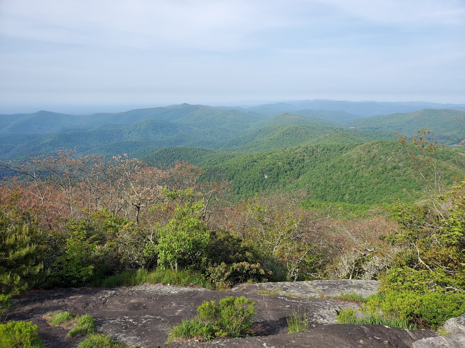
This section of the Georgia Appalachian Trail includes what Wikipedia calls perhaps its most hiked segment. It runs over Big Cedar Mountain, past Preachers Rock, and up Blood Mountain, at 4,442 feet the highest point on the AT in Georgia, according to the Georgia Appalachian Trail Club. Then it drops to Neels Gap, where the trail passes right through the stone breezeway of Mountain Crossings, an outfitter and hostel. From there, it rolls over Cowrock and Blue Mountain to Unicoi Gap.
The Blood Mountain area has special rules in spring, and it’s one of the busiest stretches of trail in the state.
The hike
Woody Gap, on Georgia Highway 60, is at mile 20.1 on the Georgia AT map. Atlanta Trails describes the first miles north: climbing to Preachers Rock on Big Cedar Mountain, passing a campsite at 1.45 miles, then descending through a fern-filled forest with large campsites around 2.6 and 3 miles, where the Dockery Lake Trail joins. The trail crosses a spring just before Jarrard Gap, about 5.8 miles from Woody Gap.
Jarrard Gap marks the start of the Blood Mountain rules. The GATC says a Forest Service camping restriction applies from Jarrard Gap to Neel Gap between March 1 and June 1, with bear canisters required during that period because of increased bear activity. Atlanta Trails adds that campfires are prohibited on the AT from Jarrard Gap to Neel Gap because of heavy campsite use near Blood Mountain.
The GATC lists the Woods Hole Shelter, 0.4 mile west on a side trail, then the summit of Blood Mountain with its stone shelter and privy. Wikipedia calls the Blood Mountain approach perhaps the most hiked segment of the AT in Georgia. The GATC FAQ names Blood and Cowrock among the few exposed rock summits with the best views on the Georgia AT.
Neels Gap comes next, and with it Mountain Crossings. Fox 5 Atlanta says the outfitter occupies the Walasi-Yi Interpretive Center, a stone building the Civilian Conservation Corps began building in 1934 as a dining and dance hall, which became Mountain Crossings in 1983. It describes the store as an outfitter, gift shop, and hostel, and notes the AT runs right through the building, its only covered stretch. The GATC says the Walasi-Yi Center has hiker supplies, equipment, and a hostel available first come, first served. Wikipedia says it’s the first mail drop for northbound thru-hikers that doesn’t require leaving the trail, and that hostel bunks are at a premium in early spring. CNY Hiking mentions supplies, stove fuel, showers, and coin laundry.
North of Neels Gap, CNY Hiking says the trail crosses Wolf Laurel Top, Cowrock, Wildcat Mountain, Poor Mountain, and Blue Mountain on its way to Unicoi Gap, 20.8 miles, with three shelters and four campsites. It describes the steep 1.2-mile side trail to the Whitley Gap Shelter, built in 1974, and the Low Gap Shelter, built in 1953. The Georgia AT map shows Tesnatee Gap at 36.2, Low Gap Shelter at 41.5, Chattahoochee Gap at 46.5, Blue Mountain Shelter at 48.7, and Unicoi Gap, on Georgia Highway 75, at 50.9.
Explore Georgia suggests shorter options: Woody Gap to the Byron Reece Trail parking area, about 10.5 miles, or Woody Gap to Hogpen Gap, about 17 miles.
For the section south, see Amicalola Falls to Woody Gap. Heading north, see Unicoi Gap to Bly Gap.
Tips
- Carry a bear canister from March through May. It’s required from Jarrard Gap to Neel Gap between March 1 and June 1.
- Check fire rules near Blood Mountain. Atlanta Trails says campfires are prohibited between Jarrard Gap and Neel Gap, but the Forest Service lists its campfire order for this stretch as running July 25, 2013 through July 25, 2025. Check current rules with the ranger district.
- Resupply at Mountain Crossings. The GATC lists supplies, equipment, and a first-come hostel.
- Expect spring crowds. Wikipedia says hostel bunks are at a premium in early spring.
- Start early for the best campsites. Atlanta Trails says sites are first come, first camp.
Camping
Camping on this section is at shelters and campsites. The GATC lists designated camping at Blood Mountain, and shelters at Woods Hole, Blood Mountain, Whitley Gap, Low Gap, and Blue Mountain. From March 1 to June 1, the Jarrard Gap to Neel Gap stretch has a Forest Service camping restriction and a bear canister requirement, and Atlanta Trails says campfires are prohibited there. Mountain Crossings’ hostel at Neels Gap is first come, first served.
Inside Intel: Plan your nights around the Blood Mountain zone. Atlanta Trails points to several large campsites between Woody Gap and Jarrard Gap, outside the restricted stretch, and says all campsites are first come, first camp. North of Neels Gap, CNY Hiking notes a campsite in Low Gap beside the Low Gap Shelter.
Trail facts
- Distance: About 30.8 miles, Woody Gap to Unicoi Gap
- Route type: Point to point
- Difficulty: Strenuous
- Elevation: Blood Mountain 4,442 feet, the AT’s high point in Georgia (GATC)
- Campsites: Woods Hole, Blood Mountain, Whitley Gap, Low Gap, and Blue Mountain shelters; campsites along the way
- Water: Springs and streams. Treat all water.
- Permits: None for the AT
- Food storage: Bear canister required Jarrard Gap to Neel Gap, March 1 to June 1
- Fires: Check current rules; the Forest Service lists its Jarrard Gap to Neel Gap campfire ban as ending July 25, 2025
- Resupply: Mountain Crossings at Neels Gap (outfitter and hostel)
- Trailheads: Woody Gap (GA 60); Neels Gap (US 19/129); Unicoi Gap (GA 75)
- Last verified: October 2, 2026
Where this comes from
This page draws on the sources below, along with other guides and trip reports. Links go to the original pages.
- Georgia Appalachian Trail Club: Trail Guide
- Georgia Appalachian Trail Club: Frequently Asked Questions
- Atlanta Trails: Woody Gap to Jarrard Gap
- CNY Hiking: AT in Georgia, Neel Gap to Unicoi Gap
- Wikipedia: Walasi-Yi Interpretive Center
- Wikipedia: Blood Mountain
- Fox 5 Atlanta: Mountain Crossings at Neel Gap
- Explore Georgia: Hiking the Appalachian Trail in Georgia
Before you go: This page is based on published trail guides, trip reports, and reviews, along with official park and agency information where we could find it. It’s meant to help backpackers discover new trails, not to replace current, official information. Conditions, closures, permits, campsites, and water sources change, and some details here may be out of date or wrong. Confirm everything with the managing agency and check current conditions before you head out, and don’t rely on this page alone for safety or navigation. Backcountry travel involves risk.