
Trails / Georgia / North Georgia Mountains
Appalachian Trail: Amicalola Falls to Woody Gap (Approach Trail and Springer Mountain)
Amicalola Falls State Park and Chattahoochee National Forest (Dawsonville to Suches)
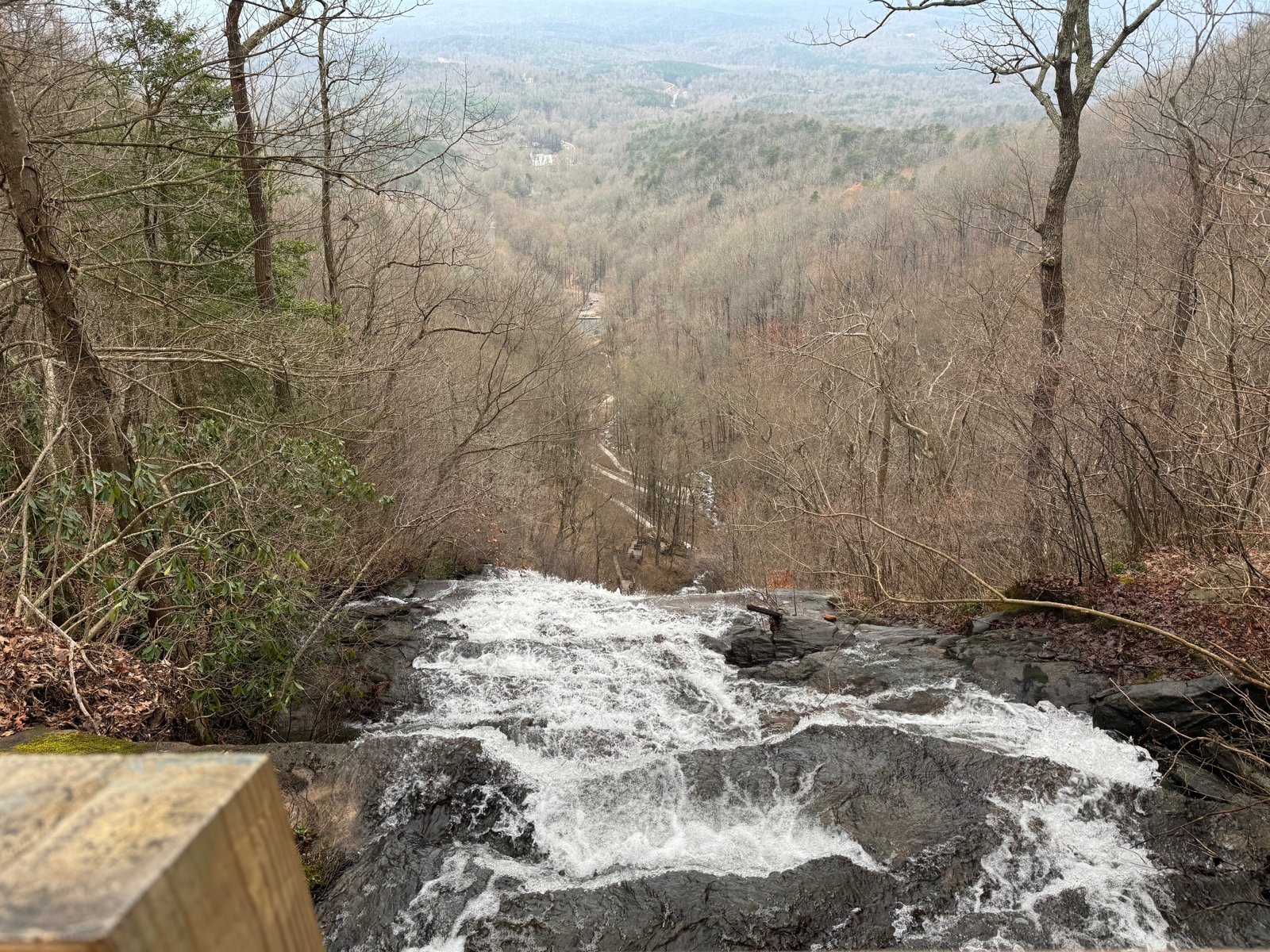
This is where the Appalachian Trail begins. From Amicalola Falls State Park, the blue-blazed Approach Trail climbs past Amicalola Falls to Springer Mountain, the AT’s southern terminus, and the white blazes head north toward Maine. This first section continues about 20 miles more through hardwood forest, past Long Creek Falls, Hawk Mountain, and Gooch Mountain, to Woody Gap.
It’s the classic start for thru-hikers, and the Georgia Appalachian Trail Club’s sample itinerary spends its first three days on this stretch.
The hike
The Georgia Appalachian Trail Club says the Approach Trail, officially the Southern Terminus Access Trail, begins behind the Amicalola Falls State Park Visitor Center and runs 8.8 blue-blazed miles. It follows the Base of the Falls Trail up to the top of Amicalola Falls, crosses the lodge road, and climbs through the Amicalola Creek watershed. The GATC puts Frosty Mountain at mile 4.1 and Nimblewill Gap at mile 6.0, with several campsites and two shelters along the way.
Wikipedia says the Georgia Appalachian Trail Club moved the AT’s southern terminus from Mount Oglethorpe to Springer Mountain in 1958 and blazed the trail from the base of Amicalola Falls so hikers could reach the AT from a major highway. Explore Georgia suggests a relatively easy overnight by hiking out and back from Amicalola and camping at the Black Gap Shelter, about 6.2 miles into the Approach Trail. Wikipedia places Black Gap Shelter about 1.5 miles south of Springer’s summit. It also notes the Len Foote Hike Inn, a backcountry inn about a mile off the Approach Trail.
Springer Mountain, at 3,782 feet, is marked by a bronze plaque on a rock, according to the GATC. The Springer Mountain Shelter sits just off the trail with a privy, a reliable spring, and established tent sites nearby.
North of Springer, the AT descends through the forest. The Georgia AT map shows Stover Creek Shelter at mile 2.8 and Hightower Gap at 8.3. The GATC says the blue-blazed side trail to Long Creek Falls is 5.2 miles north of Springer. It lists the Hawk Mountain Campsites at mile 7.4, with tent pads, a privy, and water, and the Hawk Mountain Shelter at 8.1, with a privy and limited camping outside it.
The last stretch climbs past Gooch Mountain. The GATC lists the Gooch Mountain Shelter at mile 15.7, with a bear box, a privy, an excellent spring, and tent sites, and Gooch Gap at about 17, where Forest Service Road 42 leads 2.7 miles to Suches. The map puts Woody Gap, on Georgia Highway 60, at mile 20.1.
The GATC’s sample northbound itinerary covers this section in three days: Approach Trail to Springer, 8.8 miles; Springer to the Hawk Mountain campsites, 7.9; and Hawk to Gooch Mountain Shelter, 7.7, before continuing toward Woody Gap. It advises hikers of all experience levels to take it easy through Georgia while building fitness.
AllTrails says no permits are required for the Georgia AT, that overnight stays are at shelters and campsites, and that bear canisters are strongly recommended.
For the next section north, see Woody Gap to Unicoi Gap.
Tips
- Register at the Amicalola visitor center. AllTrails says hikers starting there should.
- Camp at designated sites when you can. The GATC urges using Hawk Mountain or previously used sites.
- Bring a bear canister. AllTrails strongly recommends one on the Georgia AT.
- Take it slow. The GATC advises easing into the miles in Georgia.
- See Long Creek Falls. It’s a short side trail north of Springer.
Camping
The GATC says tent spaces are available at every shelter on the Georgia AT and at designated camping areas, including Hawk Mountain on this section. It says dispersed camping is allowed in the national forest but urges hikers to use designated sites or spots others have already used. On this section, shelters include Black Gap, Springer Mountain, Stover Creek, Hawk Mountain, and Gooch Mountain.
Inside Intel: The Hawk Mountain Campsites are the GATC’s recommended camp, with tent pads, a privy, and water, and they make the second night of its sample itinerary. Gooch Mountain Shelter, the third night, has a bear box and an excellent spring. For a short overnight, Explore Georgia points to Black Gap Shelter on the Approach Trail.
Trail facts
- Distance: About 28.9 miles (8.8-mile Approach Trail plus about 20.1 miles to Woody Gap)
- Route type: Point to point
- Difficulty: Strenuous
- Elevation: Springer Mountain 3,782 feet
- Campsites: Black Gap, Springer Mountain, Stover Creek, Hawk Mountain, and Gooch Mountain shelters; Hawk Mountain Campsites
- Water: Springs and streams at shelters. Treat all water.
- Permits: None for the AT; register at the Amicalola visitor center
- Food storage: Bear canister strongly recommended
- Trailheads: Amicalola Falls State Park (Dawsonville); Woody Gap (GA 60, near Suches)
- Last verified: October 2, 2026
Where this comes from
This page draws on the sources below, along with other guides and trip reports. Links go to the original pages.
- Georgia Appalachian Trail Club: Trail Guide
- Georgia Appalachian Trail Club: Georgia AT Guide (PDF)
- Georgia Appalachian Trail Club: Frequently Asked Questions
- Explore Georgia: Hiking the Appalachian Trail in Georgia
- Wikipedia: Springer Mountain
- Wikipedia: Amicalola Falls State Park
- Appalachian Trail in Georgia map and profile (PDF)
- AllTrails: Appalachian Trail, Georgia
Before you go: This page is based on published trail guides, trip reports, and reviews, along with official park and agency information where we could find it. It’s meant to help backpackers discover new trails, not to replace current, official information. Conditions, closures, permits, campsites, and water sources change, and some details here may be out of date or wrong. Confirm everything with the managing agency and check current conditions before you head out, and don’t rely on this page alone for safety or navigation. Backcountry travel involves risk.