
Trails / Connecticut / Northwest Connecticut
Appalachian Trail: Great Falls, Rand's View, and Limestone Spring (US 7 to US 44)
Appalachian National Scenic Trail, northwestern Connecticut (Falls Village to Salisbury)
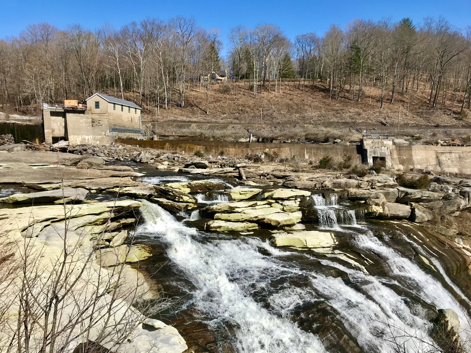
This stretch of the Connecticut Appalachian Trail runs from US 7 near Falls Village past the Great Falls of the Housatonic, over Prospect Mountain, and out to Rand’s View, a wide meadow overlook of the northern Berkshires. CNY Hiking calls Rand’s View one of the best viewpoints along the trail, with a panorama of the Taconic Range from Bear Mountain to Jug End and, on clear days, Mount Greylock.
There’s only one place to camp in these 10.3 miles: the Limestone Spring Shelter, down a steep side trail.
The hike
CNY Hiking says the section starts where the AT crosses US 7 just south of the junction with CT 112, with some shoulder parking there. The trail crosses US 7 and walks beside a cornfield near the Housatonic River. At 0.6 mile it reaches US 7 again and follows the road across the Housatonic River bridge, turning left after 300 feet onto Warren Turnpike.
The river walk is a favorite. The AMC Outdoors writer who section-hiked the Connecticut AT describes a fabulous stretch near Great Falls in Falls Village, popular with residents for river walks, with flat, soft trail under beautiful old pines. CNY Hiking’s mileage table places the Iron Bridge over the Housatonic in Falls Village at about mile 1488.1 from Springer Mountain, and says there’s even a wheelchair-accessible section of the AT near Falls Village.
At 3.2 miles, CNY Hiking says, the trail reaches Great Falls, crosses Housatonic River Road, and begins climbing Prospect Mountain. It reaches the 1,475-foot summit at 6.0 miles.
The shelter comes just past the summit. At 6.7 miles, a blue-blazed side trail on the left leads to the Limestone Spring Shelter. CNY Hiking says the side trail is steep and about half a mile long, that the shelter sleeps six, and that water comes from Limestone Spring behind the shelter, flowing out of a small limestone cave. It notes there are no other designated campsites along this stretch. The AMC’s Connecticut Chapter lists a large hardened tenting area at Limestone Spring, with a privy and a bear box, and Berkshire Hiking says group sites are available.
At 6.8 miles, the trail reaches Rand’s View. The AMC Outdoors writer describes descending Mount Prospect and emerging from dense woods into a large meadow with Rand’s View of the northern Berkshires. Early Bird on the Trail calls Rand’s View, also known as Raccoon Hill, one of the most unique views in Connecticut, and lists the Mount Prospect views and the Great Falls waterfall among this leg’s highlights.
CNY Hiking’s mileage table places Billy’s View at about 1,150 feet a little farther on. The section ends at US 44 near Salisbury, at about 700 feet.
The AMC Outdoors writer covered this stretch as a shorter day of about 10 miles, starting at the junction of US 7 and CT 112 and ending at CT 41 near Salisbury, with some minimal road walking. CNY Hiking adds that the section is also rich in history.
The ATC’s Connecticut rules apply here as everywhere on the state’s AT: no campfires, camping only at shelters and designated sites, no reservations, and no fees.
For the section to the south, see Pine Knob, Pine Swamp, and Sharon Mountain. Heading north, see Lion’s Head and Bear Mountain.
Tips
- Plan your night at Limestone Spring. It’s the only overnight option on this section.
- Save energy for the side trail. CNY Hiking calls the half-mile path to the shelter steep.
- Linger at Great Falls and Rand’s View. Both are highlights of the Connecticut AT.
- No campfires. They’re not allowed on the Connecticut AT.
- Watch traffic on the road walk. The start follows US 7 across the Housatonic bridge.
Camping
The only camping on this section is at the Limestone Spring Shelter, which CNY Hiking says sleeps six, with water from the spring behind it. The AMC lists a large hardened tenting area, a privy, and a bear box there. The ATC says camping on the Connecticut AT is allowed only at shelters and designated sites, with no reservations or fees.
Inside Intel: The Limestone Spring side trail leaves the AT just 0.1 mile before Rand’s View, according to CNY Hiking, so the meadow overlook is close to camp. CNY Hiking describes the spring itself flowing from a small limestone cave right behind the shelter, which makes water easy once you’re down the steep side trail.
Trail facts
- Distance: About 10.3 miles, US 7 to US 44
- Route type: Point to point
- Difficulty: Moderate
- Elevation: Prospect Mountain 1,475 feet; Rand’s View about 1,250 feet (CNY Hiking)
- Campsites: Limestone Spring Shelter and tent area only
- Water: Limestone Spring. Treat all water.
- Permits: None; no reservations
- Fires: Not allowed
- Trailheads: US 7 near CT 112; US 44 near Salisbury
- Last verified: October 2, 2026
Where this comes from
This page draws on the sources below, along with other guides and trip reports. Links go to the original pages.
- Appalachian Trail Conservancy: camping regulations by state
- AMC Connecticut Chapter: Appalachian Trail campsites
- CNY Hiking: AT in Connecticut, US 7 to US 44
- CNY Hiking: Appalachian Trail in Connecticut
- AMC Outdoors: Section Hiking the AT in Connecticut
- Early Bird on the Trail: Section hike the AT in Connecticut
- Berkshire Hiking: Camping
Before you go: This page is based on published trail guides, trip reports, and reviews, along with official park and agency information where we could find it. It’s meant to help backpackers discover new trails, not to replace current, official information. Conditions, closures, permits, campsites, and water sources change, and some details here may be out of date or wrong. Confirm everything with the managing agency and check current conditions before you head out, and don’t rely on this page alone for safety or navigation. Backcountry travel involves risk.