
Trails / Connecticut / Northwest Connecticut
Appalachian Trail: Lion's Head, Riga, and Bear Mountain (US 44 to the Massachusetts Line)
Appalachian National Scenic Trail and Mount Riga State Park area, northwestern Connecticut (Salisbury)
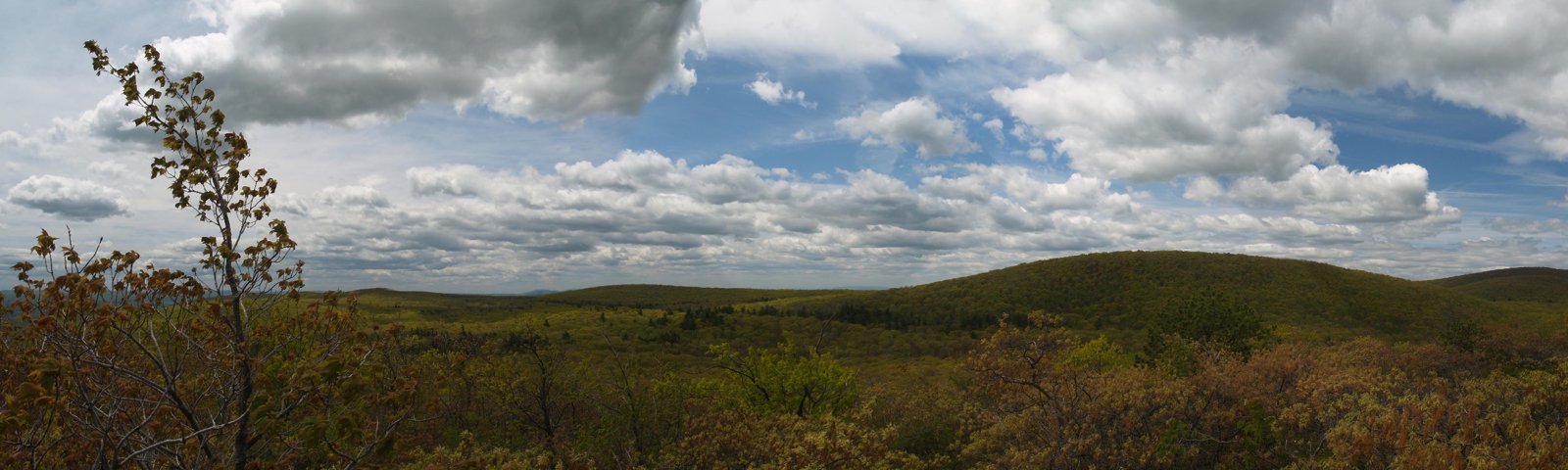
The northernmost section of the Connecticut Appalachian Trail climbs from Salisbury to Lion’s Head and Bear Mountain, the state’s highest peak, before crossing into Massachusetts. CNY Hiking describes the views from Lion’s Head as a popular day-hiking destination, along with the views from Bear Mountain. Between them are two shelters, including Riga, which The Northeast Hiker says is known for the best sunrise views of any shelter in Connecticut.
Campfires aren’t allowed, and camping is only at the shelters and designated sites.
The hike
The section starts where the AT crosses US 44 near Salisbury. CNY Hiking’s mileage table also lists a crossing of CT 41 shortly after. At 3.0 miles, the trail reaches the junction with the blue-blazed Lion’s Head Trail, and at 3.2 miles the 1,738-foot summit of Lion’s Head. At 3.3 miles, CNY Hiking says, the northern outlook of Lion’s Head looks north toward Bear Mountain, with Mount Greylock in the distance. AllTrails describes the shorter Lion’s Head hike from Route 41 as zigzagging over roots and rocks, with a small parking lot that holds about 10 cars.
At 3.9 miles, a blue-blazed trail leads right to the Riga Shelter and camping area. CNY Hiking says the shelter was built in 1990 by the AMC, sleeps six, and has a privy nearby, with water near the side trail. The Northeast Hiker adds four tent sites behind the shelter, two with tent pads and two on platforms, plus a large group site, a bear box, and a picnic table. It says there’s a spring close to the AT, and that the blue-blazed trail crosses a brook that may be a better water source if the spring isn’t flowing.
The trail continues north. CNY Hiking says it crosses Ball Brook at 4.5 miles, with the Ball Brook Campsite just north of the brook, and Brassie Brook at 5.1 miles, with the Brassie Brook Shelter and camping area about 200 feet off the trail. It notes Brassie Brook Shelter was formerly called Bond Shelter. The AMC’s Connecticut Chapter lists five hardened tent sites at Brassie, with a brook, privy, and bear box.
At 5.6 miles, the trail reaches Riga Junction, where it meets the Undermountain Trail. The AMC Outdoors writer used an Undermountain Trailhead loop for this final leg, reaching Bear Mountain’s summit around 9 a.m. and finding no one else there. Early Bird on the Trail notes that part of the route to Bear Mountain passes through Mount Riga State Park.
CNY Hiking says the trail reaches Bear Mountain Road, which isn’t passable by car, at 5.9 miles, turns sharply below Bear Mountain at 6.0 miles, and tops out at 2,316 feet at 6.5 miles. It reaches the Connecticut–Massachusetts line at 7.4 miles. Early Bird on the Trail suggests climbing the pile of rocks on Bear Mountain’s summit for the view.
Because the section ends at the state line rather than a road, you’ll need a plan to get out: loop back on the Undermountain Trail, as the AMC Outdoors writer did, or continue into Massachusetts. AllTrails lists a Bear Mountain and Mount Frissell route nearby.
For the section to the south, see Great Falls, Rand’s View, and Limestone Spring.
Tips
- Plan your exit. The section ends at the Massachusetts line; the Undermountain Trail makes a loop back possible.
- Get to Riga for sunrise. The Northeast Hiker says it has the best sunrise views of any Connecticut shelter.
- Arrive early for parking. The Lion’s Head lot on Route 41 is small.
- No campfires. They’re not allowed on the Connecticut AT.
- Check the spring at Riga. If it’s dry, the brook on the side trail may have water.
Camping
The ATC says camping on the Connecticut AT is allowed only at shelters and designated sites, with no reservations or fees and no campfires. This section has the Riga Shelter (sleeps six, four tent sites, a group site, bear box), the Ball Brook Campsite, and the Brassie Brook Shelter (five hardened tent sites, privy, bear box per the AMC).
Inside Intel: Riga is the camp to aim for. The Northeast Hiker says it’s known for having the best sunrise views of any shelter in Connecticut, and describes four tent sites behind the shelter, two of them on platforms. If Riga is full, Ball Brook and Brassie Brook are each within about a mile and a quarter farther north, per CNY Hiking’s mileages.
Trail facts
- Distance: About 7.4 miles, US 44 to the Massachusetts line
- Route type: Point to point, or a loop with the Undermountain Trail
- Difficulty: Moderate to strenuous. Climbs to Lion’s Head and Bear Mountain.
- Elevation: Lion’s Head 1,738 feet; Bear Mountain about 2,316 feet
- Campsites: Riga Shelter, Ball Brook Campsite, Brassie Brook Shelter
- Water: Springs and brooks near the camps. Treat all water.
- Permits: None; no reservations
- Fires: Not allowed
- Trailheads: US 44 or CT 41 near Salisbury; Undermountain Trailhead
- Last verified: October 17, 2026
Where this comes from
This page draws on the sources below, along with other guides and trip reports. Links go to the original pages.
- Appalachian Trail Conservancy: camping regulations by state
- Appalachian Trail Conservancy: Connecticut: Heavy Storm Damage (July 2026)
- AMC Connecticut Chapter: Appalachian Trail campsites
- CNY Hiking: AT in Connecticut, US 44 to the state line
- CNY Hiking: Appalachian Trail in Connecticut
- The Northeast Hiker: Riga Shelter
- AMC Outdoors: Section Hiking the AT in Connecticut
- Early Bird on the Trail: Section hike the AT in Connecticut
- AllTrails: Connecticut backpacking trails
Before you go: This page is based on published trail guides, trip reports, and reviews, along with official park and agency information where we could find it. It’s meant to help backpackers discover new trails, not to replace current, official information. Conditions, closures, permits, campsites, and water sources change, and some details here may be out of date or wrong. Confirm everything with the managing agency and check current conditions before you head out, and don’t rely on this page alone for safety or navigation. Backcountry travel involves risk.