
Trails / Connecticut / Northwest Connecticut
Appalachian Trail: Pine Knob, Pine Swamp, and Sharon Mountain (CT 4 to US 7)
Appalachian National Scenic Trail, northwestern Connecticut (Cornwall Bridge to US 7 and CT 112)
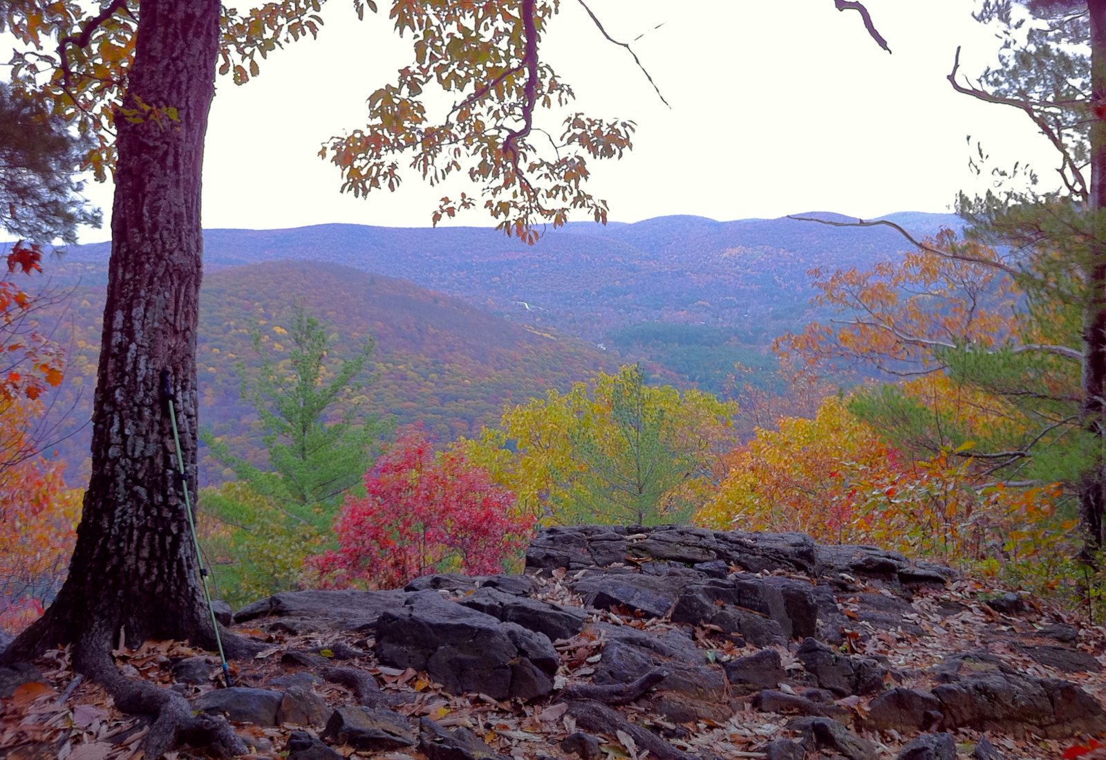
This section of the Connecticut Appalachian Trail climbs from the Housatonic River at Cornwall Bridge over Pine Knob and through the hills around Sharon Mountain, ending at US 7 near its junction with CT 112. CNY Hiking describes the 11.5 miles from CT 4 to US 7 as featuring Sharon Mountain, with the Pine Swamp Brook Shelter and several campsites along the way.
As everywhere on the Connecticut AT, camping is only at shelters and designated sites, and campfires aren’t allowed.
The hike
The section starts where the trail crosses CT 4. CNY Hiking warns that there’s no good parking at the crossing itself and that the best option is about half a mile east, near where CT 4 joins US 7 across Cornwall Bridge. The trail crosses dirt Old Sharon Road at 0.2 mile and Hatch Brook at 1.4 miles.
Pine Knob comes early. CNY Hiking says the trail reaches a junction with the Pine Knob Loop Trail at 1.5 miles and Pine Knob itself, with nice views, at 1.7 miles. A second junction with the loop trail, at 2.1 miles, leads 0.7 mile to the Housatonic Meadows State Park campground and US 7. CTvisit lists Pine Knob among the landmarks of the Connecticut AT.
The Caesar Brook primitive campsite is just south of Caesar Brook, according to CNY Hiking. Berkshire Hiking lists Caesar Brook at about mile 25.1 of the Connecticut AT, with group sites available. At 4.7 miles, the trail crosses Carse Brook on a log bridge.
The shelter comes at 5.9 miles. CNY Hiking says a blue-blazed trail leads to the Pine Swamp Brook Shelter, built in 1989, which sleeps six with a privy close by. The AMC’s Connecticut Chapter lists three hardened tent sites at Pine Swamp, water from a brook, a privy, and a bear box.
The trail continues over the high ground. CNY Hiking says it crosses gravel Sharon Mountain Road at 6.8 miles, passes near the 1,350-foot summit of Mount Easter at 7.1 miles, and reaches a blue-blazed trail to the Sharon Mountain Campsite at 8.3 miles.
Near the end, CNY Hiking describes a side trail at 11.1 miles to Belter’s Campsite, reached after a steep descent, and an outlook called Belter’s Bump at 11.2 miles. The AMC lists Belter’s as an open pine forest area with room for five tents, a spring, and a bear box. The section ends at US 7 near the junction of CT 112, where CNY Hiking says there’s a small parking area.
The AMC Outdoors writer who section-hiked the Connecticut AT in 2021 covered this stretch as one roughly 12-mile day, from Route 4 to US 7 and CT 112. Early Bird on the Trail treats it as its Pine Knob to Sharon Mountain to Route 7 leg. An AllTrails listing for the 11.2-mile stretch from the Algo Shelter to the Pine Swamp Shelter rates it hard, with about 2,647 feet of gain, and one reviewer noted at least five clearly marked camping areas over about 20 miles.
For the section to the south, see St. Johns Ledges and the Housatonic River. Heading north, see Rand’s View and Limestone Spring.
Tips
- Park smart at the south end. CNY Hiking says the best parking is half a mile east of the CT 4 crossing.
- No campfires. They’re not allowed on the Connecticut AT.
- Watch the Belter’s descent. The side trail to the campsite is steep.
- Bring a tent. Pine Swamp Brook Shelter sleeps six.
- Use the bear boxes. The AMC lists them at the campsites.
Camping
The ATC says camping on the Connecticut AT is allowed only at shelters and designated sites, with no reservations or fees. This section has the Caesar Brook campsite, the Pine Swamp Brook Shelter (sleeps six, privy, three tent sites, bear box), the Sharon Mountain Campsite, and Belter’s Campsite (open pine forest, five tents, spring, bear box). The Pine Knob Loop Trail also connects to Housatonic Meadows State Park’s campground.
Inside Intel: Pine Swamp is the most complete camp on this stretch, with a shelter, three hardened tent sites, a privy, a brook, and a bear box, according to the AMC and CNY Hiking. It sits near the middle of the section, at about 5.9 miles. For a shorter first day, the Caesar Brook campsite comes earlier, and for an open, piney site near the end, the AMC describes Belter’s.
Trail facts
- Distance: About 11.5 miles, CT 4 to US 7
- Route type: Point to point
- Difficulty: Moderate
- Elevation: Mount Easter about 1,350 feet (CNY Hiking)
- Campsites: Caesar Brook, Pine Swamp Brook Shelter, Sharon Mountain, Belter’s
- Water: Brooks and a spring at Belter’s. Treat all water.
- Permits: None; no reservations
- Fires: Not allowed
- Trailheads: CT 4 near Cornwall Bridge; US 7 near CT 112
- Last verified: October 2, 2026
Where this comes from
This page draws on the sources below, along with other guides and trip reports. Links go to the original pages.
- Appalachian Trail Conservancy: camping regulations by state
- AMC Connecticut Chapter: Appalachian Trail campsites
- CNY Hiking: AT in Connecticut, CT 4 to US 7
- CNY Hiking: Appalachian Trail in Connecticut
- Berkshire Hiking: Camping
- AMC Outdoors: Section Hiking the AT in Connecticut
- Early Bird on the Trail: Section hike the AT in Connecticut
- AllTrails: Algo Shelter to Pine Swamp Shelter
Before you go: This page is based on published trail guides, trip reports, and reviews, along with official park and agency information where we could find it. It’s meant to help backpackers discover new trails, not to replace current, official information. Conditions, closures, permits, campsites, and water sources change, and some details here may be out of date or wrong. Confirm everything with the managing agency and check current conditions before you head out, and don’t rely on this page alone for safety or navigation. Backcountry travel involves risk.