
Trails / Colorado / Central Colorado
Colorado Trail Collegiate West: Cottonwood Pass to Monarch Pass
Gunnison and San Isabel National Forests (Cottonwood Pass west of Buena Vista to Monarch Pass west of Salida)
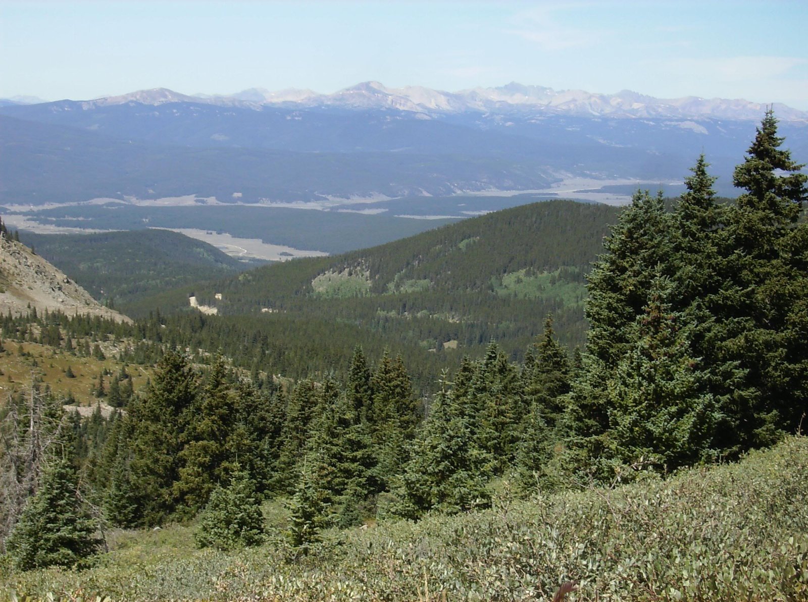
The Collegiate West route of the Colorado Trail, shared with the Continental Divide Trail, runs about 41 to 42 miles from Cottonwood Pass to Monarch Pass, by the trail foundation’s segment mileages. It follows the divide south past old mining country, the Alpine Tunnel railroad grade, and a string of high lakes, and several sources say much of it is above treeline.
That’s the catch. Water is scarce on the high ridges south of Cottonwood Pass, and afternoon lightning sends some hikers off the route entirely.
The hike
The trail foundation splits this stretch into Collegiate West segments CW03 (Cottonwood Pass to Tincup Pass Road), CW04 (Tincup Pass Road to Boss Lake Trailhead), and part of CW05, which continues past Monarch Pass to a ridge above South Fooses Creek.
One hiking guide places the paved summit of Cottonwood Pass 18.9 miles west of Buena Vista at about 12,126 feet. Heading south, it describes a high point about a mile out with 360-degree views, then a ridge above Lost Lake, and warns that hikers are exposed to the elements the whole way. One magazine says the 16-mile stretch to Tincup Road opened in 2014. A route listing that uses about 25 miles of the divide trail south of the pass calls that section almost entirely above tree line.
Water planning starts here. In a 2018 forum post, one hiker said a tarn at the top of the pass is the only source between a small flow a mile north and an unnamed lake at 12,250 feet in Mineral Basin. A 2016 thru-hiker went many hours without water on the high ridges and melted snow.
A 2024 trip report describes rocky ground near Woodchopper Creek, where flat tent spots were hard to find, and warns of a no-camping zone. Heading north on its last day, the group crossed four passes over 12,000 feet with no camping anywhere along the way.
CW03 ends at Tincup Pass Road, a rough four-wheel-drive road between St. Elmo and Tincup, according to an off-road guide. Farther south, a 2018 thru-hiker followed the old Alpine Tunnel railroad grade for a few miles of easy walking. One reference says the tunnel opened in 1882 as the first tunnel across the Continental Divide in Colorado and was abandoned in 1910.
From the ghost town of Hancock, one trail listing covers 20.5 miles to Monarch Pass, with a high point of 12,546 feet. Going south, it passes Hancock Lake, climbs Chalk Creek Pass, then drops into forest. After the Boss Lake Trailhead, the trail climbs past Boss Lake to steep switchbacks above high lakes, then follows service roads across the Monarch ski area. A 2025 hiker on that listing says most of it is above treeline and lightning is hard to avoid in places.
The 2018 thru-hiker estimated 50 to 60 mph winds on the exposed ridge by the ski area. The trail foundation says the Monarch Crest gift shop, a short walk from the U.S. 50 crossing, has some groceries and a restaurant, and Salida is about 22 miles away. For another high Colorado Trail stretch, see Colorado Trail Segment 25.
Tips
- Plan to be below treeline by early afternoon. A 2024 trip report says storms came most days around 2 to 3 p.m.
- Carry extra water south of Cottonwood Pass. Sources on the high ridges are few.
- Have a bail-out plan. One 2024 party left the West route at Tincup during a stormy forecast.
- Use the trail foundation’s Databook or app for current water and mileage.
- Arrange a shuttle. The ends are Cottonwood Pass Road and U.S. 50 at Monarch Pass.
Camping
Camping is dispersed along the trail; no designated backcountry sites were found. One mapping guide says dispersed camping is allowed in the Pike-San Isabel National Forests without a permit. On the San Isabel side, forest rules ban camping within 100 feet of water except at developed or designated sites, and limit camping and fires to developed or designated sites within half a mile of Chalk Creek below St. Elmo. Pike-San Isabel rules also require food to be kept in a vehicle or a solid, hard-sided container, or hung at least 10 feet up and 4 feet from any tree or post. Treat all water.
No permit to hike the Colorado Trail is needed, according to one guide. A 2018 hiker entered the Collegiate Peaks Wilderness just north of Cottonwood Pass; forest rules there cap groups at 15 people, ban camping within 100 feet of lakes, streams, and trails, and ban campfires above 11,000 feet. The Gunnison side’s forest listed fire restrictions as ended on Sept. 3, 2026, and Chaffee County lifted its restrictions Sept. 21, 2026. Check both forests before you go.
Inside Intel: No camper accounts recommending a specific named site were found. A 2018 thru-hiker cowboy camped on the old railroad grade after a 20-mile day from Monarch Pass. A 2024 party found only one real campsite near the Alpine Tunnel. A 2016 thru-hiker camped by a lake above 12,000 feet the night before reaching Cottonwood Pass from the south. One camping listing describes several spots along the Hancock Lake road at about 11,000 feet.
Trail facts
- Distance: About 41 to 42 miles to Monarch Pass, added up from the trail foundation’s segment figures
- Route type: Point to point
- Difficulty: Strenuous. CW03 has about 3,532 feet of gain and CW04 about 2,750 (trail foundation).
- Elevation: Cottonwood Pass about 12,126 feet; high point of 12,546 feet between Hancock and Monarch Pass (one trail listing)
- Campsites: Dispersed; few flat spots on the high ridges
- Water: Scarce on the ridges south of Cottonwood Pass; streams and lakes farther south. Treat all water.
- Permits: None found
- Food storage: Required on the San Isabel side (hang or hard-sided container)
- Resupply: Monarch Crest store near U.S. 50; Salida about 22 miles away (trail foundation)
- Trailheads: Cottonwood Pass (County Road 306 from Buena Vista); Monarch Pass on U.S. 50
- Last verified: October 22, 2026
Have a great pic of this trail? Post it to Instagram and tag us, and we might use it on the site.
More Lowdown from Backpack Trail Guide
Where this comes from
This page draws on the sources below, along with other guides and trip reports. Links go to the original pages.
- Colorado Trail Foundation: Segments of the CT
- Colorado Trail Foundation: Collegiate East and West
- Colorado Trail Foundation: Resupply towns
- Colorado Trail Foundation: Water sources
- Colorado Trail Foundation: Weather
- Colorado Trail Foundation: Closure and detour near Monarch Pass (2019)
- U.S. Forest Service: Collegiate Peak Wilderness occupancy and use restrictions
- U.S. Forest Service: Food storage prohibitions, Pike-San Isabel
- U.S. Forest Service: San Isabel National Forest occupancy and use restrictions
- U.S. Forest Service: Pike-San Isabel alerts
- U.S. Forest Service: Grand Mesa, Uncompahgre and Gunnison alerts
- U.S. Forest Service: GMUG food and refuse storage order
- Chaffee County Road & Bridge
- South Arkansas Fire: Fire restrictions
- Hiking Project: CDT Monarch Pass to Hancock
- Rocky Mountain Hiking Trails: Cottonwood Pass South
- Seeking Lost: Salida to Twin Lakes, CDT 2018
- Bike Hike Safari: CDT Day 64
- Backpacking Light: Collegiate West, Twin Lakes to Monarch Pass
- Denver Gazette: Colorado Trail, when everything goes south, go east
- Treeline Review: Colorado Trail backpacking and thru-hiking
- Backpacker: Collegiate Peaks Loop
- Salida Chamber: St. Elmo General Store
- 4x4explore: Tincup Pass
- The Outbound: Hancock Lake camping
- Wikipedia: Alpine Tunnel
Before you go: This page is based on published trail guides, trip reports, and reviews, along with official park and agency information where we could find it. It’s meant to help backpackers discover new trails, not to replace current, official information. Conditions, closures, permits, campsites, and water sources change, and some details here may be out of date or wrong. Confirm everything with the managing agency and check current conditions before you head out, and don’t rely on this page alone for safety or navigation. Backcountry travel involves risk.