
Trails / Idaho / Sawtooth Mountains
Alice–Toxaway Loop
Sawtooth Wilderness, Sawtooth National Recreation Area (Pettit Lake, south of Stanley)
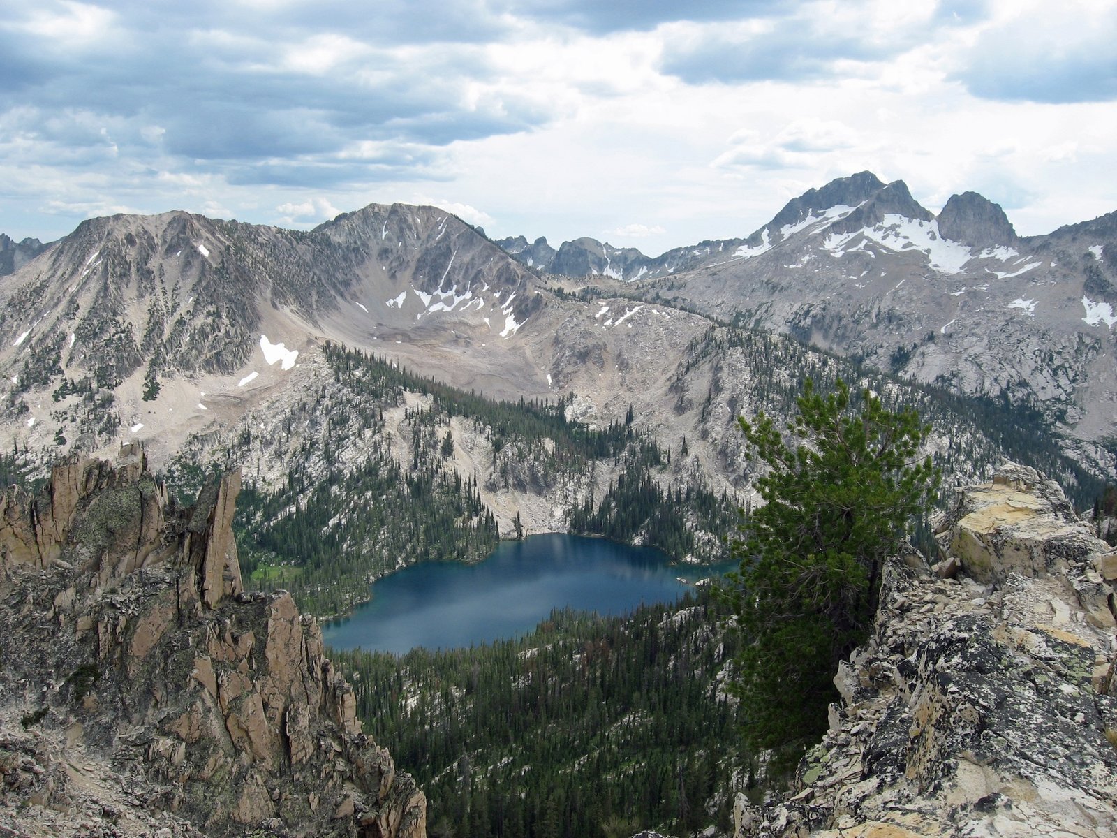
Outdoor Project calls the Alice–Toxaway Loop one of the most popular backpacking loops in Idaho’s Sawtooth Mountains. In about 18 miles it strings together a chain of alpine lakes (Alice, Twin, Toxaway, and Farley) and crosses a high pass below Snowyside Peak, starting and ending at the same trailhead on Pettit Lake.
Guides describe it as a two- to three-day trip with the chance to camp at a lake every night, and it can be hiked in either direction.
The hike
The loop starts at the Tin Cup Trailhead at Pettit Lake Campground. Hiking Project, in a description shared by the Idaho Trails Association, says you reach the Pettit Lake Cutoff junction about a quarter mile in, where you choose your direction. This description goes clockwise, toward Alice Lake first. One 2019 trip report says the trail follows the north shore of Pettit Lake, with views across to McDonald Peak, and that the wilderness boundary and permit box come at about 1.1 miles.
The route climbs along Pettit Creek through old lodgepole pine and fir forest, fording the creek several times. Hiking Project counts four creek crossings on the loop and warns they can be dangerous during spring runoff. Long switchbacks lead into a high hanging valley and then the Alice Lake basin. One guide notes El Capitan along the way. Hiking Project says there’s good camping all around Alice Lake and suggests it for the first night.
Twin Lakes are about a mile beyond Alice and a couple hundred feet higher, per one guide. A trip planner describes a land bridge between the two lakes. Past Twin Lakes, one report says, the Pettit Creek Trail ends and the Alice Lake–Redfish Lake Trail continues over Snowyside Pass. One guide calls the pass the loop’s highest point at 9,400 feet, with views of Snowyside Peak. Hiking Project says only that it tops 9,000 feet. The descent toward Toxaway Lake is steep and rocky for the first mile, according to the same guide, which says you reach the shore after about 2.5 miles.
Toxaway Lake is large, and one planning guide says it has numerous campsites but can get extremely crowded on summer weekends and holidays. Side trails branch off in this area toward Edith and Imogene Lakes and to Sand Mountain Pass, which Outdoor Project puts 9.8 miles from the Pettit trailhead. Longer versions of the loop add Edith or Imogene Lake.
Below Toxaway, the trail drops about 2 miles to Farley Lake. Hiking Project says there’s camping at Farley too, but sites are harder to find. From Farley, the trail continues down the Yellow Belly Lake drainage to the Pettit Lake Cutoff. One trip report says the cutoff climbs for a full mile before crossing a ridge and dropping back to the Tin Cup Trailhead. Another calls it roughly 500 feet up and 500 feet down.
Direction matters mostly for where the big climbs fall. One planning guide says the counterclockwise direction offers more places to stop on the first night if you need time to adjust to the altitude. One planning guide puts the trailhead at 6,996 feet and reminds sea-level visitors to hydrate and watch for signs of altitude sickness.
Hiking Project describes the forest as high-elevation lodgepole and Douglas fir, with trilliums and lots of wildflowers in spring, and lists deer, elk, bears, pika, marmots, and birds among the wildlife. Expect company: it calls this a route where you’ll see many other trail users.
For a shorter Sawtooth overnight, see Sawtooth Lake via Iron Creek.
Tips
- Pick up a permit on the way in. A free, self-issued Sawtooth Wilderness permit is required. The permit box sits at the wilderness boundary, roughly a mile from the trailhead.
- Plan for no campfires at all. A Forest Service order prohibits campfires in the Pettit and Yellow Belly Lake Creek drainages, which Discover Sawtooth describes as covering Alice, Twin, Toxaway, and Farley Lakes. Cook on a stove.
- Respect the creek crossings. Hiking Project says the crossings can be dangerous during spring runoff. One guide says one crossing can be knee-deep in early summer, so bring sandals or water shoes.
- Aim for July through October. AllTrails lists those as the best months to visit.
- Budget for the cutoff climb. The Pettit Lake Cutoff crosses a ridge between the trailhead and the Yellow Belly Lake trail; hiked clockwise, it’s the last climb of the trip.
- Mosquitoes. One 2019 report found more mosquitoes at Toxaway than at Alice and was glad to have treated clothing with permethrin.
Camping
Camping is dispersed in the Sawtooth Wilderness, and your self-issued permit covers it. Discover Sawtooth says to camp at least 100 feet from water and trails, use existing impacted sites at busy lakes, and avoid meadows. The Forest Service order limits groups to 12 people from May 1 through Nov. 30, requires dogs on trails to be on a leash of 15 feet or less from July 1 through Labor Day, and prohibits human waste within 100 feet of springs, lakes, streams, or campsites. It also bars overnight horses, mules, and goats within 200 yards of Edith Lake.
The Forest Service’s food storage order for the Sawtooth National Recreation Area does not apply inside the wilderness. Discover Sawtooth still strongly recommends a bear hang, bear canister, or bear-proof bag for food, trash, and toiletries.
Outside the wilderness, at the trailhead end, a Forest Service order in effect since June 19, 2026 (0414-04-162) prohibits camping anywhere other than a developed campground between Forest Roads 208 or 362 and Pettit Lake. If you want to camp near the trailhead the night before, use a developed campground.
Inside Intel: Several backpackers recommend Twin Lakes over Alice Lake for the first night. One guide says Twin Lakes has fewer crowds and better views. A planning guide chose Twin to avoid the crowds at Alice, and a third writer was advised to keep going to Twin and called it a peaceful first-night camp. At Toxaway, one guide suggests aiming for a spot slightly above the lake to get both lake and mountain views. If you’re hiking clockwise, Farley is the least reliable stop, since Hiking Project says its sites are harder to find.
Trail facts
- Distance: About 17 to 19 miles, depending on the source (18 per Outdoor Project)
- Route type: Loop, usually two to three days. Can be hiked in either direction.
- Difficulty: Strenuous
- Elevation: About 3,100 to 3,200 feet of gain. Trailhead near 7,000 feet; Snowyside Pass tops 9,000 feet (one guide says 9,400).
- Campsites: Dispersed. Common stops are Alice Lake, Twin Lakes (about a mile past Alice), Toxaway Lake, and Farley Lake (harder to find sites).
- Water: Lakes and creeks throughout. Treat all water. Creek crossings can be high during runoff.
- Permits: Free self-issued Sawtooth Wilderness permit at the wilderness boundary. Groups of 8 or more need a group permit.
- Fires: Not allowed anywhere on the loop’s main drainages (Forest Service order). Bring a stove.
- Bear and food storage: Not required by order inside the wilderness, but a bear hang, canister, or bear-proof bag is strongly recommended.
- Dogs: Allowed; on a leash of 15 feet or less on trails from July 1 through Labor Day.
- Trailhead: Tin Cup Trailhead, Pettit Lake Campground, south of Stanley
- Last verified: October 17, 2026
Where this comes from
This page draws on the sources below, along with other guides and trip reports. Links go to the original pages.
- U.S. Forest Service: Sawtooth Wilderness Area Occupancy and Use order
- Discover Sawtooth: Leave No Trace in the Sawtooths
- Hiking Project: Alice-Toxaway Loop
- Outdoor Project: Toxaway Lake, Sand Mountain Pass + Snowyside Divide
- Cheryl Hill: Backpacking the Alice-Toxaway Loop
- Backcountry Dirtbag: Alice Toxaway Lake Loop planning guide
- Outbound: Backpack the Alice Toxaway Loop
- U.S. Forest Service: Sawtooth National Recreation Area food storage order
- U.S. Forest Service: Sawtooth National Recreation Area Occupancy and Use order 0414-04-162
Before you go: This page is based on published trail guides, trip reports, and reviews, along with official park and agency information where we could find it. It’s meant to help backpackers discover new trails, not to replace current, official information. Conditions, closures, permits, campsites, and water sources change, and some details here may be out of date or wrong. Confirm everything with the managing agency and check current conditions before you head out, and don’t rely on this page alone for safety or navigation. Backcountry travel involves risk.