
Trails / Hawaii / Hawaiʻi Island
Muliwai Trail to Waimanu Valley
Division of Forestry and Wildlife (DLNR), Hāmākua Coast, near Waipiʻo Valley
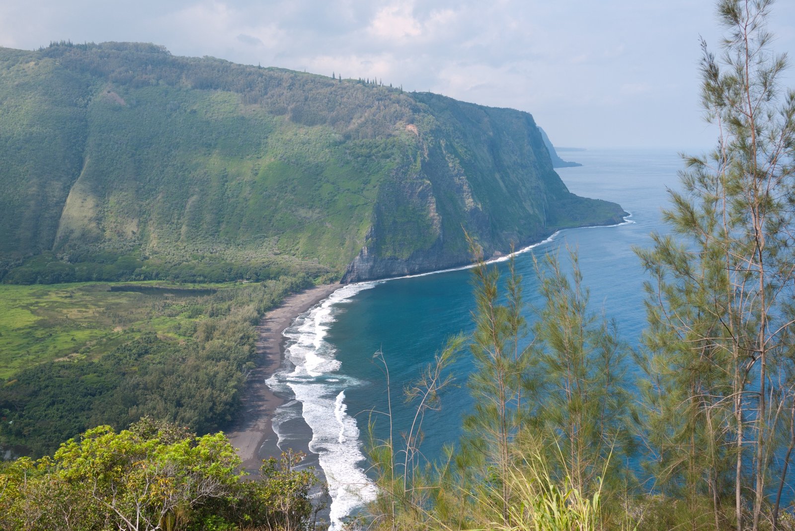
The Muliwai Trail climbs out of Waipiʻo Valley on Hawaiʻi Island’s Hāmākua Coast and crosses a dozen gulches to Waimanu Valley, a remote valley with a beach, waterfalls, and nine campsites managed by the state’s Division of Forestry and Wildlife. The state calls the trail minimally maintained, steep, eroded in places, rocky, and slippery when wet.
It’s closed right now, and getting to it is the hard part. The trail and campground are closed after Tropical Storm Nolo and a landslide, and a county emergency rule bars pedestrians from the road into Waipiʻo Valley. This page describes the trip for when access returns.
The hike
The trip begins at the Waipiʻo Valley lookout. The state puts the campsites about 9 miles from the lookout, or 7.6 miles from the Muliwai trailhead on the valley floor. Hawaii Magazine describes descending into Waipiʻo, crossing its black sand beach and stream, and starting the trail on the far side. Wandering Wheatleys lists the Waipiʻo stream crossing as one of the trip’s two major fords.
The first climb is the Z Trail, a series of switchbacks up Waipiʻo’s western wall. Both Hawaii Magazine and Wandering Wheatleys put it at about 1,200 feet, and Wandering Wheatleys calls it fully exposed.
Above the Z Trail, the route follows the high trail through forest for about 5 to 6 miles, according to Wandering Wheatleys, crossing 12 smaller gulches with small streams. The writers call those crossings “typically small and easy to cross; however, with heavy rains, it can become very slippery.” The state notes a shelter about halfway along the trail. Hawaii Magazine counts more than a dozen stream crossings in this middle stretch.
The descent into Waimanu is about 1,300 feet, and Wandering Wheatleys found it “more challenging than the Z trail up,” with little maintenance. Hawaii Magazine describes a rope strung across Waimanu Stream at the bottom: “a rope strung across Waimanu Stream helps navigate the slippery stones underfoot.” Wandering Wheatleys says the stream is typically 2 to 3 feet deep there.
Hawaii Magazine calls Waimanu a 3,600-acre valley. Its best-known sight is Waihīlau Falls; Hawaii Magazine and Wandering Wheatleys both give a total drop of about 2,600 feet, and Wandering Wheatleys calls it the third-tallest continuous waterfall in Hawaiʻi.
Hawaii Magazine describes the round trip as about 18 miles over three days, with roughly 14 hours of hiking in good weather; Wandering Wheatleys counts 16 miles and about 5 hours each way. The state lists falling rocks, hazardous cliffs, flash floods, high surf, slippery rocks, and strong currents among the hazards.
For another Hawaiʻi Island backpacking trip, see Hawaiʻi Volcanoes: Keauhou and Halapē.
Tips
- Check two closures. The trail and campground status (state) and the Waipiʻo Valley Road emergency rule (county) both decide whether this trip is possible.
- Don’t cross in flood. The state warns of flash floods; the Waimanu and Waipiʻo stream crossings are the big ones.
- Treat all water. The state says only non-potable water is available. Wandering Wheatleys warns about leptospirosis in fresh water.
- Expect mud. The trail is slippery when wet, and Wandering Wheatleys calls the descent into Waimanu the hardest part.
- Pack out everything. Hawaii Magazine says hikers must pack out all trash.
Camping
Waimanu has nine designated campsites holding up to 48 campers in all, managed by the Division of Forestry and Wildlife, according to the state’s reservation listing. Reservations open only one month ahead, and there are no refunds within 15 days of check-in. Hawaii Magazine says the sites are on the west side of the stream and gives a 6-night maximum stay. The state lists two composting outhouses and non-potable water. Open fires, motorized vehicles, bicycles, and removing plants or rocks are prohibited. Dogs are allowed on a leash.
Inside Intel: We didn’t find camper accounts recommending a specific Waimanu site. Wandering Wheatleys describes the mix: three small sites, two medium, and four large, each holding six or more people depending on size. If you’re in a larger group, aim for one of the large sites when you book.
Trail facts
- Distance: About 9 miles one way from the Waipiʻo lookout (7.6 from the Muliwai trailhead); about 16 to 19 miles round trip, depending on the source
- Route type: Out-and-back
- Difficulty: Strenuous; minimally maintained, steep, and slippery when wet
- Elevation: About 1,200-foot climb on the Z Trail; about 1,300-foot descent into Waimanu
- Campsites: Nine designated sites in Waimanu Valley, west of the stream; shelter about halfway
- Water: Streams only (non-potable); treat everything
- Permits: State camping reservation, up to one month ahead
- Dogs: Allowed on leash (state listing)
- Fires: Prohibited
- Trailhead: Waipiʻo Valley lookout; road access restricted by county emergency rule
- Last verified: October 6, 2026
Where this comes from
This page draws on the sources below, along with other guides and trip reports. Links go to the original pages.
- Hawaiʻi DLNR camping: Waimanu campsite details
- Hoodline: Hawaiʻi reopens most state parks after Hurricane Nolo, but trails stay shut
- County of Hawaiʻi: Waipiʻo Valley Road emergency rules
- Big Island Now: Waipiʻo Valley Road emergency zone extended
- Hawaii Magazine: Backpacking the Muliwai Trail to Waimanu Valley
- Wandering Wheatleys: Hiking the Muliwai Trail to Waimanu Valley
Before you go: This page is based on published trail guides, trip reports, and reviews, along with official park and agency information where we could find it. It’s meant to help backpackers discover new trails, not to replace current, official information. Conditions, closures, permits, campsites, and water sources change, and some details here may be out of date or wrong. Confirm everything with the managing agency and check current conditions before you head out, and don’t rely on this page alone for safety or navigation. Backcountry travel involves risk.