
Trails / Hawaii / Hawaiʻi Island
Nāpau Trail to Nāpau Crater (Hawaiʻi Volcanoes)
Hawaiʻi Volcanoes National Park (Kīlauea East Rift Zone, Hawaiʻi Island)
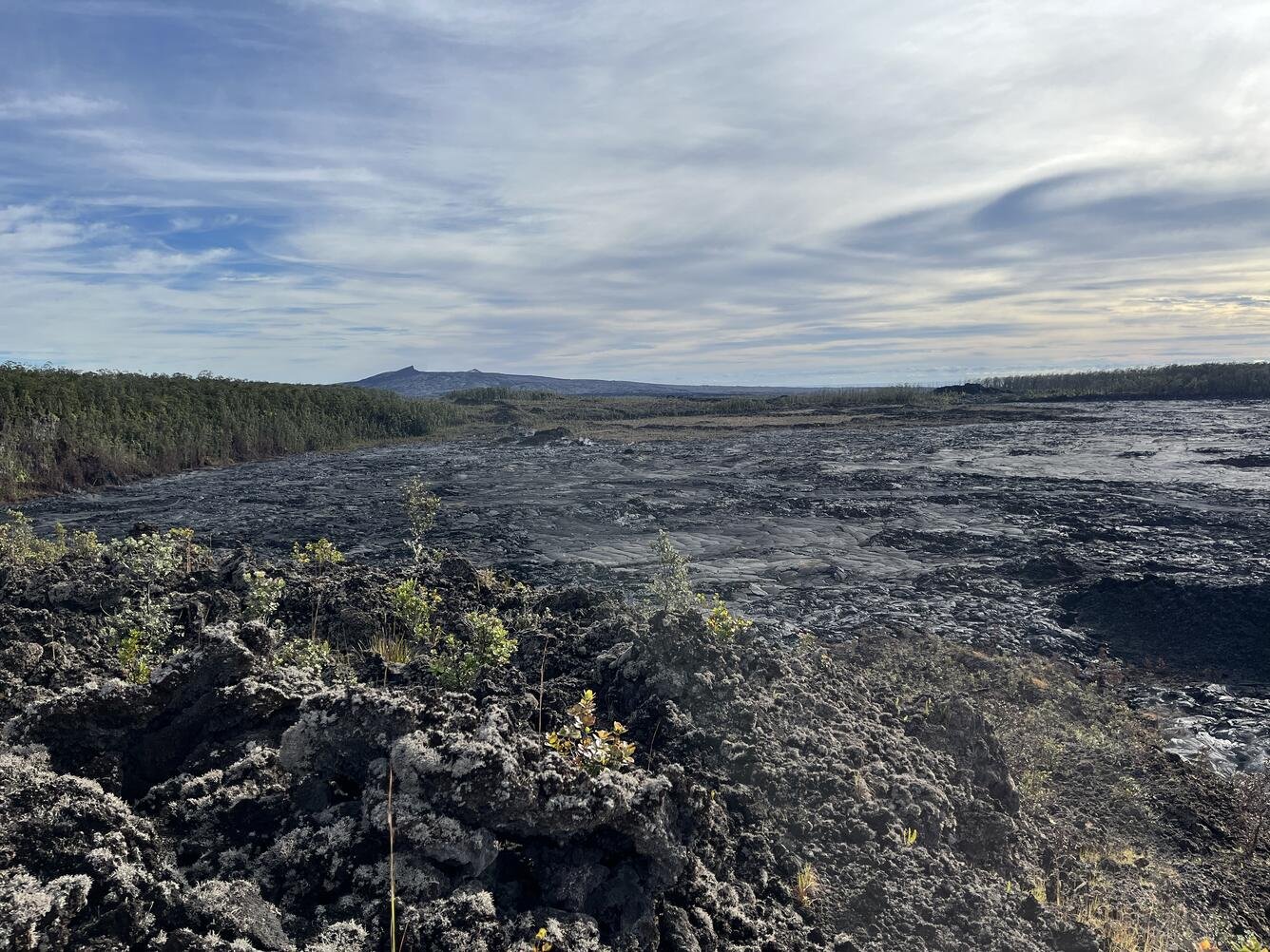
The Nāpau Trail crosses Kīlauea’s East Rift Zone from the Maunaulu lava flows to the rim of Nāpau Crater, passing Makaopuhi Crater and the site of an old pulu factory along the way. The National Park Service describes terrain ranging from recent lava flows to dense tree-fern rain forest. Backpackers can camp at a single site near the Nāpau Crater overlook.
The landscape here keeps changing. Lava from Kīlauea’s September 2024 eruption buried most of the old campsites.
The hike
NPS lists two starting points: the Maunaulu parking area, 6.2 miles from Nāpau Crater, and the Nāulu trailhead on Chain of Craters Road, 5.2 miles away. The park suggests planning 30 minutes per mile and lists modest elevation changes, about 200 feet on the Nāpau Trail and 500 feet on the Nāulu Trail.
From Maunaulu, the trail crosses lava from the Maunaulu eruptions of 1969 to 1974, according to NPS. In a 2015 hike journal posted on the park’s site, Paul Peh lists the landmarks in order: Puʻuhuluhulu (which he translates as “Hairy Hill”), Makaopuhi Crater, the Pulu Factory, and the Nāpau Crater overlook. He describes terrain shifting from smooth pāhoehoe to dense ʻōhiʻa and hāpuʻu fern forest, and says to follow the ahu, the rock cairns, across open lava. His round trip came to 13.4 miles in a little over seven hours.
At Nāpau, the scene is new. NPS says “most of the campsites and pit toilet were covered by lava in the September 2024 eruption,” and that the remaining site is reached by crossing the new flow. Big Island Video News reported in September 2024 that lava cascaded into Nāpau Crater on its northwest rim, and that the Nāpau, Maunaulu, and Nāulu trails stayed closed for a time because of gas emissions and wildfire risk.
Peh warns about the crater edges, quoting signs about a “high possibility of landslides and unstable precipices,” and says the trail beyond the rim was roped off in 2015. NPS adds that the old Kalapana Trail, which once continued past here, has been covered by miles of lava at its lower end and is overgrown and very hard to follow above: “DO NOT plan on using this trail.” NPS notes that Puʻuʻōʻō, the long-running vent farther east, stopped erupting in 2018.
NPS lists the hazards plainly: rough ʻaʻā and pāhoehoe that call for sturdy boots and long pants, numerous earth cracks, thin crusts, and lava tubes, intense sun, and hypothermia risk when it’s wet.
For the park’s coastal campsites, see Keauhou and Halapē.
Tips
- Carry all your water. NPS says there’s none; bring 3 to 4 quarts or liters per person per day.
- Start early. Peh recommends beating the afternoon heat on exposed lava.
- Wear long pants. NPS and Peh both recommend them for sharp lava and scratchy uluhe ferns.
- Stay back from crater edges. Rims can collapse.
- Watch your footing. Cracks, thin crusts, and lava tubes are common.
- Check eruption status. Kīlauea activity has closed this trail before.
Camping
All backcountry camping in Hawaiʻi Volcanoes requires a permit. NPS says permits are reserved on Recreation.gov up to 90 days ahead, then picked up in person at the Backcountry Office (open daily 8 a.m. to 4 p.m.) up to seven days before the trip, with a safety briefing. The Nāpau campsite near the overlook has space for two tents. There are no pit toilets, so use catholes, and stays are limited to three consecutive nights. Open fires and smoking are prohibited, and dogs other than service animals aren’t allowed on trails.
Inside Intel: We didn’t find camper accounts of the campsite as it is now, after the 2024 eruption. With room for only two tents, it’s a one-party site. Peh’s 2015 description of the old campground as “very basic” no longer applies, since that campground is now largely under lava.
Trail facts
- Distance: 6.2 miles one way from Maunaulu (about 12.4 round trip); 5.2 one way from the Nāulu trailhead
- Route type: Out-and-back
- Difficulty: Moderate to strenuous; rough lava, sun, no water
- Elevation: About 200 feet of change on the Nāpau Trail and 500 on the Nāulu Trail (NPS); one hiker’s GPS logged about 2,400 feet of gain round trip
- Campsites: One site near the Nāpau Crater overlook (two tents; cathole only)
- Water: None; carry 3 to 4 quarts or liters per person per day
- Permits: NPS backcountry permit (Recreation.gov) plus in-person check-in
- Dogs: Not allowed (service animals excepted)
- Fires: Open fires and smoking prohibited
- Trailheads: Maunaulu parking area or Nāulu trailhead, Chain of Craters Road
- Last verified: October 6, 2026
Where this comes from
This page draws on the sources below, along with other guides and trip reports. Links go to the original pages.
- National Park Service: Nāpau Trail
- National Park Service: Backcountry Hiking
- National Park Service: Nolo closure (Sept. 24, 2026)
- National Park Service: Post-Nolo reopening (Sept. 27, 2026)
- Big Island Video News: Kīlauea eruption changes prompt new closures (2024)
- NPS hike journal: Nāpau Trail, Paul Peh (2015)
Before you go: This page is based on published trail guides, trip reports, and reviews, along with official park and agency information where we could find it. It’s meant to help backpackers discover new trails, not to replace current, official information. Conditions, closures, permits, campsites, and water sources change, and some details here may be out of date or wrong. Confirm everything with the managing agency and check current conditions before you head out, and don’t rely on this page alone for safety or navigation. Backcountry travel involves risk.