
Trails / Georgia / North Georgia Mountains
James E. Edmonds Backcountry Trail (Black Rock Mountain State Park)
Black Rock Mountain State Park, Georgia State Parks (Mountain City, Rabun County)
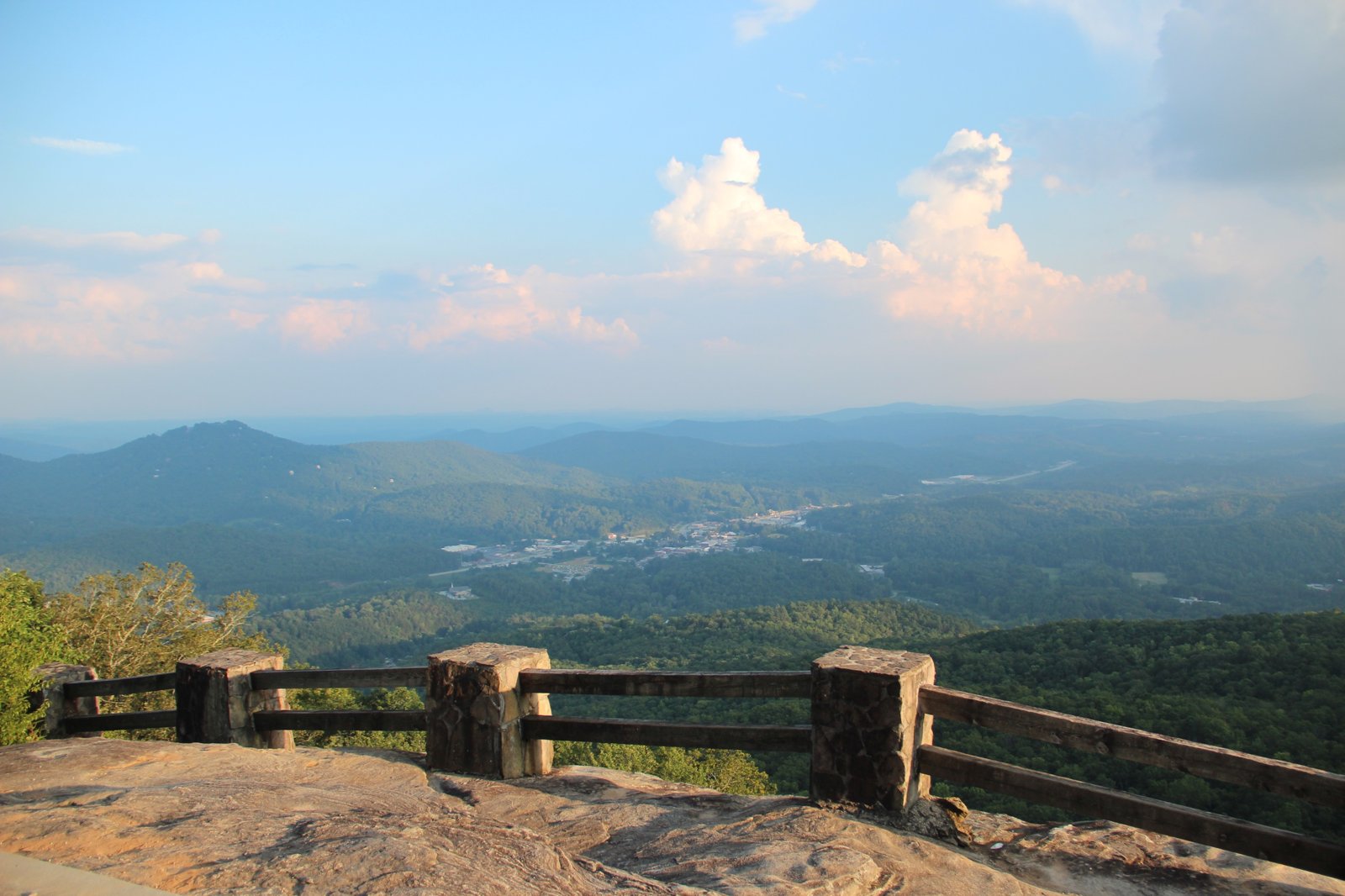
Black Rock Mountain State Park sits on the Eastern Continental Divide in Rabun County, and at 3,640 feet it’s Georgia’s highest state park, according to Campflare. Its backpacking trail, the 7.2-mile James E. Edmonds Backcountry Trail, loops through laurel-filled coves with cascading streams and small waterfalls, then climbs to the summit of Lookoff Mountain. Georgia State Parks says the summit has a stunning view of the Wolffork Valley and surrounding mountains.
Four designated campsites, by advance reservation only, make it a short but steep overnight.
The hike
Georgia State Parks says the trail is named for one of the park’s first rangers. Wikipedia identifies him as “Mr. Eddie” Edmonds, one of the park’s earliest and longest-serving rangers. Georgia State Parks says the trail offers both day hiking and backcountry camping and is quite steep in a number of places.
The loop follows streams before it climbs. Georgia State Parks describes the trail following cascading streams with small waterfalls in laurel-filled coves. Wikipedia adds that it weaves in and out of those coves along mountain streams. The park’s trail map shows the trail splitting into West Fork and East Fork sections.
The high point is Lookoff Mountain, in the northernmost part of the park. Georgia State Parks says the trail climbs to the summit for a stunning vista of the Wolffork Valley and the surrounding ranges. N-Georgia.com puts Lookoff Mountain at 3,162 feet and says one of the park’s backcountry campsites sits right on its summit.
The campsites are spread out. N-Georgia.com describes one site on the summit of Lookoff Mountain, another about half a mile away on the mountain’s southwestern spur at about 3,116 feet, and a Creek Ridge site that can be reached by a short 1.5-mile hike on the West Fork. Wikipedia says the four sites are secluded, undeveloped, and have no facilities, giving backpackers with reservations a chance to escape into the park’s quiet backcountry.
The rest of the park is worth exploring too. Georgia State Parks says the park is named for its sheer cliffs of dark-colored biotite gneiss and that it includes the Tennessee Rock Trail, where hikers can see Georgia’s Brasstown Bald. Campflare says five scenic overlooks along the park road offer 80-mile views of the Southern Appalachians, and that the park has a 17-acre lake.
Wikipedia says the park has about 11 miles of hiking trails in all, including the 200-yard Norma Campbell Cove Trail and a short trail into a moist, north-facing cove full of rosebay rhododendron near the RV camping area. Georgia State Parks describes the 0.85-mile Black Rock Lake loop, completed in 2007, around a 17-acre lake rimmed by white pine and yellow poplar. Campflare says the park entrance is about 3 miles up Black Rock Mountain Parkway, and that reservations open up to 14 months ahead.
Storms have affected the park. Wikipedia describes a storm that snapped or uprooted thousands of trees and damaged large parts of the camping and summit areas, after which most trails reopened. Campflare notes the park may close temporarily during icy winter weather because of its elevation.
For other designated-campsite trips in Georgia state parks, see the Coosa Backcountry Trail at Vogel.
Tips
- Reserve your campsite in advance. Georgia State Parks says reservations are required.
- Expect steep sections. The park says the trail is quite steep in places.
- Camp at Lookoff Mountain for the view. One site sits on the summit.
- Bring everything you need. The backcountry sites have no facilities.
- Check winter conditions. The park may close temporarily in icy weather.
Camping
Georgia State Parks says backcountry camping on the James E. Edmonds Trail is by permit only, at four designated campsites, with advance reservations required. Wikipedia says the sites are undeveloped with no facilities. The park also has 44 tent, trailer, and RV sites, 12 walk-in tent sites with bear boxes, and a pioneer group camp, per Campflare and N-Georgia.com.
Inside Intel: The Lookoff Mountain site is the one with the view. N-Georgia.com says it sits right on the 3,162-foot summit, the park’s northernmost peak, and Georgia State Parks describes a stunning vista of the Wolffork Valley from there. For a shorter walk, N-Georgia.com says the Creek Ridge site is about 1.5 miles in on the West Fork.
Trail facts
- Distance: 7.2-mile loop
- Route type: Loop
- Difficulty: Strenuous; steep in places
- Elevation: Lookoff Mountain about 3,162 feet; park high point 3,640 feet
- Campsites: Four designated backcountry sites (reservations required)
- Water: Streams in the coves. Treat all water.
- Permits: Required; advance reservations
- Trailhead: Black Rock Mountain State Park, off Black Rock Mountain Parkway, Mountain City
- Last verified: October 2, 2026
Where this comes from
This page draws on the sources below, along with other guides and trip reports. Links go to the original pages.
- Georgia State Parks: Black Rock Mountain hiking
- Georgia State Parks: Black Rock Mountain trail map (PDF)
- Wikipedia: Black Rock Mountain State Park
- Campflare: Black Rock Mountain State Park
- N-Georgia.com: Black Rock Mountain State Park
Before you go: This page is based on published trail guides, trip reports, and reviews, along with official park and agency information where we could find it. It’s meant to help backpackers discover new trails, not to replace current, official information. Conditions, closures, permits, campsites, and water sources change, and some details here may be out of date or wrong. Confirm everything with the managing agency and check current conditions before you head out, and don’t rely on this page alone for safety or navigation. Backcountry travel involves risk.