
Trails / California / Sierra Nevada
Monarch Lakes (Mineral King)
Sequoia National Park, Sequoia and Kings Canyon National Parks (Mineral King, east of Three Rivers)
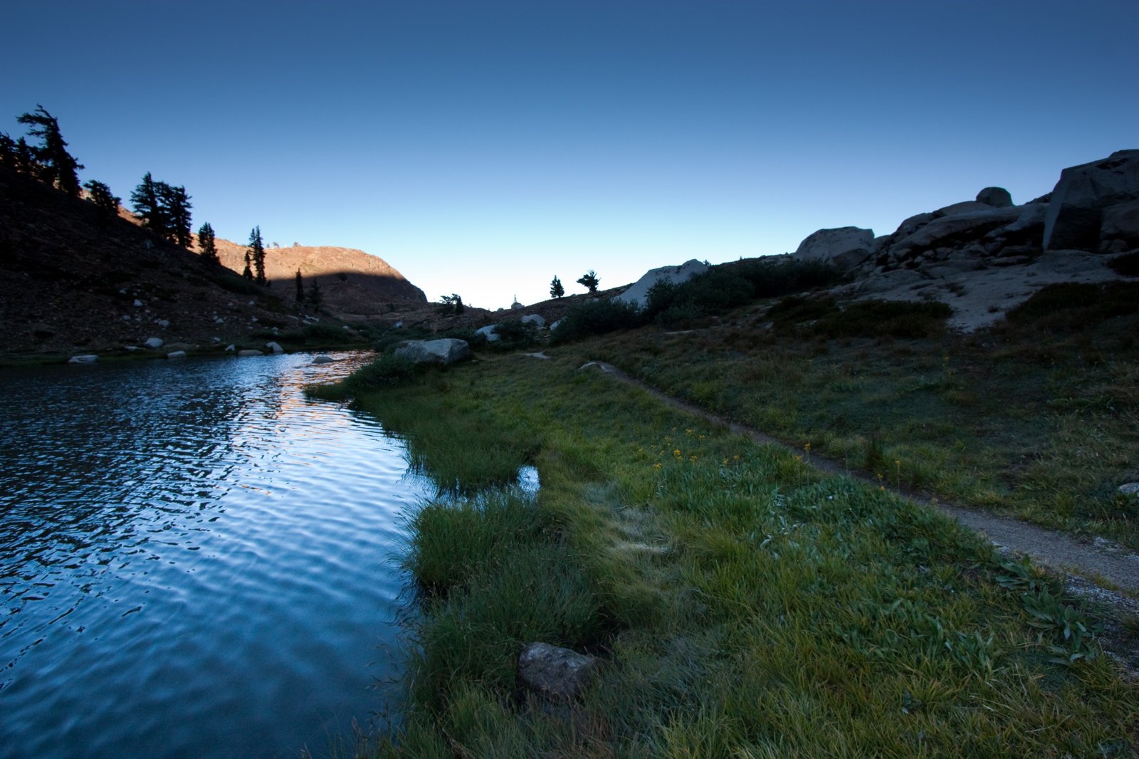
The Monarch Lakes sit in a rocky bowl beneath Sawtooth Peak in the Mineral King area of Sequoia National Park. The NPS describes a 4.2-mile hike to the lakes through meadows, red fir forest, and the avalanche-scoured Chihuahua Bowl, with views across Monarch Creek canyon to the Great Western Divide. Sierra Rec Magazine calls Mineral King a relatively less-traveled part of the park.
Getting there means a long, winding drive, and the trail climbs steeply, but there’s a camping area at the lower lake with a bear box and toilet.
The hike
The trip starts at the Sawtooth Trailhead, which the NPS says is 1 mile past the Mineral King Ranger Station. Bewilder warns that the final stretch, Mineral King Road, has 398 curves in 25 miles. Modern Hiker suggests wrapping a tarp around the underside of your car at the trailhead, because the area’s many yellow-bellied marmots tend to chew on belts and hoses in early season.
Hike Speak says the first 0.7 mile gets your heart pumping with a series of steep switchbacks. Trek with Judy notes that the Timber Gap Trail splits off at about 0.6 mile; stay on the Sawtooth Pass Trail. Hiking Walking describes the grade easing over 1.3 miles as the trail crosses Ground Hog Meadow, home to marmots, with Monarch Creek tumbling down the wall above.
The trail then crosses into Chihuahua Bowl. The NPS says the basin was named by hopeful miners for an area of rich mines in Mexico. Hiking Walking puts a junction at about 3.5 miles, where the trail to Cobalt and Crystal Lakes splits off. The NPS says the Crystal Lake trail branches at Chihuahua Bowl, passes the remnants of the old Chihuahua Mine, and reaches Crystal Lake in 4.9 miles, with no maintained trail beyond it.
Past the junction, Hiking Walking says, the trail recrosses the ridge into the Monarch Creek drainage through a stand of foxtail pines, then follows Monarch Creek as it cascades through meadows below. Modern Hiker describes crossing two branches of Monarch Creek, then climbing a low rise that turns out to be the moraine holding the lake in its glacial basin.
At the top of the moraine, the lake appears. Hiking Walking describes the lower lake in a deep bowl beneath the red, brown, and orange rock of Mineral Peak, at 11,615 feet. Beyond Limits on Foot describes the same bowl of colorful rock.
Above the lakes, the NPS says, the trail climbs 1,200 feet in 1.3 miles to Sawtooth Pass, a strenuous hike with one of the grandest views in the southern Sierra. Hiking Walking calls that stretch a very strenuous, unmaintained trail on slippery, scree-covered slopes. Modern Hiker is blunter: the trail is great up to Monarch Lake, and after that you may question whether it’s really a trail at all. Bewilder compares the climb to ascending a giant sand dune.
Sawtooth Pass is also the gateway to bigger trips. Somewhere Sierra describes a roughly 30-mile Mineral King loop, and one version passes Columbine Lake, Monarch Lake, and Sawtooth Pass.
For another Sequoia and Kings Canyon trip, see the Rae Lakes Loop.
Tips
- Protect your car. Modern Hiker suggests wrapping a tarp around the underside to keep marmots from chewing hoses.
- Store food carefully. Use the bear box at the lake or a bear-resistant container.
- Watch for marmots in camp. Somewhere Sierra met especially aggressive marmots at Monarch Lake.
- Go slow on Sawtooth Pass. The NPS calls it strenuous, and other sources describe loose scree.
- Drive carefully. Mineral King Road is long and twisting.
Camping
A Sequoia and Kings Canyon wilderness permit is required for overnight trips. The NPS says permits are limited during the quota season (May 22 to September 26 in 2026) and free and self-issued outside it. Hiking Walking describes campsites on a rocky knoll west of the lower lake with a bear box and a partially screened pit toilet. Bewilder says the Lower Monarch Lake backcountry camping area is first come, first served.
Inside Intel: The lower lake is where backpackers stay. Sierra Rec Magazine says backpackers will appreciate the campsites at Lower Monarch Lake, with a bear box and pit toilet, while Hiking Walking notes the sites on the knoll west of the lake are heavily used. Bewilder’s trip used camp as a base to day hike over Sawtooth Pass to Columbine Lake with a light pack and trekking poles.
Trail facts
- Distance: About 8.4 miles round trip (4.2 miles one way per the NPS)
- Route type: Out and back
- Difficulty: Strenuous. About 2,500 to 3,000 feet of gain.
- Elevation: Mineral Peak, above the lake, is 11,615 feet (Hiking Walking)
- Campsites: Lower Monarch Lake camping area with bear box and pit toilet
- Water: Monarch Creek and the lakes. Treat all water.
- Permits: SEKI wilderness permit required
- Bear and food storage: Bear box at the lake; bear-resistant containers recommended
- Dogs: Not allowed (AllTrails)
- Trailhead: Sawtooth Trailhead, 1 mile past the Mineral King Ranger Station
- Last verified: October 2, 2026
Where this comes from
This page draws on the sources below, along with other guides and trip reports. Links go to the original pages.
- National Park Service: Mineral King Day Hikes
- National Park Service: Sequoia and Kings Canyon Wilderness Permits
- Hiking Walking: Monarch Lake
- Modern Hiker: Monarch Lake
- Sierra Rec Magazine: Discovering Monarch Lake
- Hike Speak: Monarch Lakes
- Somewhere Sierra: Backpacking the Mineral King Loop
- Trek with Judy: Mineral King Loop
- Beyond Limits on Foot: Monarch Lakes
- Bewilder: Lower Monarch Lake
Before you go: This page is based on published trail guides, trip reports, and reviews, along with official park and agency information where we could find it. It’s meant to help backpackers discover new trails, not to replace current, official information. Conditions, closures, permits, campsites, and water sources change, and some details here may be out of date or wrong. Confirm everything with the managing agency and check current conditions before you head out, and don’t rely on this page alone for safety or navigation. Backcountry travel involves risk.