
Trails / Arizona / Northern Arizona Canyons
West Clear Creek via Trail #17 (Bull Pen)
West Clear Creek Wilderness, Coconino National Forest (east of Camp Verde)
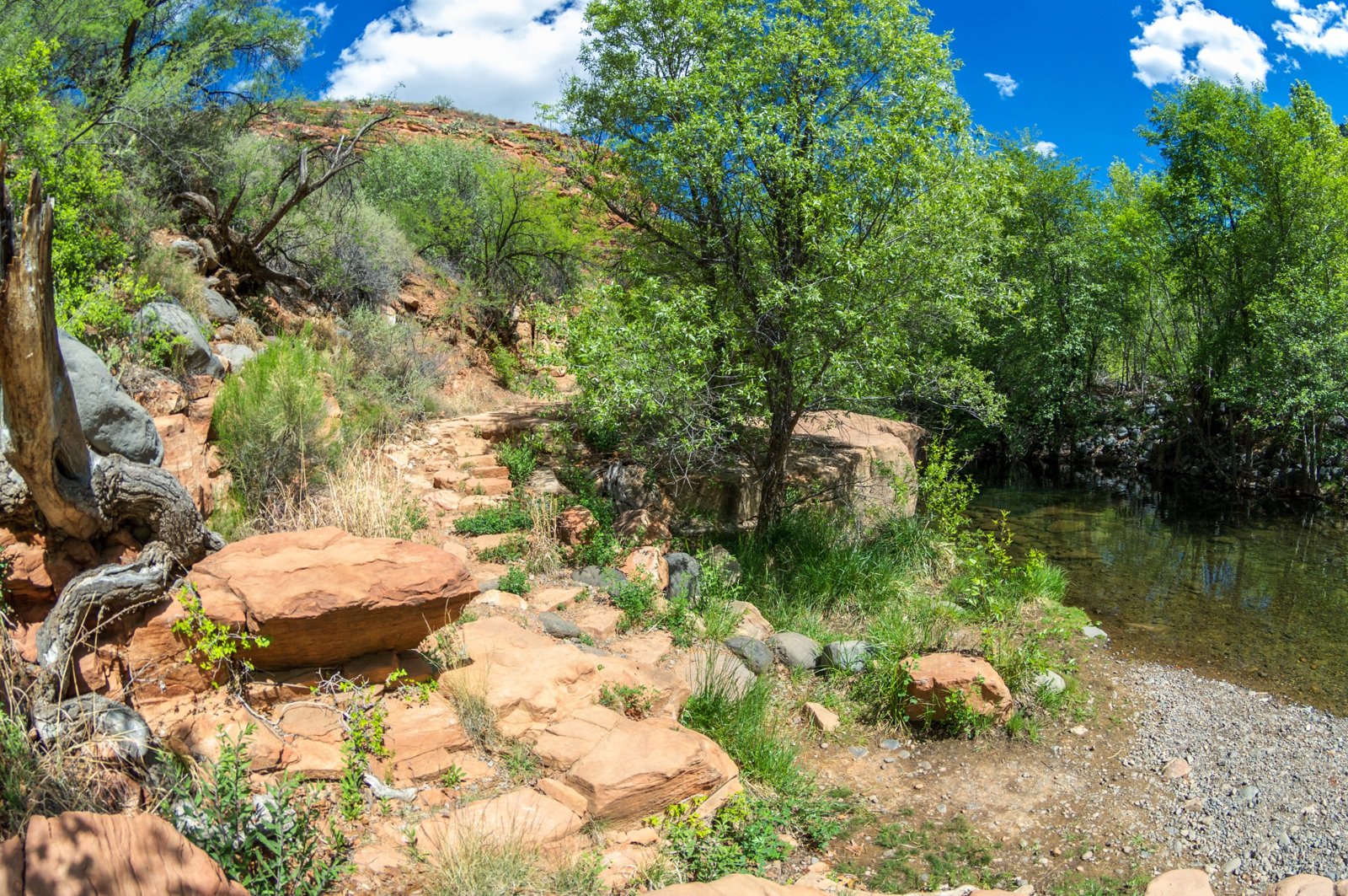
West Clear Creek has carved a deep, narrow gorge into the southern edge of the Colorado Plateau; one longtime visitor says the canyon runs more than thirty miles. Its lower reaches, reached by Trail #17 from Bull Pen Ranch, are a streamside wonderland of clear pools, slickrock water slides, and shady riparian groves between red rock walls. The Coconino National Forest describes Trail 17 as the only marked and maintained access to the lower canyon.
It’s a popular place to swim, fish, and camp, and AllTrails rates the lower trail moderate.
The hike
The trail starts at the Bull Pen Ranch trailhead at the end of Forest Road 215 (Bull Pen Road), east of Camp Verde. AllTrails gives the approach as 40 miles south on Interstate 17 to the AZ 179 exit, then east to the trailhead. HikeDesert notes the trailhead has only a small parking area and recommends arriving early in summer.
The Coconino National Forest describes Trail 17 leading upstream from Bull Pen Ranch into the deep, narrow gorge that West Clear Creek has cut into the edge of the Colorado Plateau. It says the downstream end draws many anglers, picnickers, and swimmers to the clear pools, slickrock water slides, and tree-shaded riparian areas between red rock walls. It adds that you’ll cross the stream at least four times, so bring wading shoes.
AllTrails describes the lower trail as mostly flat, ending at a small swimming hole. Reviewers say the Bull Pen swimming hole gets very crowded, with a smaller one a short walk farther up. One reviewer describes the first swimming hole about three-quarters of a mile in, with some mild cliff jumps and a rope swing, and another found beaches and camping spots beside solid swimming holes and a natural water slide farther up. A July 2026 reviewer notes that the first creek crossing’s cairn sits on the far side of the creek.
Beyond the end of the maintained trail, the canyon changes character. Backpacker describes the upper and middle canyon as a rugged gorge in Coconino sandstone where you’ll get wet, with dense alder and willow, slippery algae-covered rocks, and water from ankle-deep to 10 feet. Its route through the upper canyon includes the White Box, which it calls the canyon’s narrowest section, requiring a swim through water more than six feet deep even in spring. Backpacker describes the full route to Bull Pen Ranch as a 25-mile, four-to-six-day trip for experienced canyoneers. This page covers only the lower canyon.
Trail 17 also climbs out of the canyon. The Forest Service says that from its upper end at Bald Hill, the route drops 1,800 feet down a steep, talus-strewn slope from pinyon-juniper plateau to the canyon floor. Camp Arizona lists other wilderness trails, including Blodgett Basin #31, Maxwell #37, and Tramway #32.
Camp Arizona says several writers have described the creek as one of the most remote and beautiful streams in the Southwest. Wikipedia lists swimming, camping, backpacking, hunting, fishing, and hiking as common activities.
Flash floods are the biggest danger. Backpacker lists July through September as the higher-risk period. One longtime visitor writes that a flash flood can raise the water level 15 to 20 feet, and that in the narrow sections there’s often no escape.
For another Arizona creek canyon overnight, see Aravaipa Canyon.
Tips
- Bring shoes you can wade in. The Forest Service says you’ll cross the creek at least four times on Trail 17.
- Avoid the monsoon. Backpacker suggests May, June, and late August through October, and warns July through September carries higher flash-flood risk.
- Arrive early. HikeDesert says the trailhead parking is small, and AllTrails reviewers describe crowds at the first swimming hole.
- Stay in the lower canyon unless you’re prepared. Upstream, the canyon requires swimming long, deep pools.
- Check road conditions. Monsoon rain can make the approach temporarily impassable.
Camping
Camping is dispersed in the West Clear Creek Wilderness. HikeDesert says there’s no quota system, and we found no permit requirement. Camp Arizona says mechanized vehicles, including mountain bikes, are prohibited in the wilderness. There’s dispersed camping along Bull Pen Road outside the wilderness for car campers.
Inside Intel: The crowds thin quickly past Bull Pen. AllTrails reviewers say the first swimming hole gets very crowded, but farther up the lower canyon one reviewer found beaches and camping spots next to solid swimming holes and a natural water slide, and suggested backpacking rather than day hiking. Backpacker’s tip for campsites on the upper canyon route is to look on the upper banks among the ponderosa pines for trails leading to fire rings.
Trail facts
- Distance: About 9 to 12 miles round trip for an overnight up the lower canyon (sources vary)
- Route type: Out and back
- Difficulty: Moderate on the lower trail; very strenuous upstream
- Elevation: AllTrails lists about 813 feet of gain on the 9-mile route.
- Campsites: Dispersed along the creek
- Water: West Clear Creek. Treat all water.
- Permits: None found
- Hazards: Flash floods, slippery crossings, deep pools upstream
- Trailhead: Bull Pen Ranch, end of Forest Road 215, east of Camp Verde
- Last verified: September 30, 2026
Where this comes from
This page draws on the sources below, along with other guides and trip reports. Links go to the original pages.
- Coconino National Forest: West Clear Creek Trail No. 17
- Wikipedia: West Clear Creek Wilderness
- Backpacker: Rip & Go, West Clear Creek Canyon
- Arizona Jones Outdoor: West Clear Creek Wilderness
- Arizona Jones: West Clear Creek Wilderness (with comments)
- HikeDesert: West Clear Creek Trail
- Camp Arizona: West Clear Creek Wilderness
- AllTrails: West Clear Creek Trail
Before you go: This page is based on published trail guides, trip reports, and reviews, along with official park and agency information where we could find it. It’s meant to help backpackers discover new trails, not to replace current, official information. Conditions, closures, permits, campsites, and water sources change, and some details here may be out of date or wrong. Confirm everything with the managing agency and check current conditions before you head out, and don’t rely on this page alone for safety or navigation. Backcountry travel involves risk.