
Trails / Arizona / Southern Arizona
Aravaipa Canyon Wilderness
Aravaipa Canyon Wilderness, Bureau of Land Management, Safford Field Office (between Winkelman and Klondyke)
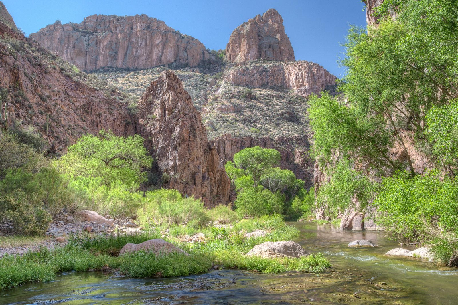
Aravaipa Canyon is a green oasis cut through the Galiuro Mountains, where a year-round creek flows between cliffs lined with saguaros. There’s no formal trail: you follow Aravaipa Creek, wading back and forth dozens of times, past cottonwoods and sycamores, and up side canyons full of pools and narrows. A strict permit system keeps the numbers low.
WildPathsAZ calls it a lush oasis you’d never expect in the desert.
The hike
The BLM says Congress created the 19,410-acre Aravaipa Canyon Wilderness to protect the canyon’s scenery, desert fish and wildlife, history, and chances for primitive recreation. Wikipedia says the wilderness includes the roughly 11-mile Aravaipa Canyon, surrounding tablelands, and nine side canyons, and that the creek becomes perennial at Aravaipa Spring and westward. The Nature Conservancy’s Aravaipa Canyon Preserve protects land on both ends.
There are two trailheads. Recreation.gov puts the west trailhead at 2,630 feet and the east at 3,060 feet, with 12.25 miles of uneven terrain between them. The west side is more accessible. Recreation.gov says to park extra cars at the ranger station and carpool the final 3 miles. The BLM says reaching the east trailhead requires a high-clearance vehicle and driving through the creek, with no bridges, and that the road is often impassable after floods.
Most people start from the west. WildPathsAZ describes a short trail down to the creek, then the first of many crossings. After that, it says, use trails appear on either side and often end abruptly, forcing another crossing. The Armchair Explorer notes there are no designated trails, campsites, signs, or facilities anywhere between the two ends. TrailGroove recommends footwear that can get wet and drain well.
The side canyons are the highlight. Back o’ Beyond lists eleven from west to east: Cave Canyon, Hells Half Acre, Javelina, Virgus, Horse Camp, Booger, Palisano, Deer Creek/Hell Hole, Parsons, Turkey Creek, and Bear Canyon. It says Horse Camp Canyon is only 5 miles from the west entrance. A TripAdvisor reviewer calls Hell Hole probably the most famous side canyon, with sheer walls on either side, and says Virgus Canyon is a delightful rockfall hike. TrailGroove describes Deer Creek Canyon’s walls as barely wider apart in places than a neighborhood street, and notes Edward Abbey wrote about Horse Camp Creek in his essay “Aravaipa Canyon.”
Mountain Tripper describes the broad flat at Horse Camp, less than a quarter mile past the Virgus confluence, as a string of campsites lasting about a quarter mile. Another reviewer says the stretch between Booger Canyon and Horse Camp is where they spot the most wildlife. Trip reports describe canyon treefrogs, native fish, bighorn sheep, and javelinas.
DesertUSA’s writer camped about six miles in, on a terrace high above the creek with a view of two cathedral-like cliffs, and dubbed it “hole-in-the-wall camp” after a rock chimney with a hole worn through it across the creek.
Weather can surprise you. Back o’ Beyond hiked solo in December and woke up to frozen shoes. Recreation.gov warns that flash floods are common, and one trip report notes a 2006 flood significantly changed the canyon.
Tips
- Get a permit for every day. The BLM says a permit is required for any recreational visit. Recreation.gov says permits are issued by the day, not the night, up to three days and two nights.
- Plan on wet feet. Several trip reports say there’s no way to keep your feet dry.
- Respect the group and stay limits. Groups can’t exceed 10 people, and the maximum stay is 3 days and 2 nights.
- Watch for flash floods. Recreation.gov says they are common.
- Use the west trailhead if you’re unsure. The east trailhead road crosses the creek and is often impassable.
- Respect private land. Both ends cross The Nature Conservancy’s preserve.
Camping
Camping is dispersed. The Armchair Explorer says there are no designated or developed campsites and that camping is limited by the available space, with the area subject to sudden rises in stream flow. American Southwest says there are plenty of sheltered, level camp spots a safe distance from the creek. The BLM says pack animals can’t stay overnight in the canyon bottom.
Inside Intel: Horse Camp and Booger Canyon come up again and again. Mountain Tripper describes Horse Camp’s quarter-mile string of campsites on a broad flat. Back o’ Beyond and The Beckoning both camped near the mouth of Booger Canyon, and Brushes and Boots set up in a sandy spot across from it on a coworker’s recommendation. A TripAdvisor reviewer hung a hammock across the creek from Horse Camp Canyon and used it as a base for exploring the western side canyons.
Trail facts
- Distance: About 11 miles from end to end (up to 12.25 per Recreation.gov); most trips are out and back from one end
- Route type: Out and back, or point to point with a long car shuttle
- Difficulty: Moderate. Little elevation change, but constant creek crossings.
- Elevation: West trailhead 2,630 feet; east trailhead 3,060 feet (Recreation.gov)
- Campsites: Dispersed, on benches above the creek
- Water: Aravaipa Creek, year-round. Treat all water.
- Permits: Required for every day in the canyon; maximum 3 days, 2 nights
- Group size: 10 people maximum
- Hazards: Flash floods; slippery creek crossings; cold water in winter
- Trailheads: West (off Highway 77 between Mammoth and Winkelman) and east (near Klondyke)
- Last verified: September 28, 2026
Where this comes from
This page draws on the sources below, along with other guides and trip reports. Links go to the original pages.
- Bureau of Land Management: Aravaipa Canyon permits
- Recreation.gov: Aravaipa Canyon Wilderness permit
- Wikipedia: Aravaipa Canyon Wilderness
- The Armchair Explorer: Aravaipa Canyon Wilderness
- WildPathsAZ: Backpack Aravaipa Canyon
- Back o’ Beyond: Aravaipa Canyon Backpacking Guide
- Mountain Tripper: Aravaipa Canyon Wilderness
- The Beckoning: Aravaipa Canyon Backpack, Day 1
- DesertUSA: Backpacking Aravaipa Canyon
- TrailGroove: Backpacking Arizona’s Aravaipa Canyon
Before you go: This page is based on published trail guides, trip reports, and reviews, along with official park and agency information where we could find it. It’s meant to help backpackers discover new trails, not to replace current, official information. Conditions, closures, permits, campsites, and water sources change, and some details here may be out of date or wrong. Confirm everything with the managing agency and check current conditions before you head out, and don’t rely on this page alone for safety or navigation. Backcountry travel involves risk.