
Trails / Alaska / Chugach Mountains
Crow Pass Trail (Girdwood to Eagle River)
Chugach National Forest and Chugach State Park (Iditarod National Historic Trail, Girdwood to Eagle River Nature Center)
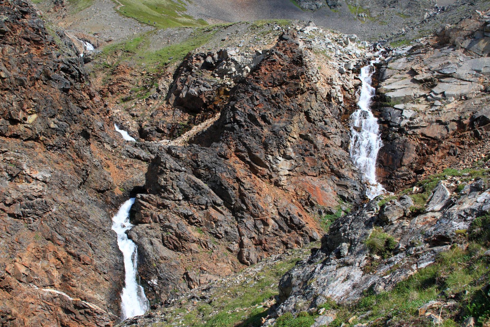
The Crow Pass Trail follows a piece of the historic Iditarod Trail over the Chugach Mountains, from the Crow Creek valley above Girdwood to the Eagle River Nature Center. It climbs past old mine ruins and waterfalls to a pass beside Raven Glacier, then descends the long Eagle River valley. Midway, it fords the glacial Eagle River.
Visit Girdwood calls it one of the best hikes in the Chugach. The river crossing is what makes it serious.
The hike
Most people start at the Crow Pass Trailhead outside Girdwood and finish at the Eagle River Nature Center. ALASKA.ORG says the trail begins at stairs at the far end of the trailhead lot. onX says the trail climbs about 2,200 feet on a wide dirt and rock path over the first 3 miles to Crow Pass. It notes that the 70-mile road distance between trailheads means arranging a pickup, or hiking out and back.
The climb passes mining history. The Crow Pass Cabin listing describes the historic Monarch Mine ruins and several waterfalls on the 3-mile approach. The Forest Service cabin sits about 500 yards off the trail in open alpine tundra at roughly 3,500 feet, with views of Crystal Lake. 10Adventures says the trail splits near the mine and both paths rejoin before the cabin. The left one passes closer to the waterfalls.
About half a mile past the cabin is Crow Pass itself. ALASKA.ORG says a clear day brings views of Raven Glacier and the surrounding peaks. onX warns the pass is exposed to whatever weather is moving through. Visit Girdwood urges exceptional care if you visit Raven Glacier.
From the pass, onX says, the trail descends through low shrubs and alder for about 9 miles to the Eagle River crossing. ALASKA.ORG puts the river about 5.5 miles from Crow Pass. Sources disagree on the distance, so plan for the longer figure. onX describes the river as roughly 150 feet wide. One AllTrails reviewer calls the crossing challenging but doable and shallower on the Girdwood side.
After the ford, the trail follows the north side of Eagle River to the nature center. onX says this area was under the Eagle Glacier around 1900 and has been exposed as the glacier retreated. ALASKA.ORG says the trail stays relatively flat for the last 12 miles, but warns it’s possible to lose the trail between the ford site and Icicle Creek. Visit Girdwood names landmarks near the end, including The Perch, Echo Bend, and Rapids Camp, and says the second half is under canopy or chest-high foliage and can be muddy.
ALASKA.ORG also describes a packrafting option: floating about 9 miles of Eagle River from the ford site, then walking the last 3 miles to the nature center. That trip requires packrafting skills and gear.
Wikipedia says the Eagle River Nature Center is the visitor center for Chugach State Park, about 12 miles up Eagle River Road from the Eagle River community.
If the full traverse is too much, Visit Girdwood suggests hiking only to the pass and exploring around Crystal Lake and Raven Glacier. For a gentler Iditarod Trail overnight, see the Johnson Pass Trail.
Tips
- Respect the Eagle River ford. onX says the river is about 150 feet wide. Cross only when conditions allow, and be prepared to wait or turn back. One guide calls fords very dangerous and stresses learning to cross safely.
- Start in Girdwood. Most guides suggest Girdwood to Eagle River so the big climb comes first. One notes it’s mostly downhill after the initial climb.
- Arrange a car shuttle. The trailheads are about 70 road miles apart (onX).
- Carry rain gear and warm layers. The pass is exposed to fast-changing weather.
- Watch the trail after the ford. ALASKA.ORG says it’s easy to lose between the ford site and Icicle Creek.
Camping
Camping is at established backcountry campsites along the route. ALASKA.ORG lists sites at miles 1.7, 3, 5.5, 6, and 9. onX says there’s plenty of camping near the ford for drying out and more rustic campsites along creeks flowing into the river. It also says campfires are allowed only on the wide gravel river bars next to the trail or in fire rings at rustic campsites. The Crow Pass Cabin near the pass requires a reservation. Chugach State Park and the Chugach National Forest both manage parts of the trail; check with them for current rules.
Inside Intel: Camping near the ford is a popular strategy. One AllTrails reviewer did the trail as a single overnight, camping right before the river ford, where there were several obvious campsites within a quarter mile. On the other side, AllTrails lists the Echo Bend campsites closer to the nature center. And if you want a roof, the reservable Crow Pass Cabin sits just 3 miles from the Girdwood trailhead.
Trail facts
- Distance: About 21 to 26 miles depending on the source (22.8 per AllTrails)
- Route type: Point to point, or out and back from either end
- Difficulty: Strenuous. Big climb to the pass; major river ford.
- Elevation: About 2,200 feet of climbing in the first 3 miles from Girdwood (onX). Cabin at about 3,500 feet.
- Campsites: Established backcountry sites; reservable Crow Pass Cabin
- Water: Streams and Eagle River. Treat all water.
- River crossing: Eagle River ford, about 150 feet wide. Serious hazard.
- Permits: Cabin reservation required; no permit found for campsites
- Fires: Only on gravel bars or in existing fire rings (per onX)
- Trailheads: Crow Pass Trailhead above Girdwood; Eagle River Nature Center
- Last verified: September 28, 2026
Where this comes from
This page draws on the sources below, along with other guides and trip reports. Links go to the original pages.
- U.S. Forest Service: Chugach National Forest hiking and backpacking
- Campflare: Crow Pass Cabin (Recreation.gov facility listing)
- ALASKA.ORG: Crow Pass Trail
- ALASKA.ORG: Crow Pass Backpack (Packraft Option)
- onX Hiking: Crow Pass / Eagle River Trail
- Visit Girdwood: Crow Pass
- AllTrails: Crow Pass Trail
Before you go: This page is based on published trail guides, trip reports, and reviews, along with official park and agency information where we could find it. It’s meant to help backpackers discover new trails, not to replace current, official information. Conditions, closures, permits, campsites, and water sources change, and some details here may be out of date or wrong. Confirm everything with the managing agency and check current conditions before you head out, and don’t rely on this page alone for safety or navigation. Backcountry travel involves risk.