
Trails / Alaska / Kenai Peninsula
Johnson Pass Trail
Chugach National Forest, Seward Ranger District (Kenai Peninsula, Iditarod National Historic Trail)
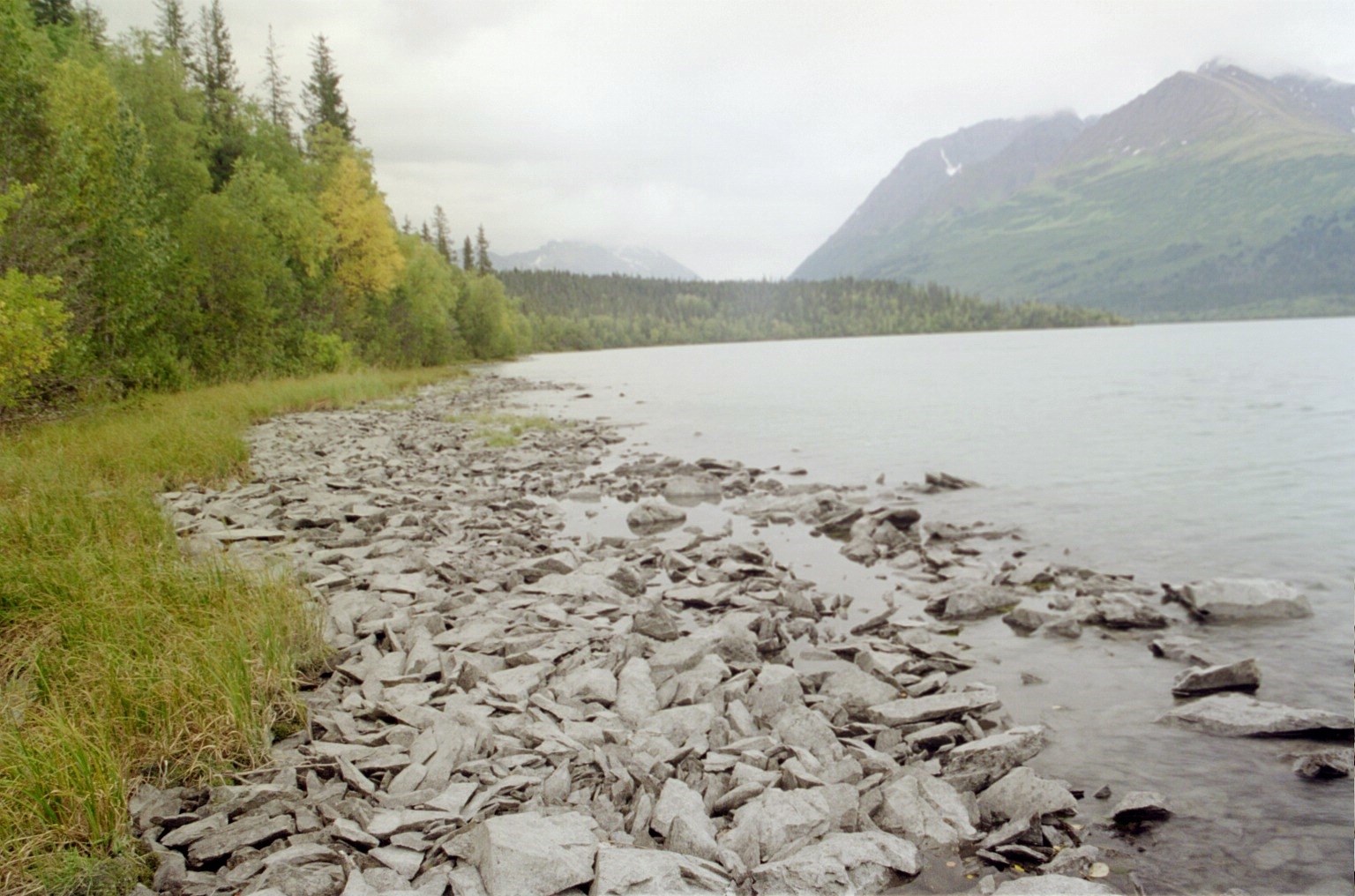
The Johnson Pass Trail follows part of the historic Iditarod Trail through the Kenai Mountains, linking two trailheads on the Seward Highway. The Forest Service calls it a 23-mile trail with gradual grades and a few steep sections. Forest opens into subalpine meadows in the middle, with two lakes, Bench and Johnson, near the pass.
The Forest Service rates it easy to moderate, with designated campsites and bear lockers along the way.
The hike
The Forest Service says the trail runs from mile 64 of the Seward Highway in the north to mile 32.5 in the south. The north trailhead is a quarter mile down a signed gravel road east of Granite Creek Campground. The south trailhead is a signed pullout west of Upper Trail Lake. The trail is mostly forested for the first 4 miles from the north and the first 10 miles from the south. The higher middle is mostly open subalpine meadows and brush, with mountain views.
ALASKA.ORG says the route was a segment of the historic Iditarod Trail. Another guide describes the Johnson Pass Trail as part of the Iditarod National Historic Trail’s 180-mile Southern Trek. ALASKA.ORG also notes that the trail originated in the 1890s as a route for Iditarod miners racing north from Seward to Nome. It traces part of the old wagon road too: south of Bench Creek, ALASKA.ORG says, the original road headed northwest on the south side of the creek, crossed the Lynx Creek valley, and came out near today’s Seward Highway west of the East Fork of Sixmile Creek. It also advises shopping before you leave Anchorage, Seward, or Soldotna, since there are no specialized camping stores or large groceries along the way.
From the north, the Forest Service map sheet says the trail winds through meadows and forest to the Bench Creek bridge at about mile 3.9. It then enters the V-shaped Bench Creek valley, which continues to Bench Lake at mile 9.3 in subalpine tundra. One guide describes bridges over Center Creek and Bench Creek and calls Bench Lake a great lunch spot.
The two lakes are a highlight. ALASKA.ORG says Bench Lake supports one of the Kenai’s rare Arctic grayling populations, and Johnson Lake has resident rainbow trout. The Forest Service map sheet says the same: grayling in Bench Lake, rainbow trout in Johnson Lake.
South of the lakes, the trail crosses Johnson Pass and descends through forest toward Upper Trail Lake. The map sheet says the first two miles from the south trailhead offer views of Upper Trail Lake. ALASKA.ORG describes mature spruce forest and views of roiling whitewater along parts of the route.
The Forest Service rates the trail easy to moderate, with a 2-to-3-day trip time one way. It recommends June through October and warns that snow can linger at higher elevations until mid-June. Its north trail page lists heavy summer use.
Trail condition varies. A 2025 AllTrails reviewer says the middle is overgrown and a few spots are flooded or washed out, though everything was crossable. Other reviewers found it well maintained, and one in June 2026 noted lots of bugs.
For a longer Kenai Peninsula trip with cabins, see the Resurrection Pass Trail.
Tips
- Plan a shuttle. The trailheads are about 32 road miles apart on the Seward Highway.
- Share the trail. The Forest Service says motor vehicles are allowed outside May 1 to Nov. 30 on parts of the trail, the north end to mile 3.6 is closed to motor vehicles year-round, and pack and saddle stock are closed April 1 to June 30. Expect mountain bikers in summer.
- Watch for late snow. The Forest Service says snow can remain at higher elevations until mid-June.
- Bring bug protection. Reviewers mention heavy bugs in summer.
- Fish the lakes. Bench Lake has Arctic grayling and Johnson Lake has rainbow trout. Check Alaska fishing regulations first.
Camping
The Forest Service says the trail has designated backcountry campsites, most with bear-resistant food lockers. ALASKA.ORG lists campsites along the route at Bench Creek, Groundhog Creek, two near the gorge, two at Johnson Lake, and one near Johnson Pass. Water is available from lakes and streams. Contact the Seward Ranger District at (907) 288-3178 for current conditions.
Inside Intel: The campsite ALASKA.ORG singles out sits about 10 miles from the north trailhead, among trees on a spruce-covered knoll overlooking the trail and Bench Lake. Two AllTrails reviewers who hiked or biked the full trail mention great campsites around Johnson Lake, one describing an amazing spot just past Bench Lake and Johnson Lake. Whichever you choose, use the bear lockers.
Trail facts
- Distance: 23 miles one way; about 18.6 miles out and back to Bench Lake from the north
- Route type: Point to point, or out and back
- Difficulty: Easy to moderate (Forest Service)
- Elevation: About 1,000 feet of gain end to end (Forest Service map sheet); more on out-and-back trips
- Campsites: Designated sites, most with bear lockers
- Water: Lakes and streams. Treat all water.
- Permits: None found
- Bear and food storage: Use the bear lockers at campsites
- Restrictions: Seasonal motorized and stock closures (Forest Service)
- Trailheads: North at mile 64 Seward Highway; south at mile 32.5 Seward Highway
- Season: June to October
- Last verified: September 28, 2026
Where this comes from
This page draws on the sources below, along with other guides and trip reports. Links go to the original pages.
- U.S. Forest Service: Johnson Pass Trail - INHT
- U.S. Forest Service: Johnson Pass Trail North - INHT
- U.S. Forest Service: Johnson Pass Trail map sheet (PDF)
- ALASKA.ORG: Guide to Backpacking and Biking the Johnson Pass Trail
- ALASKA.ORG: Johnson Pass Trail South Access
- Andrea Kuuipo Abroad: Biking Johnson Pass Trail
- AllTrails: Johnson Pass to Bench Lake
Before you go: This page is based on published trail guides, trip reports, and reviews, along with official park and agency information where we could find it. It’s meant to help backpackers discover new trails, not to replace current, official information. Conditions, closures, permits, campsites, and water sources change, and some details here may be out of date or wrong. Confirm everything with the managing agency and check current conditions before you head out, and don’t rely on this page alone for safety or navigation. Backcountry travel involves risk.