
Trails / South Carolina / Upstate South Carolina
Ellicott Rock Wilderness: Chattooga River Trail to Ellicott Rock
Ellicott Rock Wilderness, Sumter National Forest (Andrew Pickens Ranger District), where South Carolina, North Carolina and Georgia meet; Burrells Ford Road off SC 107
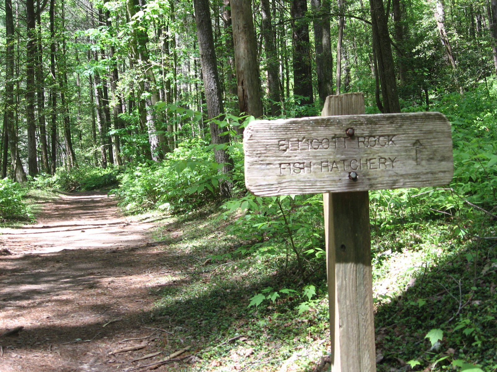
The Ellicott Rock Wilderness protects 8,274 acres where South Carolina, North Carolina and Georgia meet, and Wikipedia says the Sumter National Forest in South Carolina is its lead manager and gets most of the recreation use. The classic overnight follows the Chattooga River Trail north from Burrells Ford to Ellicott Rock, a survey mark carved in 1811.
The Forest Service’s figures put the rock about 4 miles from the Burrells Ford trailhead. No permit is needed, but group-size, setback and food-storage rules apply.
The hike
A Forest Service wilderness guide calls the Chattooga River Trail the most popular trail in the wilderness. It starts off Burrells Ford Road near the walk-in Burrells Ford Campground. Less than a quarter mile in, a 0.1-mile spur leads to Spoonauger Falls.
The website Hiking the Appalachians and Beyond describes the route in detail from a January 2018 hike. North of the falls, the trail passes the Foothills Trail connector, then reaches the East Fork of the Chattooga, crossed on a log footbridge, with a flat area of campsites. The Forest Service says the East Fork junction is 2.1 miles from Burrells Ford. The East Fork Trail leaves here for 2.5 miles to the Walhalla Fish Hatchery.
Beyond the East Fork, the guide calls Bad Creek the largest crossing, where feet may get wet. Past a sloping-rock crossing and a plank footbridge, the Ellicott Rock Trail leaves to the left and fords the river, and just beyond are Commissioners Rock and Ellicott Rock. The Forest Service puts Ellicott Rock 1.9 miles north of the East Fork junction.
Wikipedia says surveyor Andrew Ellicott inscribed “N-G” on a rock in 1811 to mark the 35th parallel, and that North and South Carolina commissioners carved a second rock about 10 feet north in 1813, inscribed “Lat 35 AD 1813 NC + SC.” It’s on the National Register of Historic Places.
Return the way you came, or make a loop: take the East Fork Trail to the fish hatchery, then the Foothills Trail 3.9 miles back to Burrells Ford Road. Adding the published segments gives about 12 miles. Past Ellicott Rock, the guide describes a rough bushwhack to Fowler Creek Falls through steep, rhododendron-choked terrain with a 10-foot rock bluff, and recommends it only for seasoned waterfall hikers.
Across the river, Georgia’s Chattooga River Trail continues downstream. The western Foothills Trail section passes Burrells Ford and the fish hatchery.
Tips
- Keep groups to six. A Forest Service order limits camping groups on the upper Chattooga.
- Hang your food. The Andrew Pickens food storage order requires it.
- Plan for wet feet at Bad Creek, especially after rain.
- Expect weekend company near Burrells Ford. N2Backpacking calls it busy on weekends.
- Treat all water. The Forest Service notes no potable water on the East Fork Trail.
Camping
Wikipedia says the wilderness has no designated campsites, but unofficial primitive sites are common, especially along the Chattooga River Trail. The Forest Service’s East Fork Trail page says primitive camping is allowed more than 50 feet from streams and trails and more than a quarter mile from roads. Groups larger than six can’t camp in the upper Chattooga corridor, and stays are limited to 14 days in any 30. Food must be stored in a bear-resistant container, hung at least 10 feet up and 4 feet out, or kept in a hard-sided vehicle. Burning or burying food or trash is prohibited.
Inside Intel: Hiking the Appalachians and Beyond describes a pleasant campsite at the end of the Chattooga River Trail, just past Ellicott Rock, and a second one down a twisting path that it calls a “fantastic spot” by a secluded sandy beach with a good river view.
Trail facts
- Distance: About 4 miles one way from the Burrells Ford trailhead (Forest Service); about 12 miles as a loop
- Route type: Out and back, or loop
- Difficulty: Moderate
- Campsites: Undesignated primitive sites; flat sites at the East Fork crossing and near Ellicott Rock
- Water: Chattooga River and tributaries. Treat all water.
- Permits: None
- Group size: 6 camping, 12 hiking (upper Chattooga order)
- Food storage: Required (Andrew Pickens order)
- Trailheads: Burrells Ford Road (FS 708); Walhalla Fish Hatchery (East Fork Trail)
- Last verified: October 12, 2026
Where this comes from
This page draws on the sources below, along with other guides and trip reports. Links go to the original pages.
- U.S. Forest Service: East Fork Trail
- U.S. Forest Service: Upper Chattooga River Corridor restrictions
- U.S. Forest Service: Food storage restrictions, Andrew Pickens Ranger District
- U.S. Forest Service: Camping occupancy and use restrictions
- U.S. Forest Service: Terrestrial trails in Ellicott Rock Wilderness
- Wikipedia: Ellicott Rock Wilderness
- Hiking the Appalachians and Beyond: Chattooga River Trail to Ellicott Rock
- Foothills Trail Conservancy: Frequently asked questions
- Foothills Trail Conservancy: Fish Hatchery Road (A10) to Burrell’s Ford Road (A11)
- N2Backpacking: Foothills Trail, Sloan Bridge to Burrell’s Ford
- Visit Oconee SC: Storm recovery updates (Oct. 2024)
- Campflare: Burrell’s Ford Campground
- FOX Carolina: Heavy rain and wind from Isaias (Oct. 11, 2026)
Before you go: This page is based on published trail guides, trip reports, and reviews, along with official park and agency information where we could find it. It’s meant to help backpackers discover new trails, not to replace current, official information. Conditions, closures, permits, campsites, and water sources change, and some details here may be out of date or wrong. Confirm everything with the managing agency and check current conditions before you head out, and don’t rely on this page alone for safety or navigation. Backcountry travel involves risk.