
Trails / Georgia / North Georgia Mountains
Gahuti Backcountry Trail (Fort Mountain State Park)
Fort Mountain State Park, Georgia State Parks (between Chatsworth and Ellijay)
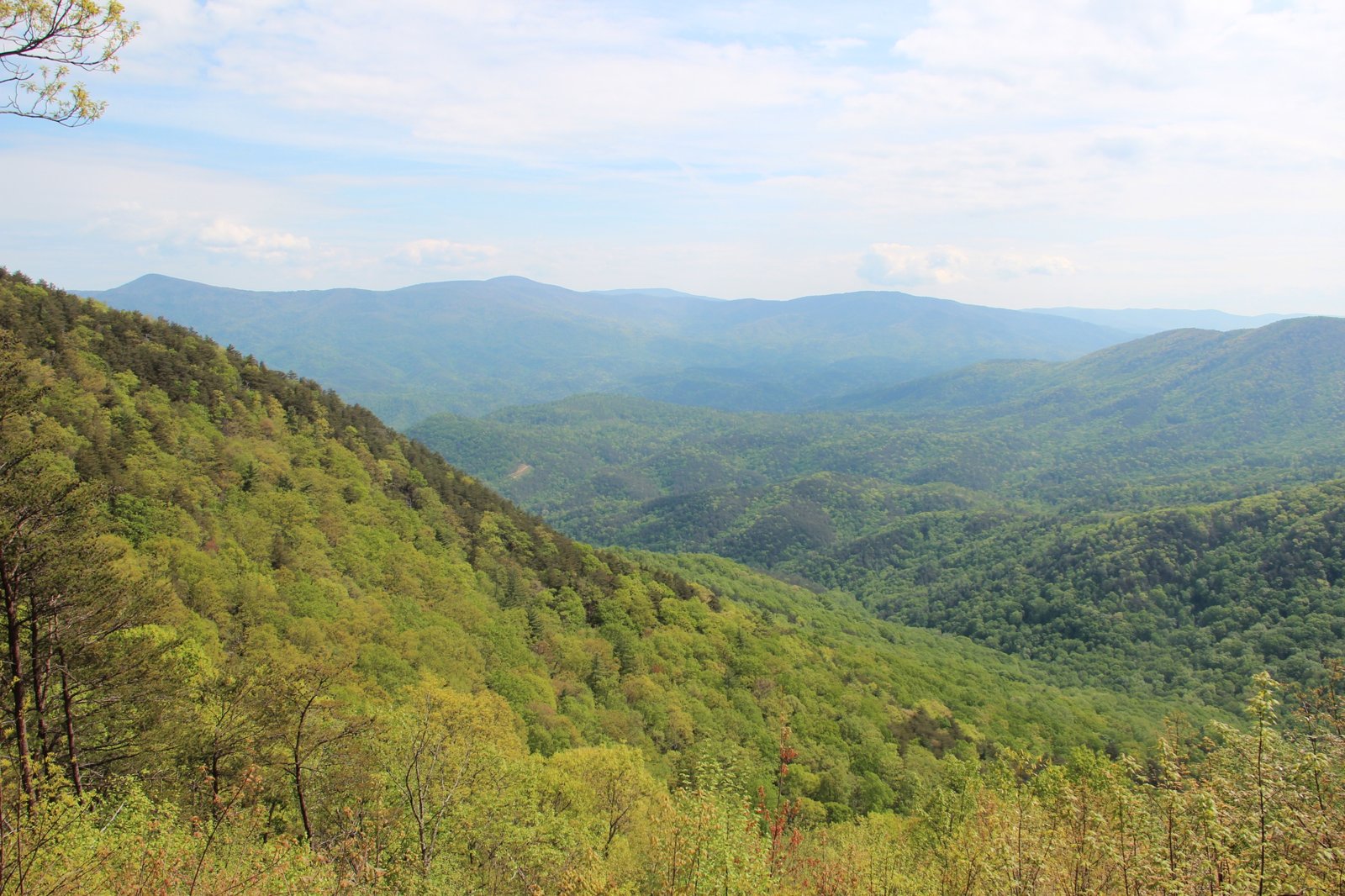
The Gahuti Backcountry Trail circles the edge of Fort Mountain State Park in North Georgia, passing just below the summits of both Cohutta and Fort Mountains, according to Georgia State Parks. It’s the park’s only trail with backcountry campsites, and it ends at the Cool Springs Overlook, with views of the Holly Creek Valley and the Cohutta Mountains. Atlanta Trails calls it a scenic loop past multiple overlooks, through rocky forest, and by a tumbling waterfall.
Camping is by permit at designated sites, so reserve ahead.
The hike
Wikipedia says Fort Mountain State Park covers 3,712 acres between Chatsworth and Ellijay, opened in 1936 on land donated by Ivan Allen Sr., and takes its name from an ancient rock wall on the peak. The park’s 2008 trail map says no one knows who built the zigzagging “wall of stones” across the southern face of the Cohutta range’s most prominent peak, and that it runs about 855 feet with 30 pits built into it.
Georgia State Parks describes the Gahuti Trail as a moderate loop that travels around the edge of the park, ever changing and both beautiful and challenging in all seasons, and warns hikers to be aware of changing weather. Fort Mountain State Park Hiking says it’s orange-blazed, hiking only, and the only trail in the park’s main system with permitted backcountry campsites.
The Celebrate Blue Ridge guide gives a mile-by-mile description. It lists water at miles 1.4, 1.8, 5.5, and 7.2, with a seasonal spring, and describes campsites at mile 1.4, an idyllic setting in a rhododendron thicket near a creek; at mile 3.2, a heavily wooded site south of the trail; and at mile 5.0, near a scenic overlook and the Big Rock Nature Trail. It notes a view west over the Chatsworth Valley at mile 5.5, a stair-step cascade on Gold Mine Creek at the Big Rock Nature Trail junction at mile 5.7, and an overlook of the Cohutta Wilderness at mile 8.2.
Secret Falls says that most of the grades are easy to moderate and recommends hiking the trail counterclockwise.
Atlanta Trails’ favorite campsite is #4, Rock Creek, for its nearby views and its location by a trickling, clear creek. It describes the Gahuti as running through some of the mountain’s more remote stretches, with epic sunsets. Fort Mountain State Park Hiking names the Goldmine Branch waterfall among the trail’s features.
The rest of the park is worth a look. Wikipedia and the park map describe the Civilian Conservation Corps stone fire tower and the stone wall, which a short trail visits. Atlanta Trails mentions a 1.2-mile loop around the mountaintop lake and the park’s 70 developed campsites near it.
The permit rules are straightforward. The Celebrate Blue Ridge guide says backpackers must reserve a designated site in advance and get a permit from the park office, one group per site per night. Georgia State Parks says the backcountry campsites are available by permit only, and the 2008 map says permits are required for all backcountry use.
For a longer Georgia mountain trip, see the Conasauga River Trail in the nearby Cohutta Wilderness.
Tips
- Reserve a site and get your permit. Pick it up at the park office before you start.
- Hike counterclockwise. Secret Falls recommends it.
- Plan water around the creeks. The guide lists water at miles 1.4, 1.8, 5.5, and 7.2.
- Watch the weather. Georgia State Parks warns conditions change.
- Visit the stone wall. A short trail leads to it and the CCC fire tower.
Camping
Backcountry camping on the Gahuti Trail is by permit only at designated sites, which Georgia State Parks says number four. Backpackers reserve a site in advance and get a permit from the park office, one group per site per night, according to the Celebrate Blue Ridge guide. The park also has 70 developed campsites near the lake.
Inside Intel: Atlanta Trails’ favorite is campsite #4, Rock Creek, beside a trickling, clear creek with views nearby. The Celebrate Blue Ridge guide describes another site at mile 1.4 as an idyllic spot in a rhododendron thicket near a creek. Ask the park office which numbered site matches which description when you pick up your permit, since counts and numbering differ between sources.
Trail facts
- Distance: About 8.2 miles (up to 8.8 per park sources)
- Route type: Loop
- Difficulty: Moderate to strenuous
- Campsites: Four designated backcountry sites (Georgia State Parks)
- Water: Creeks at several points; one seasonal spring. Treat all water.
- Permits: Required; reserve in advance and pick up at the park office
- Trail use: Hiking only; orange blazes
- Trailhead: Cool Springs Overlook area, Fort Mountain State Park, off GA 52
- Last verified: October 2, 2026
Where this comes from
This page draws on the sources below, along with other guides and trip reports. Links go to the original pages.
- Georgia State Parks: Trails at Fort Mountain State Park
- Fort Mountain State Park trail map, 2008 (Digital Library of Georgia)
- Celebrate Blue Ridge: Gahuti Backcountry Hiking Trail (PDF)
- Atlanta Trails: Fort Mountain State Park guide
- Fort Mountain State Park Hiking: Gahuti Trail
- Wikipedia: Fort Mountain State Park
- Secret Falls: Gahuti Backcountry Trail
Before you go: This page is based on published trail guides, trip reports, and reviews, along with official park and agency information where we could find it. It’s meant to help backpackers discover new trails, not to replace current, official information. Conditions, closures, permits, campsites, and water sources change, and some details here may be out of date or wrong. Confirm everything with the managing agency and check current conditions before you head out, and don’t rely on this page alone for safety or navigation. Backcountry travel involves risk.