
Trails / Florida / South Florida
Florida Trail through Big Cypress National Preserve (Oasis to I-75)
Big Cypress National Preserve, National Park Service (Oasis Visitor Center, Ochopee)
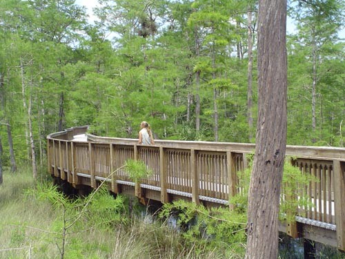
The Florida Trail begins at the Oasis Visitor Center in Big Cypress National Preserve, the southern terminus of a National Scenic Trail that the NPS says stretches about 1,400 miles to the Gulf Islands National Seashore. Its first 30 miles cross cypress swamps, sawgrass prairies, and pinelands, and much of the way you’ll be wading. Florida Hikes calls this the toughest backpacking trip in Florida.
The permit is free, but this is a serious wilderness trip. Know the water levels and the weather before you go.
The hike
The trip starts at the Oasis Visitor Center on US 41, the Tamiami Trail. Florida Hikes says all backpackers must check in with the preserve and get a free backcountry permit for their group, and that the visitor center is open daily. Florida National Parks Association says permits are also available at every backcountry trailhead. The NPS says the preserve charges no entrance fee and no fee for backcountry permits.
Water defines the trail. The NPS says portions can be under water at certain times of year, as deep as 3 to 4 feet, and that during the dry season, November through April, there may be very little drinking water at all. Florida Hikes describes water seeping south from the Okaloacoochee Slough to form a broad, shallow river across the landscape. It says to expect no better than 1 mile per hour through the toughest part, about seven miles of open cypress savannas.
An AllTrails reviewer who hiked from Oasis to I-75 found the route about 75 percent water, with miles 8 to 28 ankle to hip deep in mud, over limestone and cypress stumps, and called it not for the unprepared. Florida Hikes warns that high water combined with cool weather can lead to hypothermia, and that rescue is limited and costly, especially north of mile 20.
The campsites are the only reliably dry ground. Florida Hikes lists five designated campsites along the trail: 7 Mile, 10 Mile, 13 Mile, Oak Hill, and Ivy, each elevated just slightly above the swamps. The same AllTrails reviewer spent nights at 7 Mile and Oak Hill and found them super quiet, with starry skies.
Drinking water is the other challenge. Florida Hikes says that in dry times, only flag ponds and the Black Lagoon will have water, and that alligators will guard any smaller water holes. AllTrails says all collected water must be treated.
The preserve isn’t a park. Backpacker notes that its “preserve” designation allows some traditional uses not allowed in national parks, such as hunting and off-road vehicles, and its writers saw swamp buggy tracks on their hike north from Oasis.
The NPS says the Florida Trail runs about 36 miles from the Oasis Visitor Center to the preserve’s northern border, and Florida National Parks Association puts the whole preserve at 729,000 acres. Florida Rambler suggests talking with rangers at the visitor center before heading north from Oasis.
The trail continues north of I-75. Florida Hikes says the northern portion in Big Cypress is very different, more elevated and shady, with several outstanding backcountry campsites. It also describes a 16.2-mile Big Cypress South Loop from Oasis for a shorter trip.
For another Florida Trail section, see the Juniper Prairie Wilderness in Ocala National Forest.
Tips
- Get your free permit. Check in at the Oasis Visitor Center or a trailhead kiosk.
- Check water levels first. The NPS says water can be 3 to 4 feet deep in places.
- Plan on 1 mph through the savannas. Florida Hikes says that’s realistic in the toughest stretch.
- Carry water in the dry season. There may be little or none along the trail.
- Camp only at designated sites. They’re the only reliably dry ground.
Camping
A free backcountry permit is required for all backcountry camping in Big Cypress. Camping along the Florida Trail is at designated sites: 7 Mile, 10 Mile, 13 Mile, Oak Hill, and Ivy, per Florida Hikes. Florida National Parks Association says backcountry camping is prohibited within half a mile of developed areas or roads, and that no one may camp in the preserve’s backcountry for more than 30 days a year. AllTrails says bear canisters are required for food storage.
Inside Intel: An AllTrails reviewer who did the full trip from Oasis to I-75 split it with nights at 7 Mile and Oak Hill, and described both as super quiet with starry skies. Florida Hikes points out that the designated campsites are elevated just slightly above the swamps, which matters when you’ve been wading all day.
Trail facts
- Distance: About 30.7 miles, Oasis Visitor Center to I-75
- Route type: Point to point
- Difficulty: Strenuous. Long stretches of wading; about 1 mph in the savannas.
- Elevation: Essentially flat (about 16 feet of gain, per AllTrails)
- Campsites: 7 Mile, 10 Mile, 13 Mile, Oak Hill, and Ivy (designated)
- Water: Limited; may be none in the dry season. Treat all water.
- Permits: Free backcountry permit required
- Dogs: Not allowed (AllTrails)
- Trailheads: Oasis Visitor Center (US 41); I-75 rest area
- Season: December through April (AllTrails)
- Last verified: October 2, 2026
Where this comes from
This page draws on the sources below, along with other guides and trip reports. Links go to the original pages.
- National Park Service: Big Cypress Hiking
- National Park Service: Big Cypress Basic Information
- Florida Hikes: Florida Trail, Big Cypress South
- Florida Hikes: Hiking Big Cypress National Preserve
- AllTrails: Florida Trail, Oasis Visitor Center to Big Cypress North
- Florida National Parks Association: Camp in Big Cypress
- Florida Rambler: Big Cypress National Preserve
- Backpacker: Florida’s Big Cypress National Preserve
Before you go: This page is based on published trail guides, trip reports, and reviews, along with official park and agency information where we could find it. It’s meant to help backpackers discover new trails, not to replace current, official information. Conditions, closures, permits, campsites, and water sources change, and some details here may be out of date or wrong. Confirm everything with the managing agency and check current conditions before you head out, and don’t rely on this page alone for safety or navigation. Backcountry travel involves risk.