
Trails / California / Southern California
San Jacinto Peak via Round Valley (from the Palm Springs Aerial Tramway)
Mount San Jacinto State Park and State Wilderness (Long Valley, above Palm Springs)
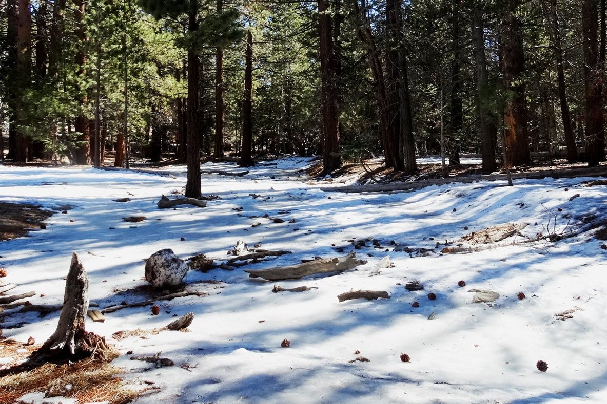
The Palm Springs Aerial Tramway lifts hikers most of the way up San Jacinto Peak; Hipcamp says the ride shaves off about 6,000 vertical feet. From the tram’s Mountain Station, a trail leads through Long Valley to Round Valley, a high meadow with a backcountry campground about 2 miles in. Many backpackers camp there and climb to the 10,804-foot summit the next morning. Bewilder calls San Jacinto the second-highest mountain in Southern California.
Camping is allowed only in designated campgrounds, and a permit is required.
The hike
The Forest Service calls the route from the tram the easiest and most popular way to the peak: 6 miles one way with about 2,318 feet of elevation change, rated strenuous. It says that after leaving the tram, you descend into Long Valley and self-register for a wilderness permit at the Mount San Jacinto State Park ranger station. Past the station, the trail traverses the tree-covered flanks of Long Valley Creek to the broad, grassy meadow of Round Valley.
AllTrails describes the tram ride as lifting you straight into the heart of Mount San Jacinto State Park. Abroad With God notes that taking the tram cuts out a lot of leg work and calls the roughly 2.1-mile walk to Round Valley an excellent beginner backpacking route.
The Palm Springs Aerial Tramway lists six primitive campgrounds in the state park and wilderness and says you must camp in a designated one. Round Valley, at 9,100 feet and 2.5 miles from the tram, is the closest, with 22 campsites, water, and pit toilets. Tamarack Valley, at 9,200 feet and 3 miles, has 8 campsites, water, and pit toilets. Little Round Valley, at 9,700 feet and 7 miles, has 6 campsites and a limited water supply. Strawberry Junction, at 8,000 feet, has no water.
From Round Valley, the Forest Service says to follow the clearly signed trail to the peak. Bewilder describes the area as having 54 miles of hiking trails and prominent peaks, and lists May to June and September to October as ideal times. The Dyrt notes campers often use Round Valley as a staging camp before summiting.
There are other ways up. Abroad With God hiked from a trailhead on the Idyllwild side, about 6.5 miles and 3,200 feet of gain to Round Valley, before stashing packs and day-hiking to the summit. An AllTrails reviewer in May 2026 backpacked the Marion Mountain route to the peak. The Dyrt’s reviewer on Little Round Valley calls it the best way to backpack San Jacinto via the Marion Mountain Trail.
The tramway’s list also includes two more remote camping zones, Skunk Cabbage and Lower Basin, both reopened in December 2020. Outdoorithm notes that the tram’s steep walkway at the top may be hard for some visitors, and Bewilder calls the tramway one of the largest and longest single-lift passenger tramways in the world.
The rules are straightforward. The Forest Service says dogs are prohibited in the State Park Wilderness. Bewilder says open campfires aren’t allowed but gas stoves are fine.
A Hipcamp reviewer appreciated how the tram helped them escape the heat of Palm Springs below.
For another Southern California backpacking trip, see the Trans-Catalina Trail.
Tips
- Get your camping permit first. The Forest Service recommends reservations in spring and summer.
- Camp only in designated campgrounds. The tramway says camping elsewhere isn’t allowed.
- Check water at your campground. Round Valley and Tamarack have water; Little Round Valley’s is limited; Strawberry Junction has none.
- Leave dogs at home. They’re prohibited in the State Park Wilderness.
- Bring a stove. Open campfires aren’t allowed.
Camping
Camping in the Mount San Jacinto State Wilderness requires a permit and is allowed only in designated campgrounds. The Palm Springs Aerial Tramway lists Round Valley (22 sites, water, pit toilets) and Tamarack Valley (8 sites, water, pit toilets) as the closest to the tram, with Little Round Valley and Strawberry Junction farther out. The Forest Service says to get a camping permit before leaving the Long Valley ranger station. Other sources describe applying by mail in advance, so confirm the current process with the state park.
Inside Intel: Abroad With God found Round Valley and Tamarack Valley the best choices for a tram-based trip, and a Hipcamp listing notes Tamarack is just up the hill if Round Valley is full. Hipcamp describes Round Valley’s sites with smooth-faced boulders to picnic on. For a higher camp closer to the summit, Little Round Valley is the option, though the tramway says its water supply is limited.
Trail facts
- Distance: About 2 to 2.5 miles from the tram to Round Valley; about 11 miles round trip including the summit
- Route type: Out and back (or loop), with an overnight at Round Valley
- Difficulty: Moderate to strenuous
- Elevation: Round Valley about 9,100 feet; San Jacinto Peak 10,804 feet
- Campsites: Designated wilderness campgrounds only (Round Valley, Tamarack Valley, Little Round Valley, Strawberry Junction, and others)
- Water: At Round Valley and Tamarack Valley; limited at Little Round Valley; none at Strawberry Junction
- Permits: Wilderness camping permit required
- Fires: Open campfires not allowed; gas stoves OK
- Dogs: Prohibited in the State Park Wilderness
- Trailhead: Palm Springs Aerial Tramway Mountain Station, Long Valley
- Last verified: October 2, 2026
Where this comes from
This page draws on the sources below, along with other guides and trip reports. Links go to the original pages.
- U.S. Forest Service: Tramway to San Jacinto Peak
- Palm Springs Aerial Tramway: Camping
- AllTrails: Mount San Jacinto State Park camping trails
- Abroad With God: Backpacking San Jacinto
- Bewilder: Mount San Jacinto State Park
- The Dyrt: Round Valley Campsite
- Outdoorithm: Round Valley Campground
- Hipcamp: Mount San Jacinto State Park camping
Before you go: This page is based on published trail guides, trip reports, and reviews, along with official park and agency information where we could find it. It’s meant to help backpackers discover new trails, not to replace current, official information. Conditions, closures, permits, campsites, and water sources change, and some details here may be out of date or wrong. Confirm everything with the managing agency and check current conditions before you head out, and don’t rely on this page alone for safety or navigation. Backcountry travel involves risk.