
Trails / California / Northern California
Sky High Lakes Loop from Lovers Camp (Marble Mountain Wilderness)
Marble Mountain Wilderness, Klamath National Forest (Lovers Camp, near Fort Jones)
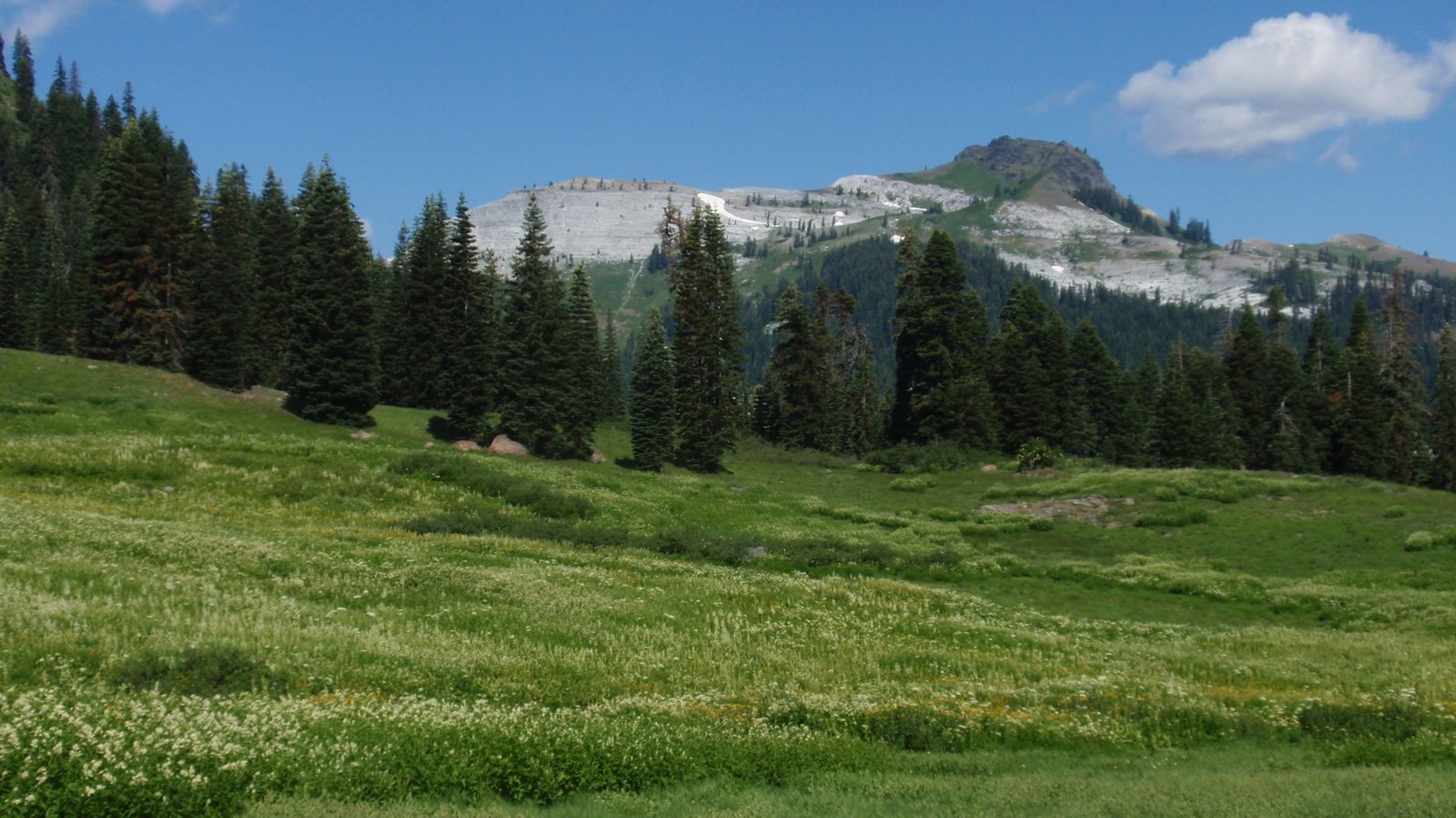
The Marble Mountain Wilderness covers more than 240,000 acres in far Northern California, and Hiking Project calls the Sky High Valley Trail one of its most popular hikes other than the Pacific Crest Trail. From the Lovers Camp trailhead, a loop of about 15 miles climbs to Marble Valley, passes the Sky High Lakes below the Marble Rim, joins the PCT along the crest, and drops back down the Red Rock Valley Trail. SummitPost calls the area one of the premier wilderness areas in California.
No wilderness permit is required, but you’ll need a California Campfire Permit even to use a stove.
The hike
Lovers Camp is the main trailhead. SummitPost says the road narrows but stays paved to a dead end at the Lovers Camp campground and trailhead. Southern Oregon Outdoors calls it the most popular and user-friendly trailhead, and warns that it’s packed on weekends and good campsites fill quickly. Outdoor Project lists the trailhead elevation at about 4,300 feet.
The Pacific Crest Trail Association describes the loop. From the trail register kiosk, after about half a mile, the Red Rock Valley Trail forks left; stay right. At 3.7 miles, a right fork leads to the Marble Valley Guard Station, which the PCTA says is the way to side trips to Marble Mountain, Black Mountain, The Castle, Big Elk Lake, or Paradise Lake. The loop follows the left fork, which becomes the Sky High Valley Trail.
The PCTA says you’ll reach Lower Sky High Lake after 5.7 miles, having passed broad meadows full of wildflowers. An Outdoor Project commenter found the trail well maintained but a fairly constant uphill climb, especially the last mile, with steps cut into marble. The same writer took a little over four hours to reach the lakes.
Southern Oregon Outdoors describes the Sky High Lakes as a trio of small emerald pools tucked into a massive bowl of overhanging cliffs, and says anglers report brook and rainbow trout. Hiking Project notes that once the snow melts, little water flows into the lakes, so they’re cool for swimming but not icy.
From the lakes, the PCTA route passes Upper Sky High Lake and Frying Pan Lake before reaching the Pacific Crest Trail at 7.5 miles. Hiking Project says the trail climbs about 650 feet from Frying Pan Lake to reach the PCT on the Marble Mountain Rim. The loop follows the PCT to the Red Rock Valley Trail junction at 9.4 miles, then descends Red Rock Valley, retracing the last mile back to Lovers Camp.
SummitPost says the region was first set aside as a Forest Service primitive area in the 1930s and was in the original class of wilderness areas created by the Wilderness Act of 1964. It says Shadow Lake, perched on cliffs high above the Sky High basin, is another secluded camping option.
Fire is a fact of life here. The San Francisco Chronicle’s Tom Stienstra describes a lightning strike starting a fire on the edge of the wilderness that crews kept from growing. The Klamath National Forest went into fire restrictions on June 18, 2026, because of a record-low snowpack and hot, dry conditions.
For another Northern California wilderness trip, see Canyon Creek Lakes in the Trinity Alps.
Tips
- Get a California Campfire Permit. Sources agree it’s required for any flame, including a backpacking stove.
- Check fire restrictions. The Klamath National Forest’s 2026 restrictions limit campfires to developed recreation sites.
- Arrive early on weekends. Southern Oregon Outdoors says Lovers Camp fills up and good campsites go fast.
- Sign the trailhead register. No wilderness permit is required, but sources describe a register at the trailhead.
- Pace the last mile. The climb to the lakes ends on marble steps.
Camping
Camping is dispersed in the Marble Mountain Wilderness. Hiking Project, Komoot, and other sources say no wilderness permit is required, but a California Campfire Permit is needed for stoves and fires. Under the Klamath National Forest’s 2026 fire restrictions, stoves with shut-off valves are allowed outside developed sites with a campfire permit, in an area cleared of flammable material. SummitPost says camping is available at numerous trailheads, including Lovers Camp.
Inside Intel: Hiking Project says the best camping is at Lower Sky High Lake, with another good spot in the trees beside Frying Pan Lake, a couple hundred yards away. The Outdoor Project commenter found multiple backcountry campsites right next to Lower Sky High Lake. For more solitude, SummitPost suggests Shadow Lake, high above the basin.
Trail facts
- Distance: About 15 miles as a loop
- Route type: Loop (lollipop), using the Canyon Creek, Sky High Valley, PCT, and Red Rock Valley Trails
- Difficulty: Moderate to strenuous. Steady climb to the lakes and the PCT.
- Elevation: Lovers Camp trailhead about 4,300 feet
- Campsites: Dispersed; Lower Sky High Lake, Frying Pan Lake, Shadow Lake
- Water: Lakes and creeks. Treat all water.
- Permits: No wilderness permit required; California Campfire Permit required for stoves and fires
- Fires: Restricted under 2026 Klamath National Forest orders; check current rules
- Trailhead: Lovers Camp, at the end of a paved road near Fort Jones
- Last verified: October 2, 2026
Where this comes from
This page draws on the sources below, along with other guides and trip reports. Links go to the original pages.
- U.S. Forest Service: Klamath National Forest fire restrictions
- Pacific Crest Trail Association: Marble Mountain Wilderness
- Hiking Project: Sky High Valley
- SummitPost: Marble Mountain (Marble Rim)
- Outdoor Project: Sky High Lakes Basin
- Komoot: Hiking in Marble Mountain Wilderness
- San Francisco Chronicle: Marble Mountain
- Southern Oregon Outdoors: Marble Mountain Wilderness
Before you go: This page is based on published trail guides, trip reports, and reviews, along with official park and agency information where we could find it. It’s meant to help backpackers discover new trails, not to replace current, official information. Conditions, closures, permits, campsites, and water sources change, and some details here may be out of date or wrong. Confirm everything with the managing agency and check current conditions before you head out, and don’t rely on this page alone for safety or navigation. Backcountry travel involves risk.