
Trails / California / Sierra Nevada
Little Lakes Valley to Gem Lakes
John Muir Wilderness, Inyo National Forest (Mosquito Flat, end of Rock Creek Road)
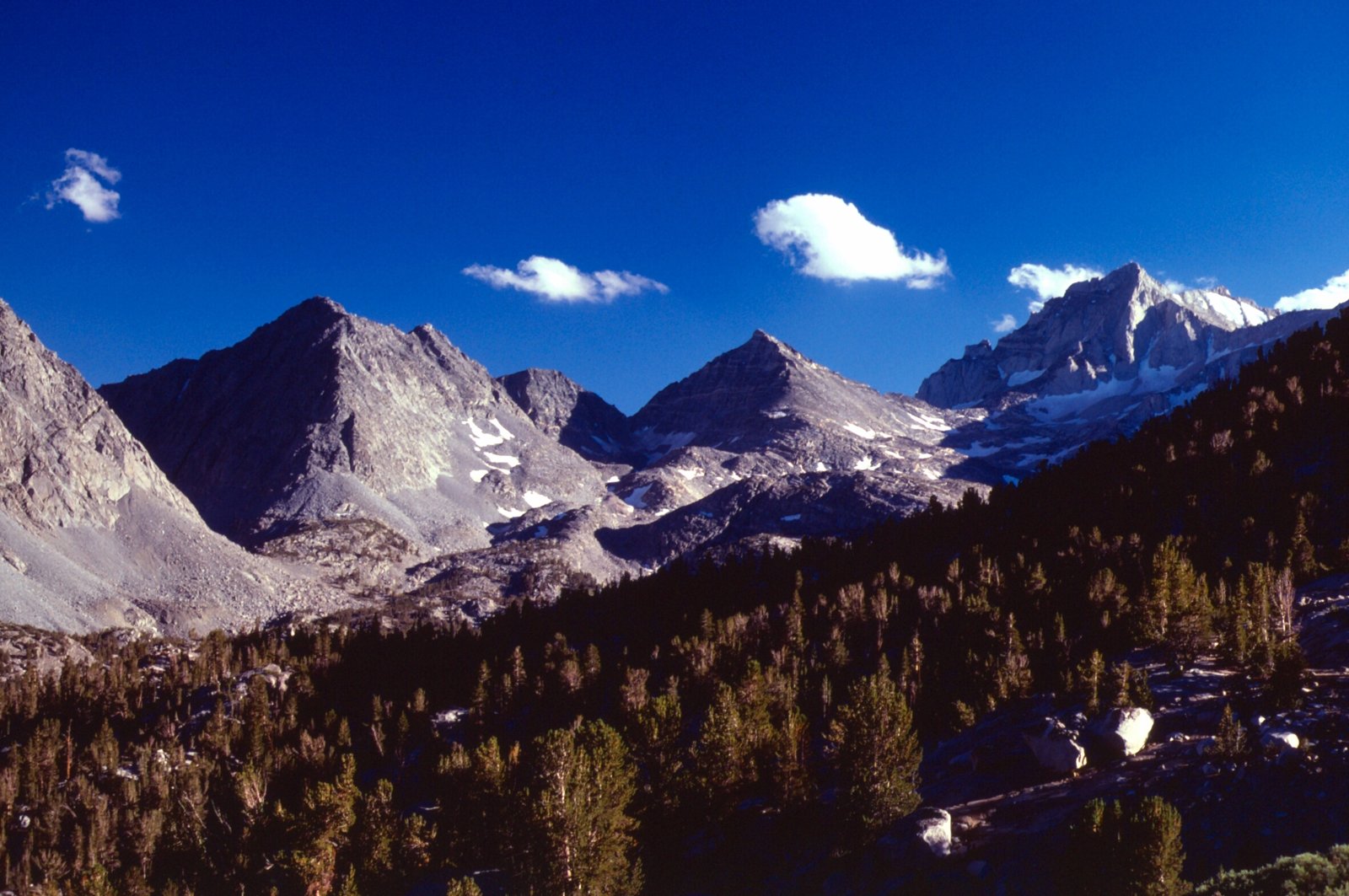
Little Lakes Valley is a high, nearly flat valley in the Eastern Sierra strung with small glacial lakes, beneath a wall of 13,000-foot peaks. The Forest Service says its easy access makes it popular for fishing, day hikes, and beginning backpackers. The trail starts at Mosquito Flat, at about 10,300 feet, which one guide calls the highest trailhead in the Eastern Sierra.
That high start is the catch. The walking is easy, but you’ll feel the altitude.
The hike
Rock Creek Road climbs from Tom’s Place on U.S. 395. SummitPost describes Bear Creek Spire, Mount Dade, and Mount Abbot, all high thirteeners, coming into view beyond Rock Creek Lake, a couple of miles before the Mosquito Flat trailhead parking. Modern Hiker puts the trailhead about 10.5 miles from Tom’s Place and warns the lot can fill quickly on weekends and during fall color season.
The Forest Service describes the valley as a glacier-carved chain of lakes, large and small, with wildflowers blooming beneath the spectacular 13,000-foot peaks of Bear Creek Spire, Mount Dade, Mount Abbot, and Mount Mills. It notes some evidence of historic mining equipment and an old road bed at Morgan Pass.
Modern Hiker describes the start: past a bathroom and a bridge over Rock Creek, the trail climbs about 250 feet in half a mile along the right bank of the creek, to a signed junction where the Mono Pass Trail goes right and the Morgan Pass Trail goes left. The Forest Service notes that trips toward Mono Pass require a different permit.
From there, the lakes come one after another. Modern Hiker names Mack Lake first, then Heart Lake about 0.7 mile later, and lists Chickenfoot Lake, Hidden Lakes, Long Lake, Box Lake, and Marsh Lake along the valley. SummitPost says that within 30 minutes of easy hiking you reach the first of several alpine lakes, and that because most of them have excellent campsite areas, they’re ideal for beginning backpackers and families with small children.
Gem Lakes are a common overnight destination near the head of the valley. A Recreation.gov itinerary, summarized by Outdoor Status, lists Gem Lakes at 3.6 miles and about 800 feet of gain. Backcountry Emily suggests side trips of about half a mile each to Chickenfoot Lake and Morgan Pass. Modern Hiker says elevation gain stays minimal until you approach Chickenfoot Lake, and even there the climbing is reasonable.
The Forest Service lists Long Lake, Chickenfoot Lake, Gem Lakes, and Treasure Lakes as common destinations. It adds that the abandoned mine road between Morgan Lakes and Pine Creek is impassable because of an unstable hillside, so you must exit via Mosquito Flat.
Derek McCoy picked up his permit and rented a bear canister in Bishop, and says bears are rarely spotted in the valley but do occasionally roam it. Follow Tiff’s Journey mentions a backpackers’ campground at the trailhead for the night before.
Derek McCoy recommends hiking all the way to Gem Lakes if you’re staying overnight. He also suggests bringing insect repellent in summer. SummitPost notes that Mosquito Flat didn’t get its name for nothing.
For a longer Eastern Sierra trip, see Big Pine Lakes.
Tips
- Reserve early. No Back Home says permits often sell out within seconds for popular weekends.
- Use a bear canister. The Forest Service requires bear-proof containers for food, trash, and scented items.
- No campfires. The Forest Service bans them anywhere in the valley.
- Bring bug spray. Mosquitoes can be thick in summer.
- Watch the altitude. You start above 10,000 feet.
Camping
A wilderness permit is required year-round for overnight trips, and the Forest Service says a quota limits visitors to 25 people per day from May 1 through November 1. Campfires are banned anywhere in the valley, groups are limited to 15, and food, trash, and scented items must be stored in bear-proof containers. Backcountry Emily says you’ll also need a California Campfire Permit to use a stove.
Inside Intel: Gem Lakes is the overnight pick. Derek McCoy recommends going all the way there if you’re staying overnight, and Forever She Wanders camped at Gem Lakes and spent the rest of the day hanging out. SummitPost points out that most of the lakes have good camping areas, which makes the valley an easy first backpacking trip for families.
Trail facts
- Distance: About 7.2 miles round trip to Gem Lakes
- Route type: Out and back
- Difficulty: Easy to moderate; high altitude
- Elevation: Trailhead about 10,200 to 10,300 feet; about 800 feet of gain to Gem Lakes
- Campsites: Dispersed at the lakes
- Water: Lakes and creeks. Treat all water.
- Permits: Required year-round for overnight trips; quota of 25 per day, May 1 to November 1
- Bear and food storage: Bear-proof containers required
- Fires: Prohibited in the valley
- Group size: 15 maximum
- Trailhead: Mosquito Flat, end of Rock Creek Road, about 10.5 miles from Tom’s Place
- Last verified: October 2, 2026
Where this comes from
This page draws on the sources below, along with other guides and trip reports. Links go to the original pages.
- U.S. Forest Service: Little Lakes Valley Trail
- U.S. Forest Service: Inyo National Forest Wilderness Regulations
- SummitPost: Little Lakes Valley
- Modern Hiker: Hiking Little Lakes Valley
- Backcountry Emily: Backpack to Little Lakes Valley
- Outdoor Status: Little Lakes Valley to Gem Lakes
- Derek McCoy: Backpacking Little Lakes Valley
- Follow Tiff’s Journey: Little Lakes Valley to Gem Lakes
- No Back Home: Little Lakes Valley
Before you go: This page is based on published trail guides, trip reports, and reviews, along with official park and agency information where we could find it. It’s meant to help backpackers discover new trails, not to replace current, official information. Conditions, closures, permits, campsites, and water sources change, and some details here may be out of date or wrong. Confirm everything with the managing agency and check current conditions before you head out, and don’t rely on this page alone for safety or navigation. Backcountry travel involves risk.