
Trails / California / Northern California
Butte Lake, Snag Lake, and Cinder Cone Loop (Lassen Volcanic)
Lassen Volcanic National Park, National Park Service (Butte Lake, northeast corner of the park)
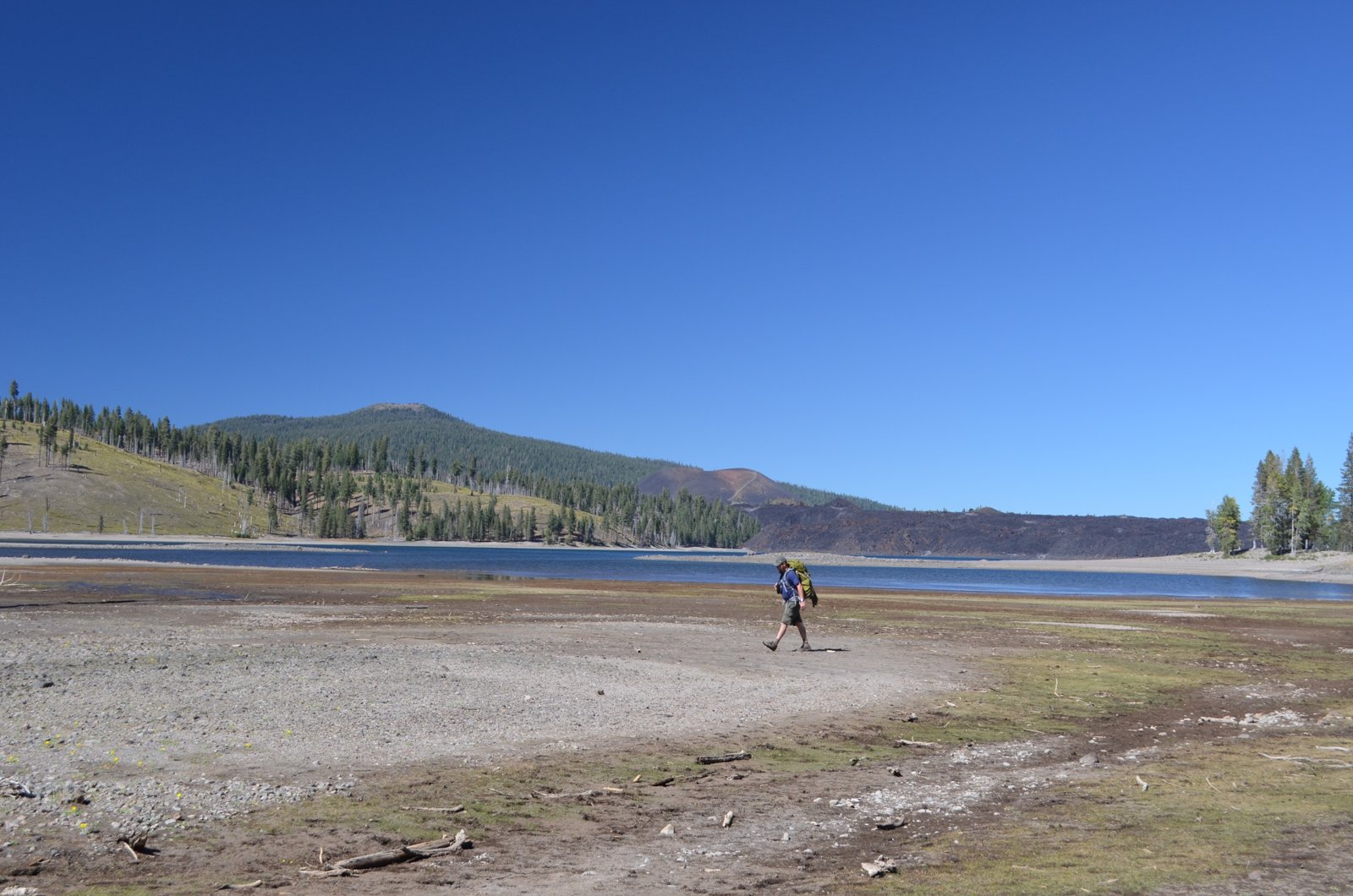
This loop circles the two largest lakes in Lassen Volcanic National Park and climbs a near-perfect volcanic cone between them. From Butte Lake in the park’s northeast corner, it passes the Fantastic Lava Beds, reaches the shore of Snag Lake for a night of camping, and returns over Cinder Cone, with views of the colorful Painted Dunes below. AllTrails calls it a great overnight backpacking trip.
The only real climb is Cinder Cone itself, about 800 feet of loose cinders, and you can walk around it if you prefer.
The hike
The trip starts at Butte Lake. The Trailmaster’s directions: from Highway 44, 11 miles east of its junction with Highway 89, turn south at the signed road to Butte Lake and drive 6 miles on graded dirt to the campground, then park at the signed trailhead near the north shore. A TripAdvisor reviewer found the dirt road passable in a normal passenger car at slow speed. A nationalparkcam.com summary says Butte Lake Campground has 101 sites at about 6,100 feet.
The NPS says the trail past Cinder Cone to Snag Lake crosses sand-like cinders, and that the shore of Snag Lake offers numerous places to camp. It also calls the area a good base for day trips to Juniper Lake or Rainbow Lake.
The geology is the star. Komoot explains that the Painted Dunes formed during an earlier eruptive phase of Cinder Cone, and that the Fantastic Lava Beds came from basalt flows erupting from the cone’s base in a later phase ending in 1666, which dammed creeks to create Snag Lake and Butte Lake. A TripAdvisor reviewer described the lava flow faces as dramatic, 50 to 80 feet high.
The Somehowlost trip report describes going the other way around: an easy 2-mile stroll around Butte Lake with views of Mount Lassen and Cinder Cone, then 3 miles through aspen forest to Snag Lake, then about 2 miles along the west side of Snag Lake to the Fantastic Lava Beds at its north end. From there, the report says, you can see both lakes, the full extent of the lava beds, and the Painted Dunes. The last 3 miles drop down the north side of the cone back to Butte Lake.
Cinder Cone is steep. AllTrails calls the climb up its backside the most strenuous part of the trip, about 800 feet. Komoot describes loose volcanic scree that makes footing difficult. Gregable notes that the climb is optional and you can easily walk around the base instead. The Trailmaster says views from the top stretch to Lassen Peak.
Komoot notes a gentler alternative: the historic Nobles Emigrant Trail follows the edge of the Fantastic Lava Beds and skirts Snag Lake on flatter ground.
AllTrails reviewers recommend Snag Lake and Butte Lake for summer swimming, and one backpacked out to Rainbow Lake. AllTrails lists longer variations, including a 20.7-mile loop adding the Cluster Lakes and a 25.5-mile loop past Rainbow Lake and the Twin Lakes.
Somehowlost lists the high point at about 6,900 feet and recommends late June through October.
For another Northern California backpacking trip, see Canyon Creek Lakes in the Trinity Alps.
Tips
- Get a wilderness permit. One permit guide says Lassen has no quota but requires online reservations.
- Bring a bear-resistant container. The NPS requires one for food and scented items.
- Take your time on Cinder Cone. The loose scree is steep; skip it if you’d rather walk around.
- Carry water between lakes. Water is mainly at Snag Lake, Grassy Creek, and Butte Lake.
- Expect mosquitoes in places. Gregable ran into them at a few spots.
Camping
A wilderness permit is required for backcountry camping in Lassen Volcanic National Park, and the NPS organizes the backcountry into zones, including Zone 22 for Snag Lake. Backcountry campers must use an approved bear-resistant container. Butte Lake Campground, at the trailhead, is the developed option the night before.
Inside Intel: Snag Lake’s western shore is the shade-seeker’s pick. Gregable notes that the western edge of Snag Lake has lots of shade for camping, while the eastern side is more shaded along the trail but has fewer standout features. An AllTrails reviewer says there are a handful of camping spots along both Snag Lake and Butte Lake, and that Rainbow Lake is a great place to camp on a longer loop.
Trail facts
- Distance: About 12.3 to 14 miles as a loop
- Route type: Loop
- Difficulty: Moderate to strenuous. About 1,700 to 2,100 feet of gain; steep scree on Cinder Cone.
- Elevation: Butte Lake about 6,100 feet; high point about 6,900 feet
- Campsites: Backcountry camping along Snag Lake (Zone 22) and other zones
- Water: Snag Lake, Grassy Creek, and Butte Lake. Treat all water.
- Permits: Wilderness permit required (no quota)
- Bear and food storage: Approved bear-resistant container required
- Trailhead: Butte Lake (Cinder Cone Trailhead), 6 miles of dirt road off Highway 44
- Season: Late June through October
- Last verified: October 2, 2026
Where this comes from
This page draws on the sources below, along with other guides and trip reports. Links go to the original pages.
- National Park Service: Lassen Backcountry Camping
- AllTrails: Butte Lake, Snag Lake and Cinder Cone Loop
- Komoot: Cinder Cone and Snag Lake Loop
- Komoot: Cinder Cone
- The Trailmaster: Cinder Cone and Fantastic Lava Beds
- Somehowlost: Butte Lake, Snag Lake, Cinder Cone Loop
- Gregable: Lassen Cinder Cone and Snag Lake
- TripAdvisor: Fantastic Lava Beds review
- National Park Cam: Lassen Volcanic
- Backcountry Emily: California permits 2026
Before you go: This page is based on published trail guides, trip reports, and reviews, along with official park and agency information where we could find it. It’s meant to help backpackers discover new trails, not to replace current, official information. Conditions, closures, permits, campsites, and water sources change, and some details here may be out of date or wrong. Confirm everything with the managing agency and check current conditions before you head out, and don’t rely on this page alone for safety or navigation. Backcountry travel involves risk.