
Trails / Arkansas / Ozark Mountains
Butterfield Hiking Trail (Devil's Den State Park)
Devil's Den State Park and Ozark National Forest (Lee Creek Valley, near West Fork)
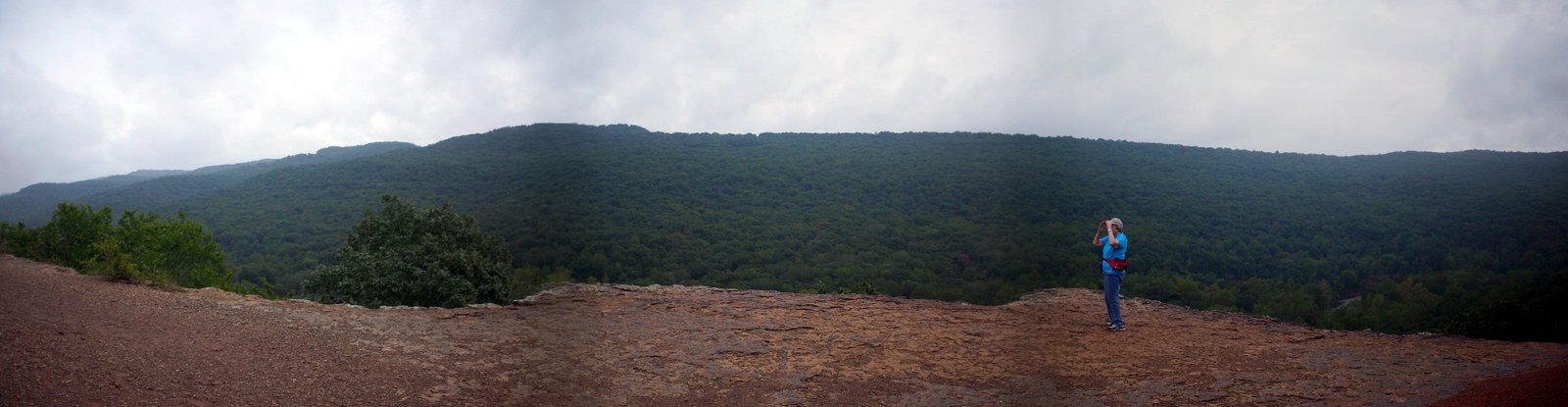
The Butterfield Hiking Trail makes a 15-mile loop from Devil’s Den State Park out into the Ozark National Forest, through the rugged hills and hollows of the Boston Mountains. Explore the Ozarks Online calls it one of the few looped backpacking trails in the state. It’s named for the Butterfield Overland stagecoach, which ran through the area from 1858 to 1861.
You’ll need a free permit from the park visitor center, and you can camp only once you’re outside the state park.
The hike
Devil’s Den is a historic park. The Encyclopedia of Arkansas calls it one of the best-preserved Civilian Conservation Corps park developments in the United States and says it contains the largest sandstone crevice cave area in the country. It says the CCC built the park’s first trails, a stone dam on Lee Creek, and cabins of native stone and logs. Wikipedia describes the park as about 2,200 acres in the Lee Creek Valley. The Encyclopedia of Arkansas says the Boston Mountains are the southernmost, highest, and most severely eroded of the three plateaus that form the Ozarks, and that Lee Creek has cut through sandstone, shale, and limestone here.
The trail itself is mostly national forest. The state park’s trail guide says more than ten miles of the 15-mile loop are in the Ozark National Forest, and that although the trail doesn’t follow the original stage route, it comes within two miles of it. Wikipedia says the loop is marked with blue blazes.
OuachitaMaps describes the route from the Lee Creek trailhead in Campground C. You cross Lee Creek, often wet, follow the blue blazes, and in a quarter mile pass the trail to the park’s walk-in camp, an option if you arrive too late to reach backcountry sites. It describes the trail running along a bench before dropping to Rock Hole Camp at mile 6.3, a well-used site right on the trail by Blackburn Creek that offers little privacy.
Viewpoints break up the climbing. AllTrails lists scenic spots such as Blackburn Creek and Vista Point. Pages of Travel describes Vista Point looking out over Blackburn Valley and Holt Ridge Overlook looking over the Lee Creek Valley. The state park trail guide offers a navigation tip: if you get lost, you never have to cross Blackburn or Lee Creek. Following either downstream will bring you to Junction Camp and the spur trail back up to the Butterfield Trail. Holt Road also runs along the ridge top, and heading north on it leads back toward the park.
Wikipedia notes that the remnants of a settlement called Anna can be seen along the trail near Junction Camp.
Devil’s Den offers more than the Butterfield. Wikipedia describes the 1.5-mile Devil’s Den Self-Guided Trail, a National Recreation Trail passing the Devil’s Den and the Devil’s Icebox, and the 3-mile Yellow Rock Trail to one of the best views in the park. The state park brochure says the park offers backpacking workshops, guided hikes, and backpacking equipment rentals.
Pages of Travel rates the Butterfield as strenuous and estimates about 12 hours of hiking as an overnight trip.
For another Ozark Mountains loop, see the White Rock–Shores Lake Loop.
Tips
- Get your free permit first. The park requires backpackers to register at the visitor center and return the permit when they finish.
- Don’t camp inside the park. Camping and campfires are prohibited along the trail within the state park boundaries.
- Expect a wet start. OuachitaMaps says the Lee Creek crossing near the start is often wet.
- Know the bail-out rule. Following Blackburn or Lee Creek downstream leads to Junction Camp.
- Use the walk-in camp if you’re late. OuachitaMaps points to the park’s walk-in camp near the start.
Camping
The state park’s trail guide says camping is permitted anywhere in the Ozark National Forest as long as the site is 100 feet off the trail and away from water, and that there are designated primitive camping areas along the trail. Other guides name three: Quail Valley, Rock Hole Camp, and Junction Camp. Camping and campfires are prohibited along the trail inside the park. The park also has 146 campsites of various types, plus cabins, according to Wikipedia.
Inside Intel: Junction Camp gets the warmest review. An AllTrails reviewer on their first overnight hiked about 4 miles the first afternoon, camped at Junction Camp, which they called a beautiful campsite by the creek, and finished the remaining 11 miles the next day. OuachitaMaps says Rock Hole Camp is well used but sits right on the trail with little privacy. If you push hard on day two, another reviewer notes, you can reach the walk-in camp at Fossil Flats or the main camping area at Lee Creek.
Trail facts
- Distance: About 15 miles
- Route type: Loop
- Difficulty: Strenuous (Pages of Travel)
- Elevation: About 2,000 feet of gain (Great Minds Think Hike)
- Campsites: Designated primitive areas (Quail Valley, Rock Hole Camp, Junction Camp) and dispersed sites in the national forest
- Water: Blackburn and Lee Creeks. Treat all water.
- Permits: Free permit required from the Devil’s Den visitor center
- Fires: Not allowed along the trail inside the state park
- Trailheads: Lee Creek (Campground C), Highway 74 above the visitor center, and the picnic area south of the visitor center
- Last verified: September 30, 2026
Where this comes from
This page draws on the sources below, along with other guides and trip reports. Links go to the original pages.
- Arkansas State Parks: Devil’s Den State Park brochure (PDF)
- Arkansas State Parks: Butterfield Hiking Trail guide (PDF)
- Encyclopedia of Arkansas: Devil’s Den State Park
- Wikipedia: Devil’s Den State Park
- OuachitaMaps: Butterfield Trail at Devil’s Den
- AllTrails: Butterfield Hiking Trail
- Pages of Travel: Camping and hiking at Devil’s Den
- Explore the Ozarks Online: Devil’s Den trails
Before you go: This page is based on published trail guides, trip reports, and reviews, along with official park and agency information where we could find it. It’s meant to help backpackers discover new trails, not to replace current, official information. Conditions, closures, permits, campsites, and water sources change, and some details here may be out of date or wrong. Confirm everything with the managing agency and check current conditions before you head out, and don’t rely on this page alone for safety or navigation. Backcountry travel involves risk.