
Trails / Arizona / Northern Arizona Canyons
Sycamore Canyon via the Parsons Trail
Sycamore Canyon Wilderness, Coconino National Forest, Red Rock Ranger District (north of Clarkdale)
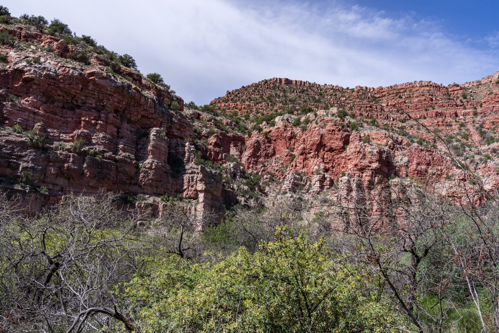
Sycamore Canyon winds more than 20 miles from the pine-covered rim of the Colorado Plateau down to its desert mouth in the Verde Valley, and Wilderness.net calls it one of Arizona’s most dramatic and beautiful canyons. The Parsons Trail follows the lower canyon upstream along a permanent creek to Parsons Spring, where the water rises from a series of large springs between red rock walls.
The catch for backpackers: camping is closed on the lower canyon, so an overnight means going past the spring.
The hike
The Parsons Trailhead is north of Clarkdale. Arizona Highways gives the directions: from Cottonwood, head toward Tuzigoot National Monument, cross the Verde River bridge, and turn onto Forest Road 131, Sycamore Canyon Road. It says a high-clearance vehicle is required. AllTrails notes the road is rugged and lists a seasonal closure alert, so check before driving.
Arizona Leisure says the only real challenge is a stairway-like drop of about 200 feet right from the trailhead down to the canyon floor. After that, the trail is nearly level. Arizona Highways lists elevations between about 3,775 and 3,671 feet and rates the trail easy, at 7.4 miles round trip to the spring.
The trail follows Sycamore Creek upstream through one of the state’s most spectacular riparian areas, according to Arizona Highways. It describes cottonwoods, sycamores, and Arizona walnuts along the creek and notes that the Sycamore Canyon Wilderness is relatively unknown compared with the Red Rock–Secret Mountain Wilderness to the east. Camp Arizona calls Sycamore Canyon the second largest canyon in Arizona. Wilderness.net adds that pinnacles tower above high, colorful cliffs and that the canyon stretches as much as seven miles from rim to rim in places.
The trail crosses the creek several times. Arizona Highways says horses are allowed only to the 3-mile mark, at the third crossing of Sycamore Creek. American Southwest describes the Parsons Trail as a 4-mile route along a permanent stream through dense riparian vegetation to the water’s source at a series of large springs.
Parsons Spring is the usual turnaround for day hikers. Arizona Leisure describes swimming, jumping off boulders, and picnicking there. For backpackers, the key is the camping rule. Wilderness.net says the southern end of the wilderness, from a half mile above Parsons Spring down, is closed to overnight camping. Wikipedia says camping is prohibited downstream of Parson Spring. Confirm the current boundary with the Red Rock Ranger District before you go, and plan to hike past it to camp.
Beyond the spring, year-round water becomes scarce. Wilderness.net warns that year-round water is limited to the lower reaches and that backpackers should always carry ample water when heading up the canyon. American Southwest says the canyon’s other trails, far to the north, are reached only by long unpaved roads through the Kaibab and Coconino forests, so visitation is very light. Wikipedia describes the 2.9-mile Taylor Cabin Trail to a cowboy cabin in the upper canyon, and a trip report describes a roughly 20-mile Taylor Cabin loop with brushy, little-used trails that can be hard to find.
For another northern Arizona creek canyon, see West Clear Creek.
Tips
- Camp beyond the closure. Camping is prohibited on the lower canyon. Confirm the boundary with the Red Rock Ranger District.
- Bring a high-clearance vehicle. Arizona Highways says one is required for Forest Road 131.
- Carry water past the spring. Wilderness.net says year-round water is limited to the lower canyon.
- Go in spring or fall. Arizona Leisure lists April through May and September through November as the best times.
- Wear shoes that can get wet. The trail crosses Sycamore Creek several times.
Camping
Camping is dispersed in the Sycamore Canyon Wilderness but prohibited in the lower canyon near the Parsons Trail. Guides describe the closure as extending from about a half mile above Parsons Spring downstream. Camp Arizona advises camping at least 200 feet from springs and burying human waste 200 feet from springs, and says fire danger is usually high. Mechanized vehicles, including bicycles, are prohibited in the wilderness. Dogs are allowed on a leash, per Arizona Highways.
Inside Intel: We didn’t find camper accounts recommending particular sites above Parsons Spring. The one consistent piece of advice from the guides is logistical: because camping is closed on the lower trail, plan to walk well past the spring, carry enough water for the drier canyon above, and treat the spring itself as a day stop for a swim rather than a campsite.
Trail facts
- Distance: About 7.4 to 8 miles round trip to Parsons Spring; more to reach legal camping beyond it
- Route type: Out and back
- Difficulty: Easy to moderate (steep drop at the start)
- Elevation: About 3,775 to 3,671 feet (Arizona Highways)
- Campsites: Dispersed, only upstream of the camping closure near Parsons Spring
- Water: Sycamore Creek and Parsons Spring; scarce farther up the canyon. Treat all water.
- Permits: None found
- Dogs: On leash (Arizona Highways)
- Trailhead: Parsons Trailhead, Forest Road 131 north of Clarkdale (high clearance required)
- Last verified: September 30, 2026
Where this comes from
This page draws on the sources below, along with other guides and trip reports. Links go to the original pages.
- Wilderness.net: Sycamore Canyon Wilderness
- Wikipedia: Sycamore Canyon Wilderness
- Arizona Highways: Parsons Trail
- Arizona Leisure: Parsons Trail
- American Southwest: Sycamore Canyon
- Camp Arizona: Sycamore Canyon Wilderness trail system
- AllTrails: Parsons Trail
- Away From the Grind: Taylor Cabin loop
Before you go: This page is based on published trail guides, trip reports, and reviews, along with official park and agency information where we could find it. It’s meant to help backpackers discover new trails, not to replace current, official information. Conditions, closures, permits, campsites, and water sources change, and some details here may be out of date or wrong. Confirm everything with the managing agency and check current conditions before you head out, and don’t rely on this page alone for safety or navigation. Backcountry travel involves risk.