
Trails / Arizona / Southern Arizona
Chiricahua Crest Trail (Rustler Park to Chiricahua Peak)
Chiricahua Wilderness, Coronado National Forest, Douglas Ranger District (Rustler Park, southeast Arizona)
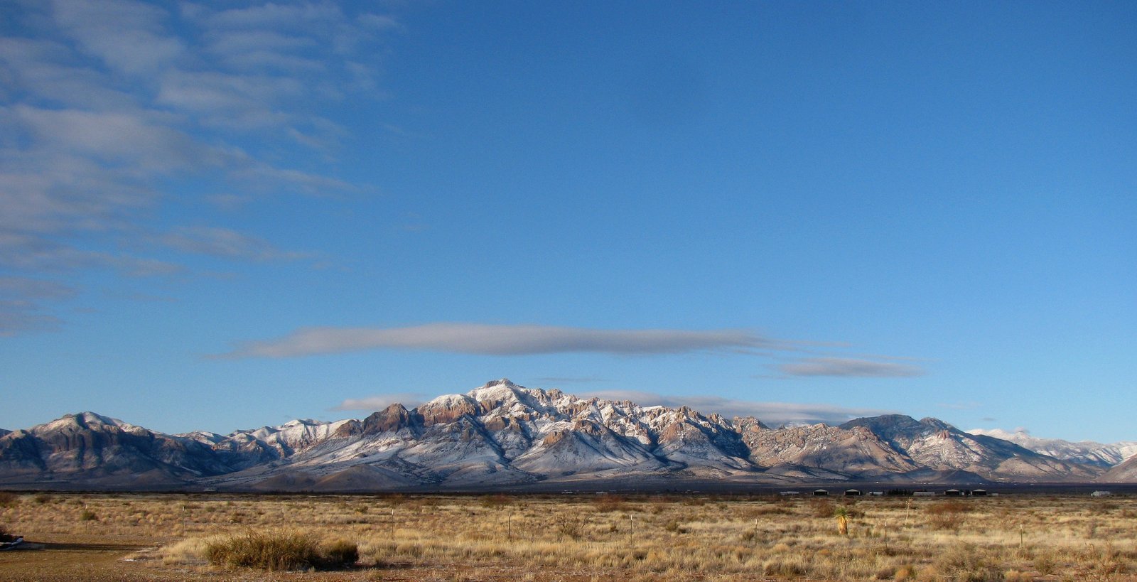
The Chiricahua Crest Trail follows the high spine of the Chiricahua Mountains in southeast Arizona. From Rustler Park at about 8,400 feet, the trail stays in pine and fir forest on a gently rolling ridge, past high meadows and a spring, to Chiricahua Peak, at 9,796 feet the highest point in the range. AllTrails calls it a cool mountain escape from the desert below.
The 2011 Horseshoe 2 Fire burned much of the range, so expect burned forest, deadfall, and changing trail conditions.
The hike
The Forest Service describes the Crest Trail as a system of trails, spurs, and side loops shaped like an upside-down letter Y on the central ridge of the Chiricahuas. Between the wilderness boundary and Monte Vista Peak, it says, the trail reaches diverse forests, wildflower meadows, soaring overlooks, and some of the highest summits in the range, including Flys Peak, Anita Park, and Chiricahua Peak.
Most trips start at Rustler Park Campground. The Forest Service’s directions: from Arizona 181, drive 4 miles toward Chiricahua National Monument, turn south on FR 42, continue up Pinery Canyon 12 miles to FR 42D, and drive about 2.5 miles to the campground. Arizona Handbook calls Rustler Park the highest trailhead in the Chiricahuas and gives the round trip to Chiricahua Peak as 10.5 miles.
The first landmark is the wilderness boundary, about 2.5 miles from the campground. There, the Forest Service says, the Centella Trail heads east from a junction with the Long Park, Crest, and Flys Peak trails. The Flys Peak Trail climbs over that mountain’s 9,666-foot summit, one of the steepest climbs in this part of the range. The Crest Trail skirts around it instead. Outdoor Pilgrim took the Fly Peak detour on the way out and stayed on the Crest Trail around the west side on the way back.
Past Round Park, the trail reaches Anita Park. A HikeArizona trip report puts Anita Park about 4.9 miles from Rustler Park, with the Chiricahua Peak summit trail turnoff about half a mile beyond. It describes Anita Park as beautiful and only slightly affected by the burn, with plenty of tall trees for hanging food and a cooking area with a fire ring. The signed Anita Park Springs trail leads about a quarter mile to a spring with a stone catch basin.
At Junction Saddle, the Crest Trail splits. Outdoor Pilgrim explains the branches: Trail 270A climbs to Chiricahua Peak’s summit, 270B skirts the west side to Monte Vista Peak, and 270C skirts the east side toward Finnicum Peak and Sentinel Peak. AllTrails lists a reviewer who found the summit views obstructed by pines but noted good shade and cooler temperatures.
Fire has shaped the whole range. Arizona Handbook says the 2011 Horseshoe 2 Fire burned nearly the entire range. The HikeArizona report describes a ranger-board notice urging extreme care off the Crest Trail, since only the Crest Trail was regularly maintained, and says side trails in the burn area, such as those to Centella Point and Flys Peak, were nearly blocked by fallen trees. The Chiricahua Trails site tracks trail conditions and lists some spurs in bad condition.
The Forest Service notes the area is part of the vast homeland of the Chiricahua people.
Tips
- Carry water and a filter. The Forest Service says no drinking water is available; natural sources must be purified.
- Stay on the Crest Trail. Side trails in the burn area may be blocked by deadfall.
- Drive carefully. The road to Rustler Park climbs through Pinery Canyon; Arizona Handbook says trailers and RVs over 28 feet aren’t permitted.
- Check fire restrictions. Ask the Coronado National Forest about current restrictions before you go.
- Store food carefully. Rustler Park Campground has bear boxes, and HikeArizona notes plenty of trees for hanging food at Anita Park.
Camping
Camping is dispersed in the Chiricahua Wilderness. Arizona Handbook says no permits are needed for backpacking or hiking. Outdoor Pilgrim says Rustler Park Campground has no potable water and requires food to be stored in bear boxes. Contact the Douglas Ranger District for current conditions and fire restrictions.
Inside Intel: Anita Park is where the HikeArizona writer points backpackers. That writer calls it beautiful and only slightly affected by the fire, with a cooking area, tall trees for hanging food, and a spring a quarter mile down a signed side trail. Arizona Handbook adds that Fly Peak is an easy half-mile side trip from the wilderness boundary, so you can tag it on the way in or out.
Trail facts
- Distance: About 10.5 to 11 miles round trip from Rustler Park to Chiricahua Peak; the full Crest system is much longer
- Route type: Out and back
- Difficulty: Moderate to strenuous
- Elevation: Rustler Park about 8,400 feet; Chiricahua Peak 9,796 feet (Arizona Handbook)
- Campsites: Dispersed; Anita Park is a popular spot
- Water: Anita Spring and other springs, not guaranteed. No potable water. Treat all water.
- Permits: None required (Arizona Handbook)
- Food storage: Bear boxes at Rustler Park; hang food in the backcountry
- Trailhead: Rustler Park Campground, via FR 42 and FR 42D
- Last verified: September 28, 2026
Where this comes from
This page draws on the sources below, along with other guides and trip reports. Links go to the original pages.
- U.S. Forest Service: Crest #270, Wilderness Boundary to Monte Vista
- U.S. Forest Service: Centella #334
- U.S. Forest Service: Chiricahua trails handout (PDF)
- HikeArizona: Chiricahua Peak from Rustler Park
- Arizona Handbook: Chiricahua Mountains
- Outdoor Pilgrim: Chiricahua Peak
- Chiricahua Trails: trail conditions
Before you go: This page is based on published trail guides, trip reports, and reviews, along with official park and agency information where we could find it. It’s meant to help backpackers discover new trails, not to replace current, official information. Conditions, closures, permits, campsites, and water sources change, and some details here may be out of date or wrong. Confirm everything with the managing agency and check current conditions before you head out, and don’t rely on this page alone for safety or navigation. Backcountry travel involves risk.