
Trails / Alaska / Kenai Peninsula
Lost Lake and Primrose Trails
Chugach National Forest, Seward Ranger District (Iditarod National Historic Trail, north of Seward)
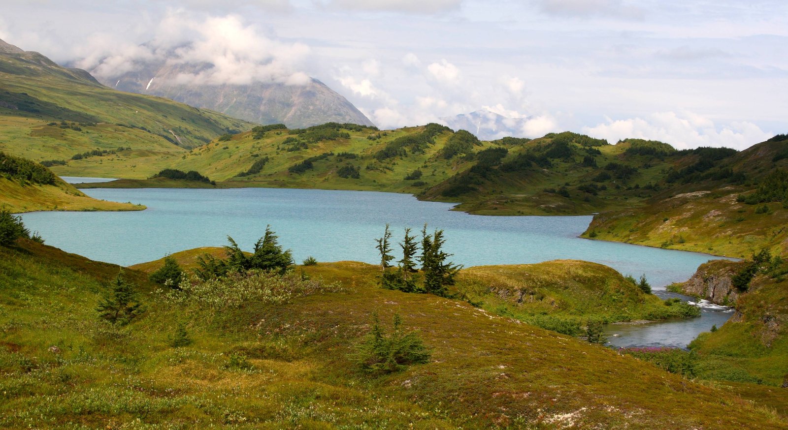
Lost Lake sits in an open alpine basin below Mount Ascension, reached by two segments of the Iditarod National Historic Trail. The Lost Lake Trail climbs from just north of Seward, and the Primrose Trail climbs from Kenai Lake. Linked together, they make a point-to-point trip of about 15 miles with a short shuttle on the Seward Highway.
KMTA calls it a popular trail with buckets of alpine lakes, and one of its author’s favorites for backpacking.
The hike
The Forest Service describes the Lost Lake Trail as 7.3 miles from mile 5 of the Seward Highway to Lost Lake. It climbs gradually through dense spruce forest and emerges after 2 miles onto an open mountainside of meadows and brush with big mountain views. After 4 miles it levels into subalpine wet meadows and hemlock groves, then climbs an alpine ridge that crests after 6 miles. From there it descends and follows rolling alpine terrain around the east side of Lost Lake, where it meets the Primrose Trail. The map sheet adds that salmonberries ripen between miles 3 and 4 in August, and that a 1.4-mile side trail at mile 3.68 leads to the reservable Clemens Cabin.
From the other side, the Primrose Trail runs 7.5 miles from Primrose Campground, a mile off mile 17 of the Seward Highway. The Forest Service describes a gradual 5-mile climb through dense forest to an alpine area of lakes, hills, and panoramic views. Its map sheet says the first 3.4 miles follow a mining road built in 1911 to reach the Primrose mine, and there are steep sections in the first 5 miles. An unmaintained spur at mile 2 leads to a view of Primrose Falls, an active mine and a view of Kenai Lake come at mile 3.7, and the trail breaks out of the trees at mile 5.
The Forest Service says Mount Ascension, at 5,710 feet, forms the west border of Lost Lake. The map sheet calls the trip an excellent multi-day outing for fishing at Lost Lake and enjoying the scenery. It notes that a trail branching off toward Long Lake leads to rainbow trout. Once above timberline, the Lost Lake sheet says, hiking off trail in any direction is possible.
Snow shapes the season. The Forest Service says snow can linger into July in the high country, and the Lost Lake sheet warns of snow above mile 4 into mid-July.
Which way to go? One AllTrails reviewer who carried a heavy pack up from Primrose found the first 3.5 to 4 miles a steady, gradual climb, with the steepest part from about mile 4 to 6, still in the woods. KMTA describes linking the two trails as an elegant point-to-point with a short shuttle. Anchorage Activities notes the Lost Lake Trailhead is about 2 miles north of the Seward city limits.
The Lost Lake Trail sees heavy summer use, the Forest Service says. The American Hiking Society notes that the lower and middle sections include both summer and winter routes, used by hikers, berry pickers, hunters, and snowmachiners in winter.
For more Kenai Peninsula Iditarod Trail hiking, see the Johnson Pass Trail.
Tips
- No campfires in the alpine. The Forest Service asks visitors not to build campfires in the Lost Lake and Primrose areas above mile 4.3 on the Lost Lake side (the Primrose sheet says beyond mile 5.2). Bring a stove.
- Stay off the peninsulas. Camping is closed on the Lost Lake peninsulas to let vegetation recover.
- Camp out of sight. The Forest Service asks backpackers to camp out of sight of the trail and 200 feet from lakes and streams.
- Bring bug spray. AllTrails recommends it in summer.
- Expect snow into July. High sections can hold snow well into summer.
Camping
The Forest Service map sheets list designated campsites at miles 3.68 and 7.3 on the Lost Lake Trail, and at miles 5.4, 6.4, 7, and 7.5 on the Primrose Trail. The American Hiking Society says some are equipped with bear boxes and pit toilets. The Forest Service also says there are many excellent spots for backcountry camping in the alpine area around Lost Lake, as long as you camp out of sight of the trail and 200 feet from water. The Clemens Cabin, off the Lost Lake Trail, is by reservation only. Contact the Seward Ranger District at (907) 288-3178.
Inside Intel: We didn’t find camper accounts recommending one particular site here. What the sources do agree on: the designated sites around the lake (mile 7.3 on the Lost Lake Trail and the upper Primrose miles) put you in the alpine basin, and the Forest Service points to the hills and valleys around Lost Lake for off-trail exploring. Keep off the closed peninsulas.
Trail facts
- Distance: About 14.8 miles point to point; about 14 miles out and back to Lost Lake from either trailhead
- Route type: Point to point with a short shuttle, or out and back
- Difficulty: Moderate to strenuous
- Elevation: About 1,600 to 1,920 feet of gain, depending on the direction (Forest Service)
- Campsites: Designated sites on both trails; dispersed alpine camping away from trails and water; reservable Clemens Cabin
- Water: Lakes and streams. Treat all water.
- Permits: None found for camping; cabin by reservation
- Fires: Not in the alpine areas (see Tips)
- Trailheads: Lost Lake Trailhead, mile 5 Seward Highway; Primrose Trailhead, Primrose Campground off mile 17 Seward Highway
- Last verified: September 28, 2026
Where this comes from
This page draws on the sources below, along with other guides and trip reports. Links go to the original pages.
- U.S. Forest Service: Lost Lake Trail - INHT
- U.S. Forest Service: Primrose Trail - INHT
- U.S. Forest Service: Lost Lake trail map sheet (PDF)
- U.S. Forest Service: Primrose trail map sheet (PDF)
- KMTA National Heritage Area: Trail Maps
- American Hiking Society: Chugach National Forest volunteer vacation
- AllTrails: Lost Lake via Primrose Trail
Before you go: This page is based on published trail guides, trip reports, and reviews, along with official park and agency information where we could find it. It’s meant to help backpackers discover new trails, not to replace current, official information. Conditions, closures, permits, campsites, and water sources change, and some details here may be out of date or wrong. Confirm everything with the managing agency and check current conditions before you head out, and don’t rely on this page alone for safety or navigation. Backcountry travel involves risk.