
Trails / Alaska / Southeast Alaska
Deer Mountain Trail and Shelter
Tongass National Forest (Ketchikan)
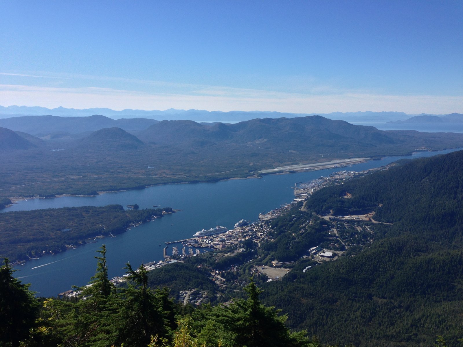
Deer Mountain is the peak that rises right behind downtown Ketchikan. Wikipedia says it dominates the town’s skyline at about 3,001 feet. The Deer Mountain National Recreation Trail climbs it straight from town, gaining about 2,000 feet in the first two miles, and a tiny Forest Service shelter sits near the summit.
Past the shelter, the trail continues as a rugged alpine traverse to the Silvis Lakes, a much more serious trip.
The hike
The Forest Service says the Deer Mountain trailhead is reached by walking or driving half a mile up Ketchikan Lakes Road to the junction with Nordstrom Drive, going straight, and turning right into the trailhead parking. There’s no water or restroom at the trailhead. One guide puts the shelter about 4 miles from downtown Ketchikan on foot.
The Forest Service describes the trail as natural tread with short sections of boardwalk, steep, with many switchbacks, gaining 2,000 feet in the first two miles. It lists heavy use and rates it difficult. Trailhead Traveler says scenic overlooks at the first and second mile points give broad views of the surrounding waterways and islands.
At about 2.5 miles, Trailhead Traveler says, the trail forks. The right fork goes a quarter mile to the Deer Mountain summit. The left fork goes a quarter mile to the Deer Mountain shelter and then continues along the traverse toward Silvis Lakes. AllTrails lists the summit out-and-back at 5.7 miles with about 2,600 feet of gain and calls it a very popular area.
The Dyrt describes the shelter as a small, Forest Service–maintained hike-in shelter with room for two people, a built-in table on the lower level, and a small sleeping loft above. One reviewer calls the three-mile hike up relatively difficult because it’s continuously uphill.
Beyond the shelter, the character of the trail changes. The Forest Service says that from the Deer Mountain shelter to the Blue Lake shelter, the route is marked and some tread exists. Past Blue Lake to John Mountain and Upper Silvis Lake, there are some markers but very little tread. Ketchikan’s visitor trail guide calls the whole route most difficult and warns that it crosses high alpine ridges that can be dangerous because of elevation and poor weather, and that it’s poorly marked approaching Silvis Lakes.
Tongass Teague, a Ketchikan local’s hiking guide, describes the Deer Mountain to Silvis Lakes traverse as a 14-mile one-way route over Deer Mountain and Northbird Peak, skirting John and Mahoney Mountains, ending at the south end of the Tongass Highway. The guide warns that several people have gotten into trouble on the traverse and not to underestimate a route that crosses multiple mountains. It also says off-trail hiking around Ketchikan is very difficult and not recommended for newcomers hiking solo.
Trailhead Traveler notes that how far you go depends on your abilities and how much snow is at the top. Ketchikan’s visitor guide lists the full route at 9.9 miles from town to Lower Silvis Lake.
For another Southeast Alaska overnight, see the Chilkoot Trail (U.S. side).
Tips
- Pace the climb. The Forest Service says the trail gains about 2,000 feet in the first two miles.
- Carry water. There’s no water at the trailhead, per the Forest Service.
- Bring rain gear. Ketchikan’s trail guide warns of poor weather on the alpine ridges.
- Don’t treat the traverse casually. Beyond Blue Lake the Forest Service says there’s very little tread, and a local guide warns several people have gotten into trouble.
- Check snow. Trailhead Traveler says snow at the top can limit how far you can go.
Camping
The Deer Mountain shelter sits about a quarter mile past the summit fork. The Dyrt describes it as free, with space for two. The Forest Service also mentions a Blue Lake shelter farther along the traverse. We didn’t find a Forest Service page confirming shelter reservation rules, so confirm with the Tongass National Forest office in Ketchikan before counting on it. Bring a tent in case it’s occupied, and camp on durable surfaces.
Inside Intel: The shelter is small, so plan for company. The Dyrt describes room for just two people, and AllTrails calls this a very popular area where you’ll likely meet others. The one Dyrt camper review warns that the short hike up is harder than the mileage suggests, because it climbs the whole way. If you’re continuing on the traverse, the Blue Lake shelter is the next stop, but the Forest Service says the trail beyond it has very little tread.
Trail facts
- Distance: About 2.5 to 2.75 miles one way to the shelter; about 5.7 miles round trip for the summit. Traverse to Silvis Lakes about 10 to 14 miles one way.
- Route type: Out and back, or point-to-point traverse
- Difficulty: Strenuous. Steep and continuously uphill.
- Elevation: About 2,000 feet of gain in the first two miles (Forest Service). Deer Mountain about 3,001 feet (Wikipedia).
- Campsites: Deer Mountain shelter (sleeps two); Blue Lake shelter on the traverse
- Water: None at the trailhead. Carry what you need.
- Permits: None found
- Trailheads: Deer Mountain Trailhead off Ketchikan Lakes Road; Silvis Lake trailhead at the end of South Tongass Highway
- Season: June through September (AllTrails)
- Last verified: September 28, 2026
Where this comes from
This page draws on the sources below, along with other guides and trip reports. Links go to the original pages.
- U.S. Forest Service: Deer Mountain Trailhead
- U.S. Forest Service: Deer Mountain Trailhead (activities)
- Wikipedia: Deer Mountain (Alaska)
- Trailhead Traveler: Best Hikes in Tongass National Forest
- Tongass Teague: Intro to Hiking in Ketchikan
- Ketchikan Alaska: Hiking Trails
- The Dyrt: Deer Mountain Shelter
Before you go: This page is based on published trail guides, trip reports, and reviews, along with official park and agency information where we could find it. It’s meant to help backpackers discover new trails, not to replace current, official information. Conditions, closures, permits, campsites, and water sources change, and some details here may be out of date or wrong. Confirm everything with the managing agency and check current conditions before you head out, and don’t rely on this page alone for safety or navigation. Backcountry travel involves risk.