
Trails / Alabama / Cheaha and Talladega
McDill Point via the Pinhoti and Cave Creek Trails
Cheaha Wilderness, Talladega National Forest, Talladega Ranger District (next to Cheaha State Park)
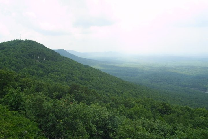
McDill Point is a set of big rock outcrops on the Pinhoti Trail near Cheaha Mountain, Alabama’s highest point. Outbound calls it one of the best overlooks in Alabama and a perfect overnight destination, with primitive campsites near the cliffs for sunset and stars. A loop of about seven miles on the Cave Creek and Pinhoti Trails gets you there and back.
Outbound’s reviewers note it also works as a shorter backpacking trip or a fun day hike.
The hike
The trip starts at the Cheaha Trailhead, which Outbound places at the far end of a parking area just before Cheaha State Park on AL 281. The Forest Service says the Cheaha Wilderness covers 7,245 acres and offers numerous overlooks with panoramic views of east-central Alabama. It notes Cheaha Mountain, in the state park, rises to 2,407 feet.
Both main guides go clockwise, starting on the Cave Creek Trail. A 2014 trip report from Hiking the Appalachians and Beyond describes the Cave Creek Trail passing a campsite in a gap before crossing Cave Creek at 2.1 miles. A gradual climb follows to a junction at 4.7 miles, where a 0.2-mile spur leads to McDill Overlook. Outbound’s version reaches the Pinhoti by way of a connector from the Cave Creek Trail and then heads north.
On the spur, both guides mention remnants of a plane crash beside the trail, next to a campsite. Outbound says to look for blue and white pieces of the plane on the right. The spur then climbs past more campsites and opens onto a large rock outcrop. The 2014 writer called the view from McDill Overlook the most beautiful they had seen in Alabama, looking back to Talladega Mountain and south over the national forest.
Back on the Pinhoti heading north, the same report describes a steep drop and an equally steep, rocky climb to McDill Point, another outcrop with a nice view of the valleys. At 5.6 miles there’s another overlook with views of Cheaha Mountain, and at 5.9 miles the climb to Hernandez Peak begins. An AllTrails listing names more stops on the way back toward the state park, including Pulpit Rock and Bald Rock.
Outbound notes an easier option: hike the loop counterclockwise for a quicker trip to the overlooks, or do it as a shorter out-and-back via Hernandez Peak. AllTrails lists that out-and-back at about 5 miles.
Longer options start from the same area. AllTrails lists a 12.9-mile loop that climbs the Nubbin Creek Trail to the Pinhoti and McDill Point, and an 11.5-mile Cave Creek to Pinhoti loop it describes as less traveled and often done as a multi-day backpacking trip. Hikers on Hammock Forums mention adding the Nubbin Creek and Odum Scout Trails to the Cave Creek loop.
Reviewers mention kids enjoying the plane wreckage and poking around for caves. One camper described waking up to the view as one of the most beautiful they’d seen.
The Pinhoti is Alabama’s long trail. The Forest Service describes it as crossing more than 100 miles of the Talladega National Forest, with an offshoot to the Cheaha Wilderness. For a longer, tougher overnight farther south on the same ridge, see the Pin-Chin-Sky Loop.
Tips
- Carry your water. A camper review says there’s no water at the overlook campsites, and the nearest seasonal stream dries up in warmer months. Cave Creek, about two miles in, is the water source hikers mention on the loop; check that it’s flowing.
- Bring a headlamp. Outbound suggests keeping one on you for sunset or stargazing on the cliffs.
- Choose your camp by wind. The cliff-edge spots have the views but are breezier.
- Watch your step on the rocks. The Pinhoti section includes steep, rocky pitches between the overlooks.
- Expect company on the short route. AllTrails calls the Hernandez Peak and McDill Point route very popular.
Camping
Camping is dispersed in the Cheaha Wilderness. Outbound describes a campsite that comfortably fits three or four tents about 100 yards before the overlook, plus a few spots right at the cliffs big enough for a small tent or hammocks. A review on The Dyrt describes another site just downhill from the overlook on the Pinhoti, on a slight incline, with no water and a fire pit built by earlier visitors. We found no permit requirement for camping in the Cheaha Wilderness; confirm with the Talladega Ranger District (256-362-2909).
Inside Intel: Outbound’s pick is the campsite about 100 yards short of the overlook. It’s big enough for three or four tents and close to the cliffs, but sheltered from the wind. The spots right on the cliffs have better views but get breezier. Skip the sloped site below the overlook on the Pinhoti unless the others are full; one reviewer found the incline made sleeping and setting up awkward.
Trail facts
- Distance: About 7 miles as a loop; about 5 miles out and back via Hernandez Peak
- Route type: Loop, or out and back
- Difficulty: Moderate, with rocky climbs on the Pinhoti
- Elevation: Outbound lists about 1,024 feet of gain for the loop.
- Campsites: Dispersed. Several near McDill Overlook; one below it on the Pinhoti.
- Water: None at the overlook camps. Cave Creek is about two miles in. Treat all water.
- Permits: None found. Confirm with the Talladega Ranger District.
- Trailhead: Cheaha Trailhead, just before Cheaha State Park on AL 281
- Last verified: September 28, 2026
Where this comes from
This page draws on the sources below, along with other guides and trip reports. Links go to the original pages.
- U.S. Forest Service: National Forests in Alabama wilderness
- U.S. Forest Service: Talladega National Forest handout (PDF)
- Outbound: McDill Point via Cheaha Trailhead
- Hiking the Appalachians and Beyond: Cave Creek–Pinhoti Trail Loop
- The Dyrt: McDill Point Backcountry
- The Dyrt: Pinhoti Trail Backcountry after passing McDill Point
- AllTrails: McDill Point area trails
- AllTrails: Hernandez Peak and McDill Point via Pinhoti Trail
Before you go: This page is based on published trail guides, trip reports, and reviews, along with official park and agency information where we could find it. It’s meant to help backpackers discover new trails, not to replace current, official information. Conditions, closures, permits, campsites, and water sources change, and some details here may be out of date or wrong. Confirm everything with the managing agency and check current conditions before you head out, and don’t rely on this page alone for safety or navigation. Backcountry travel involves risk.