
Trails / Florida / Florida Panhandle
Florida Trail through St. Marks National Wildlife Refuge
St. Marks National Wildlife Refuge, U.S. Fish and Wildlife Service (Wakulla, Jefferson, and Taylor Counties, south of Tallahassee)
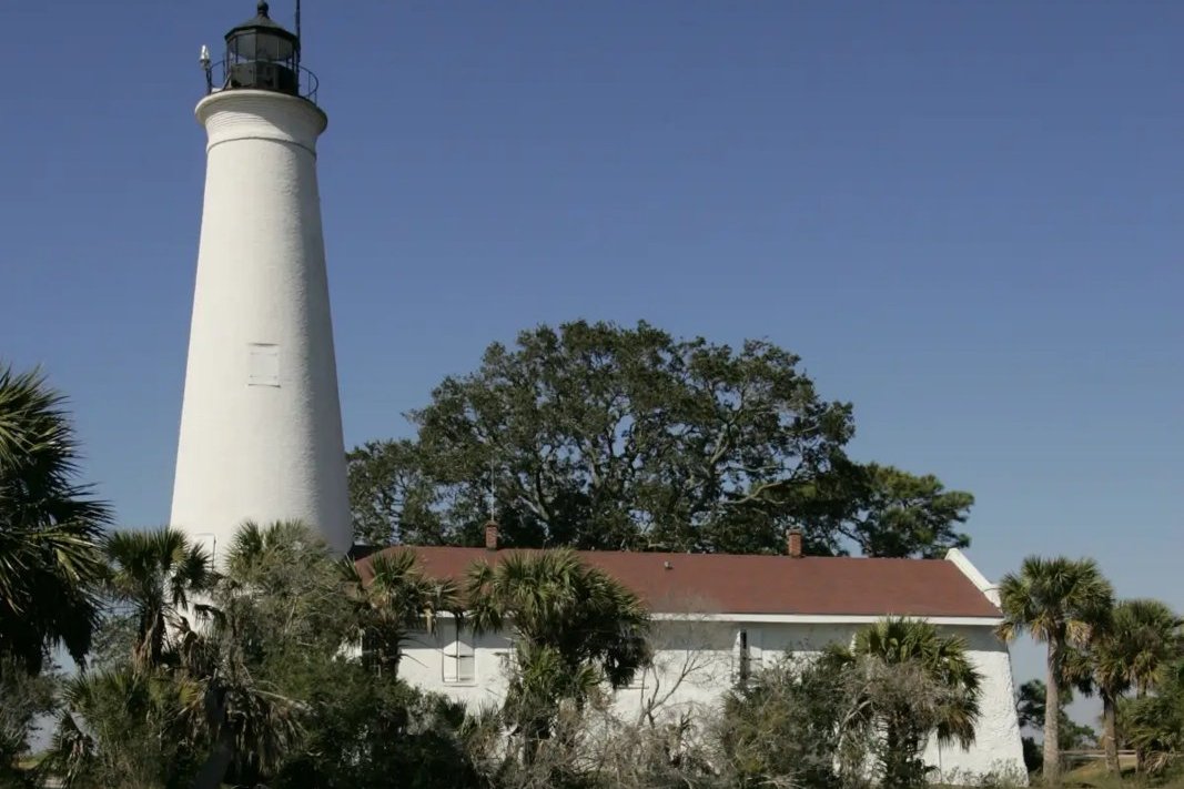
The Florida Trail crosses St. Marks National Wildlife Refuge from west to east along Florida’s Big Bend coast, south of Tallahassee. Florida Hikes and the Florida Trail Association say it’s the only backpacking experience in a National Wildlife Refuge in America, and the refuge allows it only for hikers crossing its full length. The route mixes forest, palm hammocks, old railroad grades, and long levees out into the open marshes of Apalachee Bay.
You’ll need a permit in advance, a plan for the St. Marks River crossing, and a lot of bug spray.
The hike
The U.S. Fish and Wildlife Service calls the refuge’s section of the Florida Trail about 56 miles long. It says the refuge was established in 1931 to provide winter habitat for migratory birds, making it one of the oldest in the National Wildlife Refuge System, and that it covers more than 86,000 acres. The Apalachee Chapter of the Florida Trail Association says this section was among the first designated as a National Scenic Trail, in 1981, and that it crosses a greater variety of forest types and wildlife zones than any other north Florida section.
The Apalachee Chapter describes the route. For about 15 miles, the trail follows refuge roads closed to vehicles, which makes for easy hiking. Between Wakulla Beach Road and Spring Creek Highway, it passes through an area known as the Cathedral of Palms, with a short side trail to Shepherd Spring. The trail also passes through two federally designated wilderness areas, one along the west side of the Aucilla River and one along the east side of the St. Marks River, where it follows an old railroad bed north from Port Leon. Recreation.gov says the St. Marks Wilderness was designated in 1975 and covers about 17,350 acres.
The St. Marks River is the main obstacle. The Apalachee Chapter describes it as deep and broad, and Florida Hikes says the refuge can assist Florida Trail hikers with the crossing. Call the refuge to arrange it.
East of the river, the trail heads out onto the levees of Apalachee Bay. Florida Hikes describes the levee leading into the wide-open spaces of the Big Bend, with spectacular views between the Ring Dike campsite and Lighthouse Road. It says the Ring Dike Campsite has the most outstanding views of any campsite on the Florida Trail but no fresh water. Florida DEP’s paddling guide notes that the Ring Dike campsite is about a mile up Deep Creek and is set apart from the open marsh by a ring of large live oaks.
The campsites have basic facilities. Florida Hikes says each offers benches and a fire ring, and warns of intense mosquitoes or gnats at the Pinhook River, Ring Dike, and Marsh Point campsites, which sit right along the estuary.
The permit process is strict. The FWS says only backpackers hiking all the way through the refuge may camp, by permit only, and asks hikers to notify the refuge office if plans change. Its permit page says the permit lets staff know where hikers are in case of emergencies or prescribed burns. The FTA warns that failing to get a permit could jeopardize the arrangement for future hikers.
For another Panhandle trip, see Torreya State Park.
Tips
- Get your permit at least two weeks ahead. Florida DEP’s paddling guide recommends it, and the FTA says it must be in hand before you enter.
- Arrange the St. Marks River crossing. Call the refuge at 850-925-6121.
- Plan to hike the whole refuge. Camping is only for full through-hikers.
- Carry water to Ring Dike. Florida Hikes says it has no fresh water.
- Bring serious bug protection. Estuary campsites are known for mosquitoes and gnats.
Camping
The FWS says camping in the refuge is by permit only and only for backpackers hiking all the way through its section of the Florida Trail. The FTA says a small fee applies per campsite. Camping is only at designated campsites, which Florida Hikes says have benches and a fire ring. Day hikers can’t camp.
Inside Intel: Ring Dike is the campsite people talk about. Florida Hikes calls its views the most outstanding of any campsite on the Florida Trail and recommends stopping at its bench for the view. It sits on the estuary’s edge with no fresh water, so carry what you need, and expect mosquitoes or gnats.
Trail facts
- Distance: About 56 miles across the refuge (FWS); other sources give 41 to 47.4
- Route type: Point to point
- Difficulty: Moderate to strenuous. Long levee walks; a major river crossing.
- Campsites: Designated campsites, including Pinhook River, Ring Dike, and Marsh Point
- Water: Limited on the coast; none at Ring Dike. Treat all water.
- Permits: Written overnight permit required before entering; only for full refuge through-hikers
- Hazards: St. Marks River crossing; insects; prescribed burns
- Trailheads: Carraway Cutoff (west), Wakulla Beach Road, and the refuge Visitor Center on Lighthouse Road
- Last verified: October 2, 2026
Where this comes from
This page draws on the sources below, along with other guides and trip reports. Links go to the original pages.
- U.S. Fish and Wildlife Service: St. Marks NWR Florida Trail information (PDF)
- U.S. Fish and Wildlife Service: Florida Trail Permit, St. Marks NWR
- Recreation.gov: St. Marks Wilderness
- Florida Trail Association: Permits
- Apalachee Chapter, FTA: St. Marks NWR
- Florida Hikes: St. Marks National Wildlife Refuge
- Florida Hikes: Florida Trail, Apalachee Bay
- Florida DEP: Big Bend paddling trail, Segment 5 (PDF)
Before you go: This page is based on published trail guides, trip reports, and reviews, along with official park and agency information where we could find it. It’s meant to help backpackers discover new trails, not to replace current, official information. Conditions, closures, permits, campsites, and water sources change, and some details here may be out of date or wrong. Confirm everything with the managing agency and check current conditions before you head out, and don’t rely on this page alone for safety or navigation. Backcountry travel involves risk.