
Trails / Arkansas / Ozark Mountains
Ozark Highlands Trail: Hurricane Creek Wilderness (Big Piney to Fairview)
Hurricane Creek Wilderness, Ozark National Forest, Big Piney Ranger District
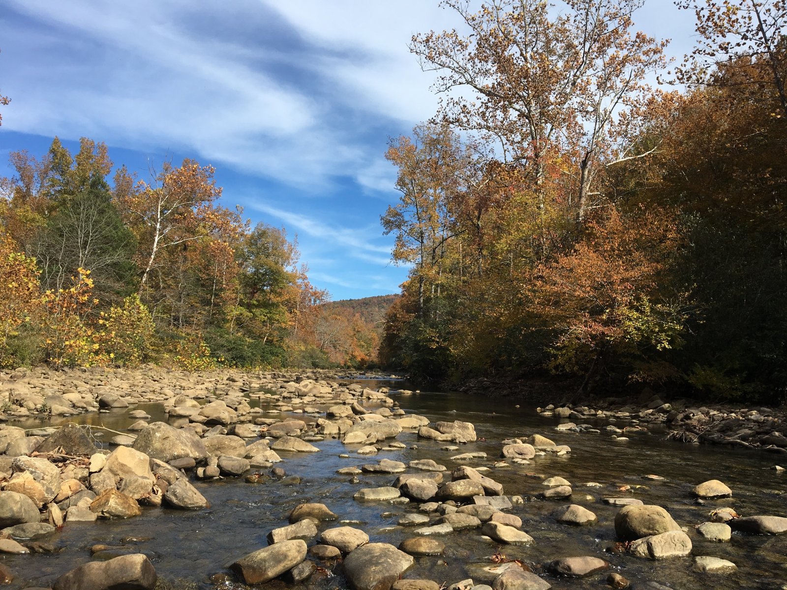
The Hurricane Creek Wilderness section of the Ozark Highlands Trail runs about 20 miles from Big Piney Creek to Fairview Campground, deep in the Boston Mountains. Its highlight is a natural stone bridge that Backpacker describes as an arch rising high above the forest floor. The trail crosses Hurricane Creek twice and passes big campsites along the water.
One Sierra Club group took four days, including the drive, on this section of what Backpacker calls the best unknown thru-hike in America.
The hike
Compulsive Hiker places this section, Section 6, between Big Piney Creek at about OHT mile 103.8 and Fairview Campground at mile 123.8. Big Piney Creek is also known as Fort Douglas. The Forest Service describes Big Piney Creek as a National Wild and Scenic River, and Explore the Ozarks lists the Fort Douglas/Highway 123 area as a swimming hole.
A 2012 Compulsive Hiker trip report describes the route east from the Big Piney trailhead. The group hiked about 2 miles in, all uphill, on the first evening. The next day brought the first crossing of Hurricane Creek, which was also the first water since the trailhead. They ate lunch at the natural bridge near mile 112, crossed Hurricane Creek a second time, and camped at mile 115 in a large, well-used campsite.
Greenbelly places a large natural bridge at mile 109.9, just north of the trail. Backpacker calls the natural bridge in the Hurricane Creek Wilderness a stone arch rising high above the forest floor.
The next day, the same trip lunched on Hurricane Creek at the spur to Chancel, near mile 118.4. That afternoon brought three or four more good water sources, one at an established campsite at mile 121 and another along an old road at mile 123. The trip ended at Fairview Campground.
Explore the Ozarks calls Fairview Campground a welcome rest stop along the Ozark Highlands Trail. The Big Piney Ranger District, it says, has six developed campgrounds and several hundred miles of trails, and the Ozark Highlands Trail offers 165 miles of rugged but very scenic adventure in the district.
The wider trail is a big undertaking. Backpacker describes the Ozark Highlands Trail as about 270 miles long, with 50 more miles planned, and says it passes rocky ridgelines, limestone canyons full of waterfalls, and river valleys where elk, black bears, bobcats, and armadillos roam. Greenbelly says the miles aren’t entirely connected, with bushwhacking and road walks needed for a full thru-hike, but that water is generally plentiful and logistics easy.
Greenbelly mentions Hobo Falls, in the Ozone-to-Fairview part of the trail, as a nice spot to swim and admire the waterfall, and says several shuttle services are listed on the Ozark Highlands Trail website. Compulsive Hiker notes the Ozark Highlands Trail Association sells a pair of maps for this part of the trail, and OuachitaMaps offers free downloadable topo maps of the Ozone-to-Fairview stretch.
A Compulsive Hiker commenter names the stretch between Ozone and the Big Piney trailheads, the section just west of this one, as a favorite.
For the next section east, see the Ozark Highlands Trail through the Richland Creek Wilderness.
Tips
- Carry water for the first climb. The 2012 trip found no water until the first Hurricane Creek crossing.
- Plan a shuttle. Leave a vehicle at Fairview Campground, as the 2012 group did.
- Bring a good map. The Ozark Highlands Trail Association and OuachitaMaps both publish maps of this section.
- Camp well off the trail. Backpacker says to camp at least 200 feet from the trail and water.
- Check hunting seasons. The trail runs through national forest open to hunting.
Camping
Camping is dispersed in the Hurricane Creek Wilderness. Backpacker says camping is permitted in most places as long as you’re 200 feet from the trail or any water source. We found no permit requirement. Fairview Campground, at the east end, is a developed campground. Contact the Big Piney Ranger District at (479) 284-3150 for current conditions.
Inside Intel: The 2012 Compulsive Hiker group camped at mile 115, just past the second crossing of Hurricane Creek, in a large, well-used site. On their next day they noted another established campsite with water at mile 121. The natural bridge near mile 110 to 112 makes a natural lunch stop on the way.
Trail facts
- Distance: About 20 miles, Big Piney Creek to Fairview Campground
- Route type: Point to point with a shuttle
- Difficulty: Strenuous
- Campsites: Dispersed; established sites near mile 115 and mile 121
- Water: Hurricane Creek and side streams; none on the first climb from Big Piney. Treat all water.
- Permits: None found
- Trailheads: Big Piney (Fort Douglas, Highway 123 area) and Fairview Campground
- Last verified: September 30, 2026
Where this comes from
This page draws on the sources below, along with other guides and trip reports. Links go to the original pages.
- U.S. Forest Service: Ozark-St. Francis National Forests
- Compulsive Hiker: Ozark Highlands Trail
- Compulsive Hiker: Big Piney to Fairview (Hurricane Creek Wilderness)
- Backpacker: Why the Ozark Highlands Trail is the Best Unknown Thru-Hike in America
- Greenbelly: Ozark Highlands Trail guide
- OuachitaMaps: Ozark Highlands Trail, Ozone to Fairview
- Explore the Ozarks Online: Big Piney Ranger District
Before you go: This page is based on published trail guides, trip reports, and reviews, along with official park and agency information where we could find it. It’s meant to help backpackers discover new trails, not to replace current, official information. Conditions, closures, permits, campsites, and water sources change, and some details here may be out of date or wrong. Confirm everything with the managing agency and check current conditions before you head out, and don’t rely on this page alone for safety or navigation. Backcountry travel involves risk.