
Trails / Arkansas / Buffalo National River
Buffalo River Trail: Boxley to Ponca
Buffalo National River, National Park Service (Boxley Valley to Ponca, Upper District)
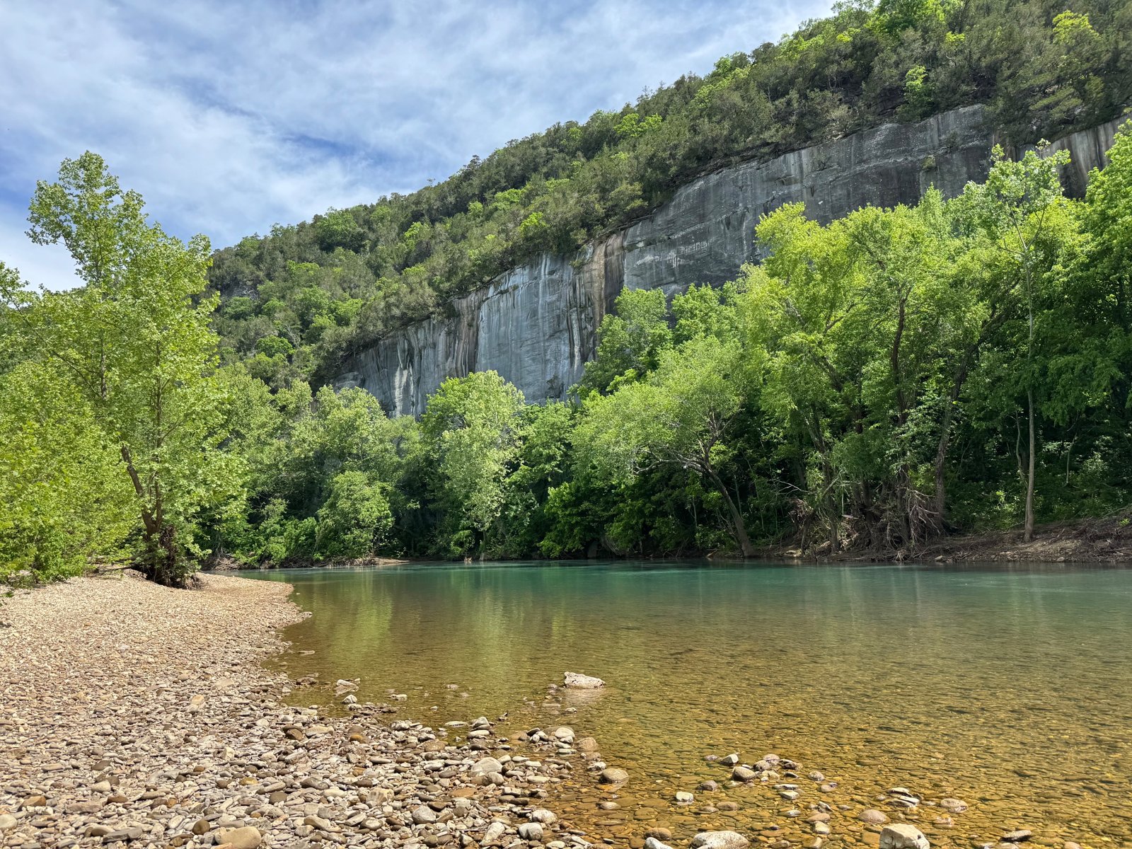
The Buffalo River Trail’s westernmost section runs about 11 miles from the south end of Boxley Valley to Ponca, along the hillsides on the east side of the Buffalo River. Boxley Valley is known for its elk, and Buffalo River Partners describes locust trees, stands of beech, moss-covered boulders, and clear running streams along the way.
Water can be scarce in dry spells, so check recent conditions.
The hike
The trail starts at the South Boxley Trailhead. Buffalo River Partners says overnight parking is allowed there and that the original Whiteley homestead, with its root cellar and chimney, is right at the start. ArkOkHiker notes the parking area is across the highway from the trail itself. To begin, Buffalo River Partners says, cross the highway and follow the BRT signs. Backpacker’s route heads east along a weathered fence, with the forested Ozarks across Boxley Valley to the west, and suggests watching for elk.
Buffalo River Partners says volunteers built this section in 1994, including groups from the Ozark Society, the American Hiking Society, and the Sierra Club. ArkOkHiker describes the trail meandering along the hillsides on the east side of the river, looking down into Boxley Valley.
Arrington Creek comes at about 3.3 miles. ArkOkHiker calls it the first good spot to camp, with two campsites, fire rings, and level ground. At about mile 7.8, the same writers reached a field next to Pearly Spring and saw signs of elk using the area. Less than half a mile beyond their campsite, they came to Running Creek, which looked about waist-high where the trail crossed.
Buffalo River Partners says much of the trail is blazed white with BRT signs, but warns that it becomes less visible after Running Creek, so pay attention. National Park Maps describes the section as starting just south of Boxley Bridge and dropping into two valleys before reaching Ponca.
OuachitaMaps says elk, reintroduced to the area in the early 1980s, and black bears both live here, and that the trail stays mostly in the highlands with river access in only a few places. Explore Harrison says the Buffalo River Trail is for hikers only and that all trailheads except the Ponca Low Water Bridge have overnight parking.
Water depends on the season. An AllTrails reviewer who hiked the whole western section in January 2026 found the stretch from Boxley to Ponca dry except for Arrington Creek, which had enough to filter. The same reviewer called the full Boxley-to-Pruitt trip one of the more difficult three- or four-day backpacking trips they’d done in Arkansas. Another reviewer described overgrown sections in November 2025.
An older Backpacker article recommends the nearby Lost Valley Trail, just off AR 43 between Boxley and Ponca, as a 2.3-mile introduction to the area, with 200-foot bluffs, Cobb Cave, and Eden Falls.
Backpacker credits the Buffalo with helping jump-start the national Wild and Scenic River program in 1968, and its three-day route continues past Ponca toward Steel Creek and Big Bluff.
For the next section downstream, see the Buffalo River Trail from Ponca to Kyles Landing.
Tips
- Carry water. One reviewer found the section dry except for Arrington Creek.
- Watch for elk. Boxley Valley is known for them; one trip found elk sign near Pearly Spring.
- Check Running Creek. One trip found it waist-high at the crossing.
- Stay alert for the trail after Running Creek. Buffalo River Partners says it gets harder to see.
- Park at South Boxley. Overnight parking is allowed there; the Ponca Low Water Bridge trailhead has none, per Explore Harrison.
Camping
Backcountry camping is allowed along the Buffalo River Trail. Guides and outfitters say no permit is required and that sites should be at least half a mile from designated NPS campgrounds; confirm with the park. ArkOkHiker found two established campsites with fire rings at Arrington Creek. Wikipedia says camping is generally allowed throughout the park except in the Hemmed-In Hollow area, on Big Bluff, in historic structures, on private property inside the park, or within 100 feet of any trail or watercourse.
Inside Intel: Arrington Creek, at about mile 3.3, is the first good camp, according to ArkOkHiker, with two sites, fire rings, and level ground. It’s also where an AllTrails reviewer found the only water on the section in a dry January. ArkOkHiker’s group debated stopping there for an easy first day or pushing on, and kept going toward Running Creek.
Trail facts
- Distance: About 11 miles, South Boxley Trailhead to Ponca
- Route type: Point to point with a shuttle
- Difficulty: Moderate to strenuous
- Campsites: Dispersed; established sites at Arrington Creek (about mile 3.3)
- Water: Arrington Creek and seasonal streams; can be dry. Treat all water.
- Permits: None reported for backcountry camping
- Trail use: Hikers only (Explore Harrison)
- Trailheads: South Boxley Trailhead (overnight parking); Ponca
- Last verified: September 30, 2026
Where this comes from
This page draws on the sources below, along with other guides and trip reports. Links go to the original pages.
- National Park Service: Buffalo River Trail brochure (PDF)
- Buffalo River Partners: The Buffalo River Trail from Boxley to Ponca
- ArkOkHiker: Buffalo River Trail, Boxley to Ponca
- Backpacker: Rip & Go, Buffalo River Trail
- Backpacker: Arkansas’ Buffalo National River
- OuachitaMaps: Buffalo River Trail overview
- Explore Harrison: Buffalo River Trail
- AllTrails: Buffalo River Trail
- National Park Maps: Buffalo River maps
- Wikipedia: Buffalo National River
Before you go: This page is based on published trail guides, trip reports, and reviews, along with official park and agency information where we could find it. It’s meant to help backpackers discover new trails, not to replace current, official information. Conditions, closures, permits, campsites, and water sources change, and some details here may be out of date or wrong. Confirm everything with the managing agency and check current conditions before you head out, and don’t rely on this page alone for safety or navigation. Backcountry travel involves risk.