
Trails / Alaska / Interior Alaska
Pinnell Mountain National Recreation Trail
Steese National Conservation Area, Bureau of Land Management (Steese Highway, northeast of Fairbanks)
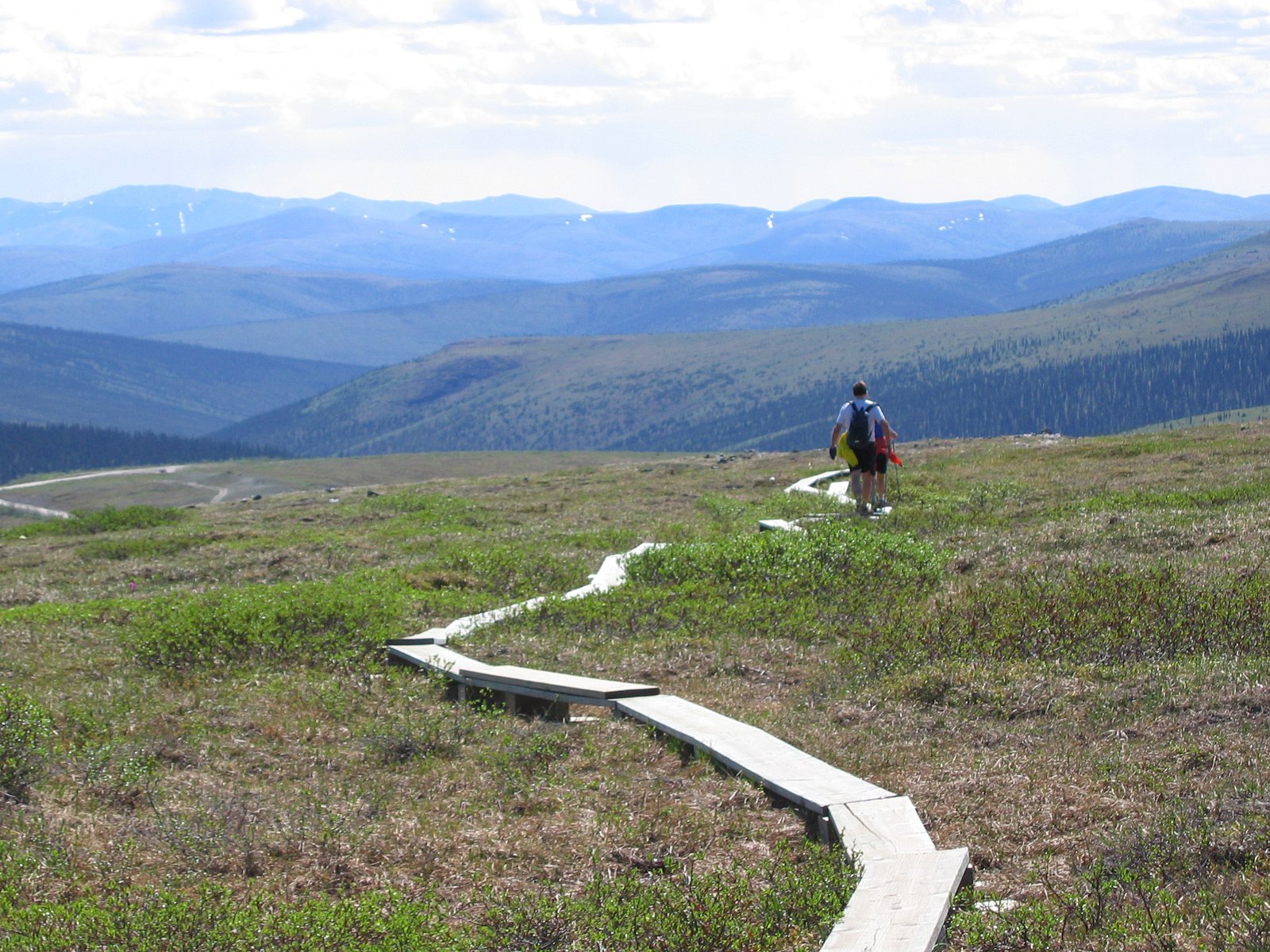
The Pinnell Mountain Trail runs 27 miles along alpine ridgetops northeast of Fairbanks, entirely above timberline. The Bureau of Land Management says it crosses open tundra with views north to the Yukon River and south to the Alaska Range. Rock cairns mark the way, wooden posts count the miles, and two small shelters offer refuge from storms.
American Trails calls it one of the few maintained primitive hiking trails in Interior Alaska. Its main challenges are weather and water.
The hike
The trail runs between two summits on the Steese Highway, a maintained gravel road from Fairbanks toward the Yukon River. The BLM says Eagle Summit, at milepost 107, is about a 2.5-hour drive from Fairbanks in good conditions, and the trail ends at Twelvemile Summit at milepost 85.5. The Fairbanks Daily News-Miner says most people hike from Eagle Summit to Twelvemile Summit. The trail was built for hikers but is open to all non-motorized use.
The BLM’s highway brochure adds a bonus at the start: around the summer solstice, Eagle Summit is one of very few places in Alaska south of the Arctic Circle where you can drive to see the midnight sun. A quarter-mile accessible interpretive loop with a viewing deck starts there too.
The News-Miner describes a primitive trail following alpine ridges with panoramic views of the White Mountains and Crazy Mountains. It says most of the trail has at least an 8 percent grade, and some sections exceed 25 percent. One 2016 trip report says the first half mile from Eagle Summit climbs 600 feet and names Porcupine Dome, at 4,915 feet, as the trail’s high point. The same writers found the trail lightly used, with cairns about 100 yards apart as the main guide, and slogged through boggy sections where the BLM had worked on erosion control.
The two shelters come at about miles 10 and 18 from Eagle Summit. American Trails says the Ptarmigan Creek Shelter sits near mile 10.1 in a saddle just below Pinnell Mountain. The other is the North Fork Shelter, farther along toward Twelvemile Summit. Both are free and first come, first served.
The News-Miner recounts the trail’s history. It was built in 1968 and 1969, opened on July 18, 1970, and was designated a National Recreation Trail in 1971. It’s named for Robert Pinnell, who died in a climbing accident on nearby Porcupine Dome in 1952. American Trails says American Hiking Society volunteer crews do most of the maintenance.
Wildlife is a highlight. One AllTrails reviewer saw caribou, porcupine, marmots, and ptarmigan and found the trail in fantastic shape, with short muddy sections and easily avoided snow patches. Another reviewer called the stretch between the Ptarmigan Creek shelter and Eagle Summit the hardest part.
An Outdoorsy guide to the Steese National Conservation Area adds that foxes, moose, and bears also frequent the Steese Highway corridor and the Pinnell Mountain Trail. The BLM warns hikers to come prepared for unpredictable, dramatic alpine weather. Much of the trail is exposed, and the shelters are the only cover.
For a shorter Interior Alaska loop, see the Chena Dome Trail.
Tips
- Carry plenty of water. American Trails recommends that backpackers always carry at least 3 quarts or liters. Water gets scarce later in summer.
- Check the shelter catchments. The BLM asks hikers to confirm with the Fairbanks District Office that the shelters’ water systems are working.
- Hike Eagle Summit to Twelvemile. That’s the most common direction, per the News-Miner.
- Prepare for weather. The trail is entirely above timberline and exposed to storms.
- Follow the cairns. In fog or low light, the cairns and mileposts are the main route markers.
Camping
Camping is dispersed along the trail, and the two shelters are first come, first served, with no fee. American Trails says water is available at both shelters from catchment systems that collect snowmelt and rain, and that small ponds along the trail are other sources, plus snow early in summer. All water should be treated. The BLM says the shelters are for refuge from storms.
Inside Intel: Hikers tend to plan nights around the shelters and their water. One AllTrails reviewer who traversed from Eagle Summit in July 2024 found the catchment cans full at both shelters and described them as well kept. Another reviewer found water in snow patches and tundra pools as well as at the shelters. Because the BLM says water gets harder to find later in summer, earlier trips have more options.
Trail facts
- Distance: 27 miles one way
- Route type: Point to point with a shuttle between Eagle Summit and Twelvemile Summit
- Difficulty: Strenuous. Steep grades and exposed alpine terrain.
- Elevation: Eagle Summit about 3,600 feet; high point about 4,915 feet at Porcupine Dome (one trip report)
- Campsites: Dispersed; Ptarmigan Creek and North Fork trail shelters (first come, first served)
- Water: Shelter catchments, tundra ponds, and snowfields. Scarce late in summer. Treat all water.
- Permits: None found
- Trail use: Non-motorized
- Trailheads: Eagle Summit (Steese Highway milepost 107); Twelvemile Summit (milepost 85.5)
- Last verified: September 28, 2026
Where this comes from
This page draws on the sources below, along with other guides and trip reports. Links go to the original pages.
- Bureau of Land Management: Pinnell Mountain National Recreation Trail
- Bureau of Land Management: Pinnell Mountain Trail (water information)
- Bureau of Land Management: Steese and Elliott Highways brochure (PDF)
- American Trails: Pinnell Mountain Trail, Alaska
- Fairbanks Daily News-Miner: Pinnell Mountain National Recreation Trail
- AllTrails: Pinnell Mountain Trail
- The Good, The Bad and the RV: Pinnell Mountain Trail
- Outdoorsy: Steese National Conservation Area
Before you go: This page is based on published trail guides, trip reports, and reviews, along with official park and agency information where we could find it. It’s meant to help backpackers discover new trails, not to replace current, official information. Conditions, closures, permits, campsites, and water sources change, and some details here may be out of date or wrong. Confirm everything with the managing agency and check current conditions before you head out, and don’t rely on this page alone for safety or navigation. Backcountry travel involves risk.