
Trails / Alaska / Kachemak Bay
Grace Ridge Trail (Kachemak Bay State Park)
Kachemak Bay State Park, Alaska State Parks (across Kachemak Bay from Homer, water taxi access)
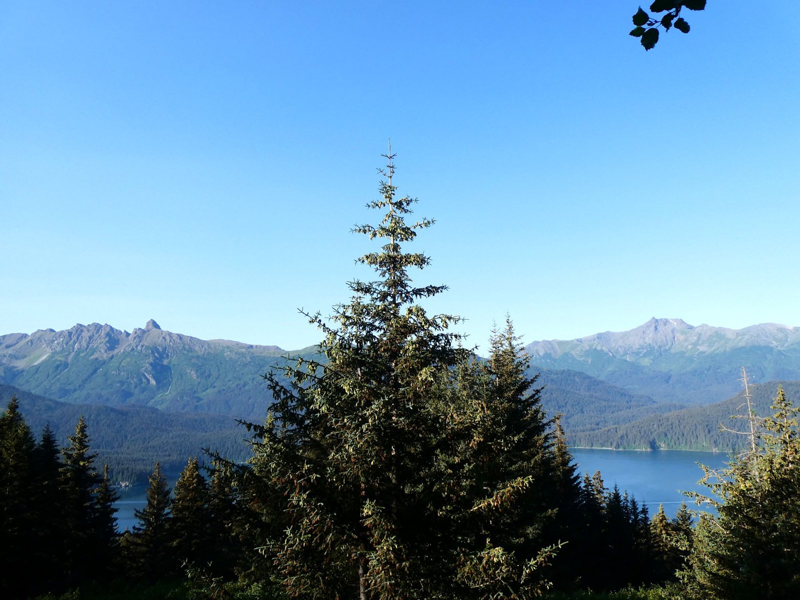
Grace Ridge rises straight out of Kachemak Bay between Sadie Cove and Tutka Bay, across the water from Homer. The trail starts at sea level on one beach, climbs through old-growth Sitka spruce to an open alpine ridge more than 3,000 feet up, and drops to another beach on the far side. The only way to reach either end is by boat.
On a clear day, Mako’s Water Taxi says, you can see four volcanoes from the ridge: Augustine, Iliamna, Redoubt, and Spurr.
The hike
The trail connects Kayak Beach, at the north end near the mouth of Sadie Cove, with the South Grace Trailhead in Tutka Bay. AllTrails says the south end is across from the Sea Star Cove public-use cabin, and water taxis can drop off at either end regardless of tide. Moon describes water taxis from Homer to both trailheads, with campsites and yurts at each.
From Kayak Beach, Moon says, the trail climbs steeply through old-growth Sitka spruce to an overlook at 2.3 miles, then continues into the alpine to the 3,100-foot summit of Grace Peak at about 4.5 miles. AllTrails describes the north start following an old road now thick with alders, with huge spruce trees on a narrow ridge and the roar of hidden waterfalls below. At mile 1.6, it says, a creek rushing along the trail is a good water source before the climb to the alpine. Alaska Hike Search describes about 3 miles of boreal rainforest and 1,800 feet of climbing to a knob above treeline.
On top, the trail follows barren, rocky ridges for a mile or two, according to Alaska Hike Search. Moon describes 360-degree views of Kachemak Bay, the Kenai Mountains, coves, islands, glaciers, and forests. Mako’s says the ridge looks down on Sadie Cove on one side and Tutka Bay on the other.
The descent to Tutka Bay is steeper, per Alaska Hike Search. Mako’s recommends hiking the other way: start at the South Grace Trailhead, where cell service is spotty, and finish at Kayak or Quarry Beach, which is easier on the knees. AllTrails agrees that south to north is much more common.
Totals vary. AllTrails lists 9.1 miles one way with about 3,400 feet of gain, and one reviewer’s GPS read 9.2 miles and 3,500 feet. Mako’s calls it a 9-mile hike. Alaska Hike Search says most hikers don’t do the whole trail and instead go up from one beach and back down to it.
Planning centers on the boat. Andrea Kuuipo Abroad says only water taxis reach Grace Ridge from Homer and names Mako’s Water Taxi and Coldwater Alaska. One TripAdvisor reviewer advises calling several days ahead because water taxis get busy in high summer. Moon adds that bikes aren’t allowed on state park trails. Mako’s lists travel time from Homer Harbor at about 30 to 45 minutes. Cell coverage varies: one TripAdvisor reviewer usually had service in the park, while Mako’s says it’s spotty at the back of Tutka Bay.
AllTrails calls Kachemak Bay State Park Alaska’s first state park, at more than 400,000 acres.
For another Kachemak Bay overnight, see Grewingk Glacier Lake.
Tips
- Carry all your water for the ridge. AllTrails says there’s no water on the ridge. Fill up at the trailhead streams or the creek 1.6 miles from Kayak Beach.
- Book the water taxi early. Taxis get busy in summer. Arrange drop-off and pickup at different beaches for the full traverse.
- Hike south to north. Mako’s and AllTrails both say it’s the usual direction, ending on the gentler side.
- Watch the weather. The ridge is exposed alpine terrain above treeline.
- No bikes. Moon says bikes aren’t allowed on state park trails.
Camping
AllTrails says there’s a developed campsite at Kayak Beach and an undeveloped campsite at the South Grace Trailhead. Moon lists campsites and yurts at both trailheads, and Mako’s mentions yurts at Kayak Beach, Quarry Beach, and Tutka 1 at the south end. Andrea Kuuipo Abroad says wild campers will find a few flat, open areas around miles 2 and 3 from the Kayak Beach side. Confirm current rules and yurt reservations with Alaska State Parks.
Inside Intel: Kayak Beach is the camp most people mention. Alaska Hike Search calls its tent camping nice and scenic, and it’s the developed campsite AllTrails describes at the north end. If you’d rather sleep high, Andrea Kuuipo Abroad points to a few flat, open spots around miles 2 and 3 above Kayak Beach, though there’s no water up there, so carry enough for the night.
Trail facts
- Distance: About 8.2 to 9.2 miles one way, depending on the source
- Route type: Point to point by water taxi, or out and back from one beach
- Difficulty: Strenuous. Sea level to about 3,100 feet.
- Elevation: About 3,000 to 3,500 feet of gain
- Campsites: Developed site at Kayak Beach; undeveloped site at South Grace; yurts at both ends
- Water: Near both trailheads and at mile 1.6 from Kayak Beach. None on the ridge.
- Permits: None found for the trail; confirm camping and yurt rules
- Access: Water taxi from Homer only
- Season: June to August (Alaska Hike Search)
- Last verified: September 28, 2026
Where this comes from
This page draws on the sources below, along with other guides and trip reports. Links go to the original pages.
- Alaska State Parks: Guide to Grace Ridge Trail (PDF)
- AllTrails: Grace Ridge Trail
- AllTrails: Kachemak Bay State Park backpacking
- Moon Travel Guides: Recreation in Kachemak Bay State Park
- Mako’s Water Taxi: Grace Ridge
- Alaska Hike Search: Grace Ridge
- Andrea Kuuipo Abroad: Hike Grace Ridge Trail
- TripAdvisor: Great Hiking on Grace Ridge
Before you go: This page is based on published trail guides, trip reports, and reviews, along with official park and agency information where we could find it. It’s meant to help backpackers discover new trails, not to replace current, official information. Conditions, closures, permits, campsites, and water sources change, and some details here may be out of date or wrong. Confirm everything with the managing agency and check current conditions before you head out, and don’t rely on this page alone for safety or navigation. Backcountry travel involves risk.