
Trails / Alabama / Northeast Alabama
Walls of Jericho (Alabama Trailhead)
James D. Martin–Skyline Wildlife Management Area, Alabama Forever Wild Land Trust (Jackson County, north of Scottsboro)
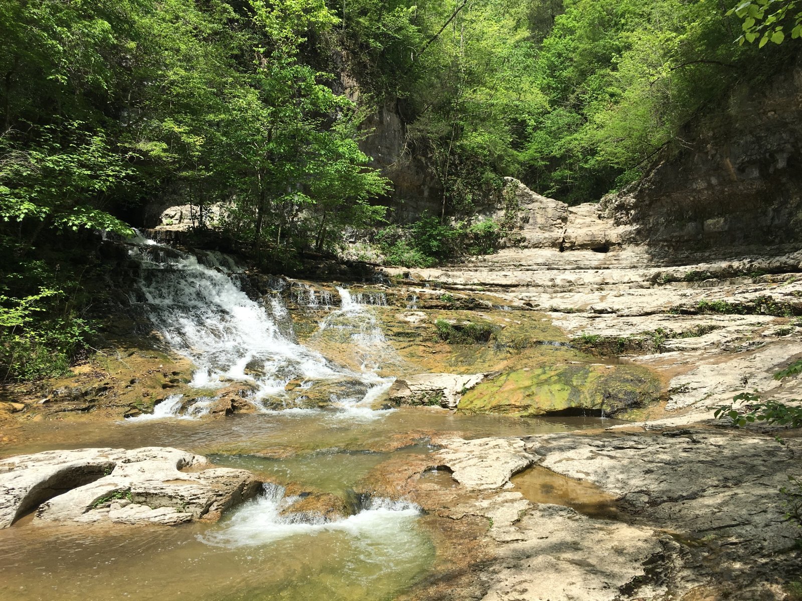
The Walls of Jericho is a deep limestone gorge at the headwaters of the Paint Rock River, where waterfalls pour into a natural amphitheater of sheer rock walls. From the Alabama trailhead, the trail descends to Hurricane Creek and follows Turkey Creek into the gorge. The Nature Conservancy calls the Paint Rock headwaters globally significant.
One Huntsville hiker sums it up: all downhill on the way in, uphill coming back.
The hike
The trailhead is on Alabama Highway 79 on the Cumberland Plateau, north of Scottsboro. Alabama Forever Wild says two trails leave the parking area: the Bear Den Point Trail loops 4.7 miles east, and the Walls of Jericho Trail heads west, down to Hurricane Creek and then along Turkey Creek into the Walls. Its photo captions warn that the hike is strenuous and hikers should take plenty of water.
The Meanderthals trip report describes the Walls of Jericho Trail as very good, with some exposed roots and rocks. The trailhead sign puts it at three miles to Hurricane Creek, then about another half mile to the amphitheater. That report gives a starting elevation of 1,765 feet and about 1,350 feet of gain. An Outbound reviewer describes gentle switchbacks at first, then small waterfalls, sinkholes, and caves, before crossing Hurricane Creek on a log with a handrail.
At Clark Cemetery, Forever Wild says, hikers can choose an upper or lower trail. Meanderthals describes the South Rim Trail as poor to fair, muddy and slippery in places, with serious erosion. Wikipedia describes the surrounding forest as full of bluffs, rock outcroppings, caves, and sinkholes.
The amphitheater itself straddles the Tennessee–Alabama line. Meanderthals says the natural amphitheater fills from two main waterfalls and is difficult to walk around, so be careful. One Huntsville hiker describes a big, slippery cave, swimming holes, and a waterfall that doesn’t always run. Wikipedia notes that a seven-mile trail connects the Tennessee and Alabama trailheads.
Horses use the area too. Visit Jackson County lists an 11-mile horseback riding trail, and The Nature Conservancy says both the hiking and horse trails lead into the gorge, so expect to share the lower trail at times.
The land has a long private history. Meanderthals says Texas oilman Harry Lee Carter bought about 60,000 acres in Franklin County, Tennessee, and Jackson County, Alabama, in the 1940s, and that the Walls were closed to the public in 1977. The Nature Conservancy later acquired the property. According to the Conservancy, Alabama’s Forever Wild program bought the 12,500-acre Alabama section, now the Skyline Wildlife Management Area, and the Tennessee tract went to the Tennessee Wildlife Resources Agency.
Wikipedia says the Turkey Creek drainage supports the state-endangered limerock arrowwood, one of only three known occurrences in the state, and that protecting Turkey Creek also protects rare mussels and fish downstream in the Paint Rock River.
Meanderthals suggests allowing about six hours, including two at the amphitheater; they took four and a half with a half-hour stop. For an overnight, the camping area on Hurricane Creek splits the trip neatly and puts you close to the gorge in the morning.
Tips
- Save energy for the climb out. The trail descends most of the way in, so most of the climbing comes at the end. Meanderthals logged about 1,350 feet of total gain.
- Carry plenty of water. Forever Wild’s trailhead signs warn the hike is strenuous.
- Be careful in the amphitheater. Meanderthals says it’s difficult to move around and the rocks can be slippery.
- Check hunting seasons. The area is part of a Wildlife Management Area. Plan fall and winter trips around hunts and wear blaze orange.
- Waterfalls vary. One hiker notes the main waterfall doesn’t always run. Wet seasons are the best time to see it.
Camping
Alabama Forever Wild lists two primitive camping areas on the Walls of Jericho trail. One is at the north end of the hiking parking lot, with room for six to eight tents. The other is on Hurricane Creek next to Clark Cemetery, with room for eight tent sites. Both are first come, first served. Forever Wild says fires are allowed but must be put out before you leave, and all trash must be packed out. The Forever Wild management plan says public overnight camping is allowed at designated campsites only, so camp in these areas rather than anywhere along the trail.
Inside Intel: The Hurricane Creek camping area near Clark Cemetery is the one on the trail itself, partway down with the gorge ahead. One Huntsville hiker turned the Walls into an overnight and camped near the waterfall. With just eight tent sites and no reservations, arriving early on nice weekends is the best way to get a spot. The trailhead camping area works as a fallback for late arrivals.
Trail facts
- Distance: About 7 miles round trip (about 3.5 miles each way to the amphitheater)
- Route type: Out and back
- Difficulty: Strenuous. Steady descent in, steady climb out.
- Elevation: About 1,050 feet of elevation change and 1,350 feet of total gain (Meanderthals). Trailhead about 1,765 feet.
- Campsites: Two designated areas: trailhead (6 to 8 sites) and Hurricane Creek at Clark Cemetery (8 sites)
- Water: Hurricane Creek and Turkey Creek. Treat all water.
- Permits: None listed by Forever Wild for its camping areas. Confirm.
- Fires: Allowed; extinguish completely (Forever Wild)
- Hunting: Wildlife Management Area. Check season dates.
- Trailhead: Walls of Jericho parking area on Alabama Highway 79, Jackson County
- Last verified: September 28, 2026
Where this comes from
This page draws on the sources below, along with other guides and trip reports. Links go to the original pages.
- Alabama Forever Wild: Walls of Jericho
- Alabama Forever Wild: Camping
- Alabama Forever Wild: Walls of Jericho management plan (PDF)
- The Nature Conservancy: The Walls of Jericho
- Wikipedia: The Walls of Jericho (canyon)
- Meanderthals: Walls of Jericho and South Rim Trails
- Outbound: Walls of Jericho and other Alabama backpacking
- Visit Jackson County: Walls of Jericho
- Trizzle Travels: Top 10 hikes near Huntsville
Before you go: This page is based on published trail guides, trip reports, and reviews, along with official park and agency information where we could find it. It’s meant to help backpackers discover new trails, not to replace current, official information. Conditions, closures, permits, campsites, and water sources change, and some details here may be out of date or wrong. Confirm everything with the managing agency and check current conditions before you head out, and don’t rely on this page alone for safety or navigation. Backcountry travel involves risk.