
Trails / Alabama / South Alabama
Conecuh Trail
Conecuh National Forest, Conecuh Ranger District (Open Pond, south of Andalusia)
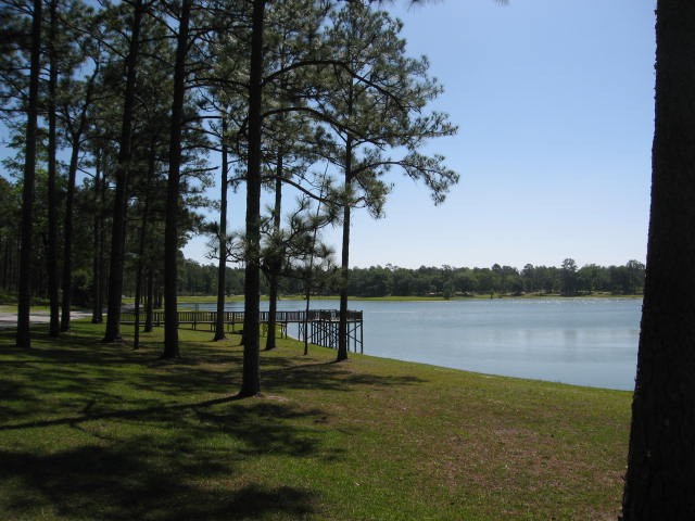
The Conecuh Trail winds about 20 miles through the flat, sandy coastal plain near the Florida line, past longleaf pine savannas, cypress ponds, and clear springs. The Forest Service describes it as an easy to moderate trail through open, fire-maintained longleaf pine in the uplands and dark wet swamps and bays in the bottoms.
It’s best in the cool months. Summer brings heat, humidity, and bugs.
The hike
The trail starts near the Open Pond Recreation Area, which the Forest Service calls the largest recreation area in the forest. Open Pond itself is a natural sinkhole pond of about 30 acres, and the day-use area has a historic Civilian Conservation Corps pavilion. Wikipedia says the Conecuh Trail was built by the Youth Conservation Corps, who extended it each year starting in 1976. It says the name Conecuh is believed to come from the Muskogee language and means “land of cane,” fitting for a trail that passes through canebrakes.
The trail is two loops joined by a connector. Hiking Project says the Blue Spring Loop starts at the parking area near Open Pond, picks up the South Loop, and passes Buck and Ditch Ponds. It describes the trail as well marked with white diamonds, mostly pines and oaks with thick undergrowth, and notes charred areas where the Forest Service had burned the understory.
Backpacker’s writer followed the South Loop past the green water of Buck Pond to Five Runs Creek, where cypress knees poke through clear water. Next came Blue Spring, which the writer describes as a car-size pool of startlingly clear water, good for a chilly swim. Hiking Project calls it a small, clear spring with a blue tint at the far east end of the loop and mentions a small campsite beside it. It also warns of an unmarked fork before the bridge to Blue Spring, and says the writer heard coyotes overnight.
A roughly four-mile connector leads north to the North Loop. Backpacker says it passes another clear pool at Natural Spring and crosses meadows of longleaf pine, where red-cockaded woodpeckers are sometimes seen. It also warns of a few species of venomous snakes.
On the North Loop, the Backpacker writer crossed Camp Creek and camped at Nellie Ponds, home to the endangered gopher frog. The next day brought Mossy Pond, lined with tall, moss-draped cypress, and a nearby bog of sundews and pitcher plants. A University of South Alabama trip plan describes the North Loop as about 13.8 miles with three dark green cypress ponds, including Mossy and Gum, and gopher tortoises and white-top pitcher plants in the longleaf forest.
The grades are gentle. Backpacker says the trail rarely exceeds a 5 percent grade, and the Forest Service says about 10 miles are open to mountain biking. Blue Lake Recreation Area, a spring-fed lake a short drive from Open Pond, is a good place for a swim before or after.
Backpacker recommends November through March, when cooler weather and fewer bugs make the trail most pleasant.
Tips
- Go in the cool season. Backpacker suggests November through March. Summers are hot and humid, with heavy insects.
- Plan around deer season. The Forest Service says camping has restrictions during deer hunting season. From mid-November through January, coordinate your trip with the Conecuh Ranger District (334-222-2555).
- Wear blaze orange in hunting season. The trail runs through the Blue Spring Wildlife Management Area.
- Watch for snakes. Backpacker warns of several venomous species.
- Carry water. The South Alabama trip plan says to pack in your own water, even though you’ll pass ponds.
Camping
The Forest Service says primitive camping along the trail is allowed, with some restrictions during deer hunting season. HikeArizona says to camp at least 200 feet from the trail. Open Pond Campground, at the trailhead, is the developed option. We found no permit requirement for backcountry camping outside hunting season; confirm with the Conecuh Ranger District.
Inside Intel: Nellie Ponds is the camp the Backpacker writer chose on the North Loop, and the South Alabama trip plan also recommends it for its dark night sky, bright stars, and frogs singing you to sleep. From there, the plan says, it’s a short three-mile walk back to the trailhead to finish the North Loop. On the South Loop, Hiking Project’s writer mentions a small campsite right beside Blue Spring.
Trail facts
- Distance: About 20 miles total. North Loop about 13.5 to 15.7 miles; South Loop about 7 to 8 miles; connector about 4 miles.
- Route type: Two loops joined by a connector. Can be done as one long trip or as separate overnights.
- Difficulty: Easy to moderate. Grades rarely exceed 5 percent.
- Campsites: Dispersed. Nellie Ponds and near Blue Spring are mentioned by trip reports.
- Water: Ponds, springs, and creeks, but carry water. Treat all water.
- Permits: None found outside hunting season. Coordinate during deer season.
- Hunting: Blue Spring Wildlife Management Area. Deer hunts roughly mid-November through January.
- Hazards: Venomous snakes, heat and insects in summer
- Trailhead: Open Pond Recreation Area, off AL 137 south of Andalusia
- Last verified: September 28, 2026
Where this comes from
This page draws on the sources below, along with other guides and trip reports. Links go to the original pages.
- U.S. Forest Service: Conecuh National Forest handout (PDF)
- Backpacker: Alabama’s Conecuh Trail, Southern Comfort
- Wikipedia: Conecuh National Forest
- Hiking Project: Blue Spring Loop
- Trailhead Traveler: Hikes in Conecuh National Forest
- University of South Alabama Campus Rec: Conecuh North Loop trip plan
- HikeArizona: Conecuh Trail
Before you go: This page is based on published trail guides, trip reports, and reviews, along with official park and agency information where we could find it. It’s meant to help backpackers discover new trails, not to replace current, official information. Conditions, closures, permits, campsites, and water sources change, and some details here may be out of date or wrong. Confirm everything with the managing agency and check current conditions before you head out, and don’t rely on this page alone for safety or navigation. Backcountry travel involves risk.